About
From Mount Rainier National Park:
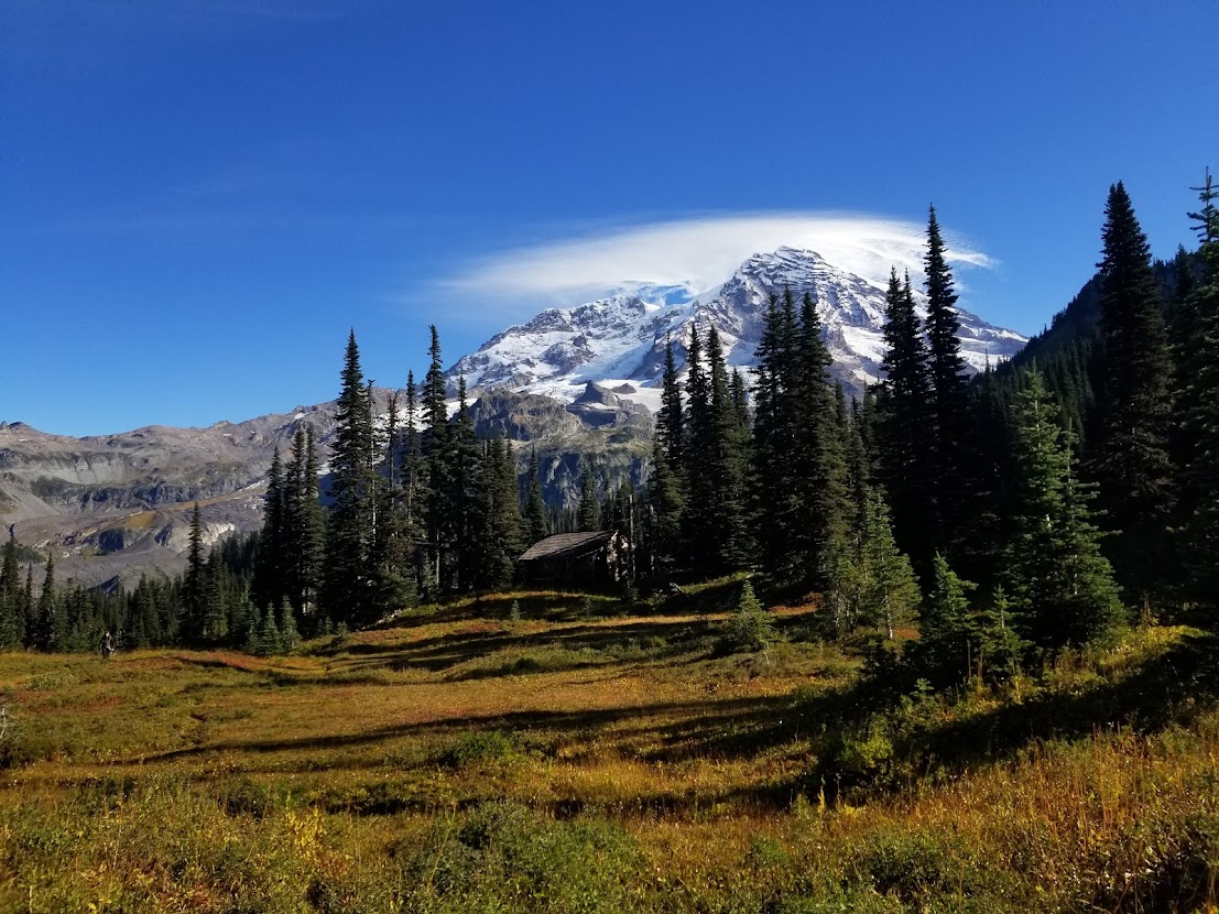
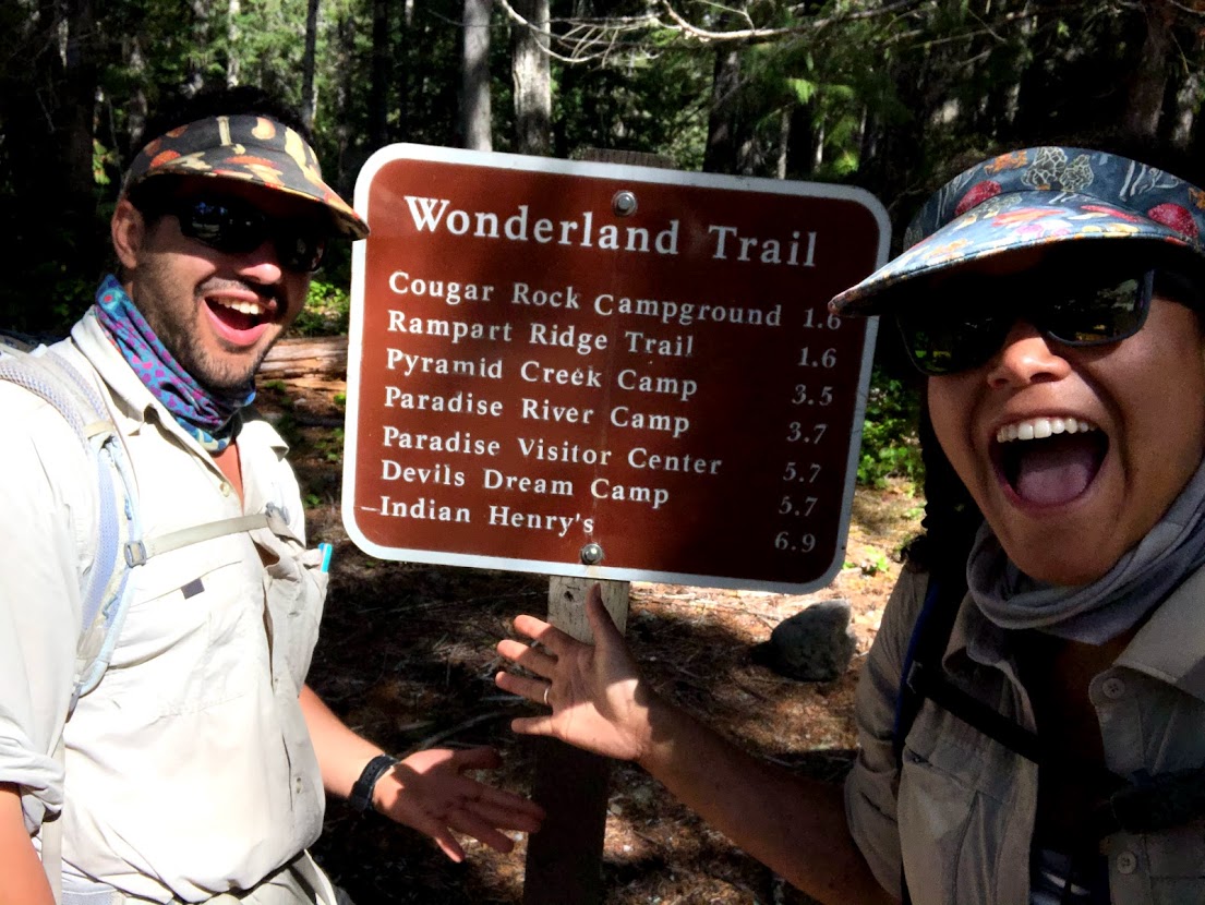
The Wonderland Trail is 93 miles (150 km) long and encircles Mount Rainier. It is a strenuous hike with lots of elevation gain and loss, through lowland forests and valleys and into high alpine and sub-alpine areas.

Widely regarded as one of the most scenic hikes in the Pacific Northwest, I’d first heard of the Wonderland Trail when walking across WA state on the PCT in 2016. Naturally, when I moved to WA in 2019, it was top of my list to experience.
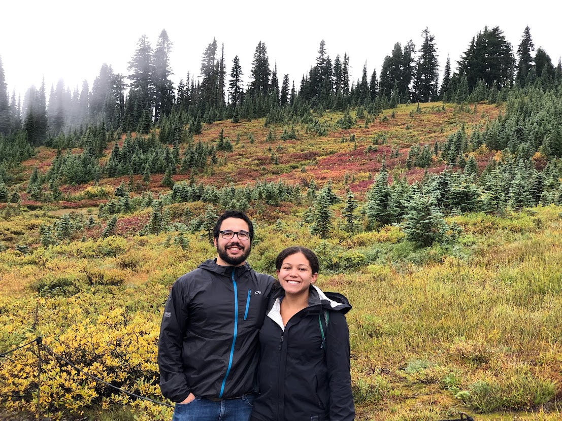
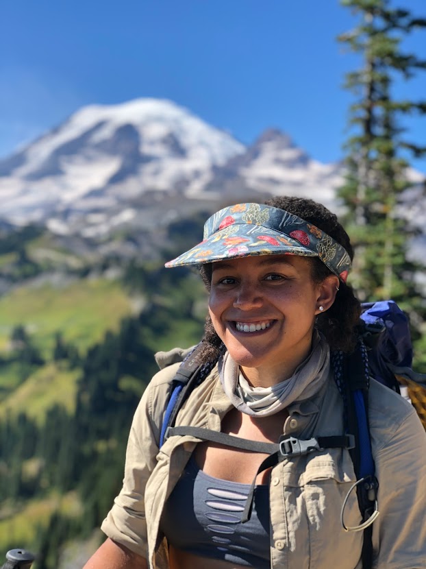
Since then I am proud to say that I have thru hiked the Wonderland twice: once in 2019, and once in 2020. Although I obtained permits for 2 in 2019, my girlfriend, Tynesha, suffered an injury that year and was unable to join me. She doubled-down and completed the trail in 2020.
In 2019 I completed the trail in 3 nights/4 days, with multiple 26+ mile days. In 2020, Tynesha and I completed the trail in 4 nights/5 days, with our longest day being 24+ miles. To prepare, we hiked the Loowit Trail, Timberline Trail, and PCT Section J.
For simplicity, I’ll mostly be referring to my 2020 experience (with some 2019 media thrown-in for imagery).
A word on permits:
The Wonderland Trail is well-groomed and cared for by the National Park Service. As such, hikers are only permitted to stay at specific campgrounds along the way (no dispersed or stealth camping). Permits usually become available through the MORA website in spring of that year, with hikers learning of their permit status a month or two later. These permits can be incredibly stringent to acquire, so how did I luck-out twice in a row? Here’s the secret:
Most hikers plan on taking 7+ days to hike only 93 miles, with highly specific dates, and requesting to stay at each unique and iconic campsite along the trail. To make things simple, each time I applied, it was for a short itinerary (see previous comments about hiking 20+ miles per day), a small group (1-3 passengers), flexible dates (usually mid-August through mid-September, when the crowds thin-out), and with no preference on where I camp (it’s just where I sleep… doesn’t need to have an exceptional view). I believe if other hikers have similar expectations and prepare accordingly, they too can have success in acquiring a permit. Finally, taking this approach also negates the need for a resupply mid-journey, as most individuals are capable of carrying enough food for 5 days.
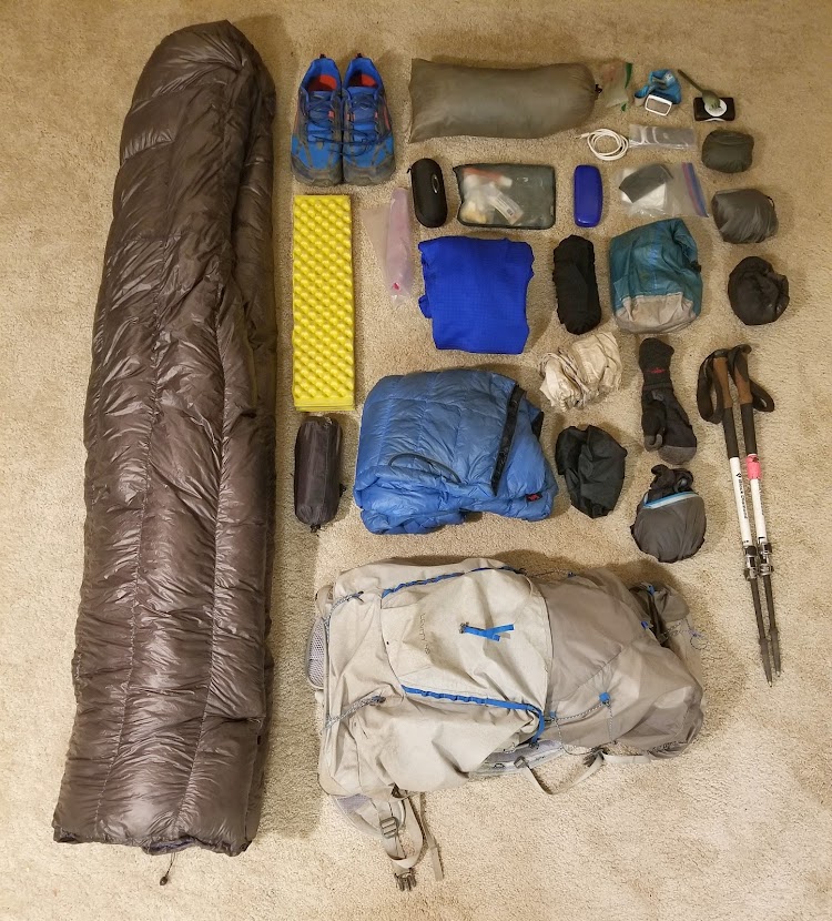
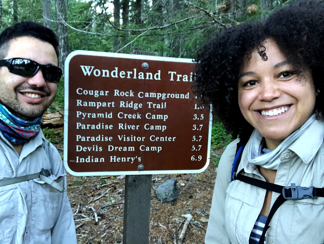
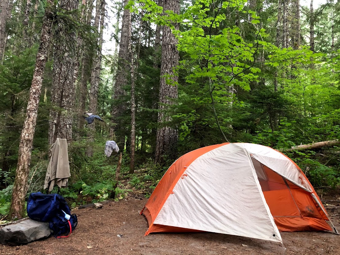
Both of my Wonderland Trail thru hikes were clockwise, starting and ending at Longmire, WA. Here’s my comprehensive gear list for my 2019 Wonderland Trail hike, which was during the shoulder season of 9/24/19-9/27/19:
Day 0 9/2/20 – King County to Rainier
Mount Rainier National Park asks hikers to pick-up their permit either the day of their hike, or the day before their hike is set to begin. We had over 19 miles to hike on day 1, so we felt it prudent to acquire our permit the day before in order to save us some time the following morning. We live near Seattle, only a few hours away from the park, so we have the luxury of arriving a day early without much difficulty.
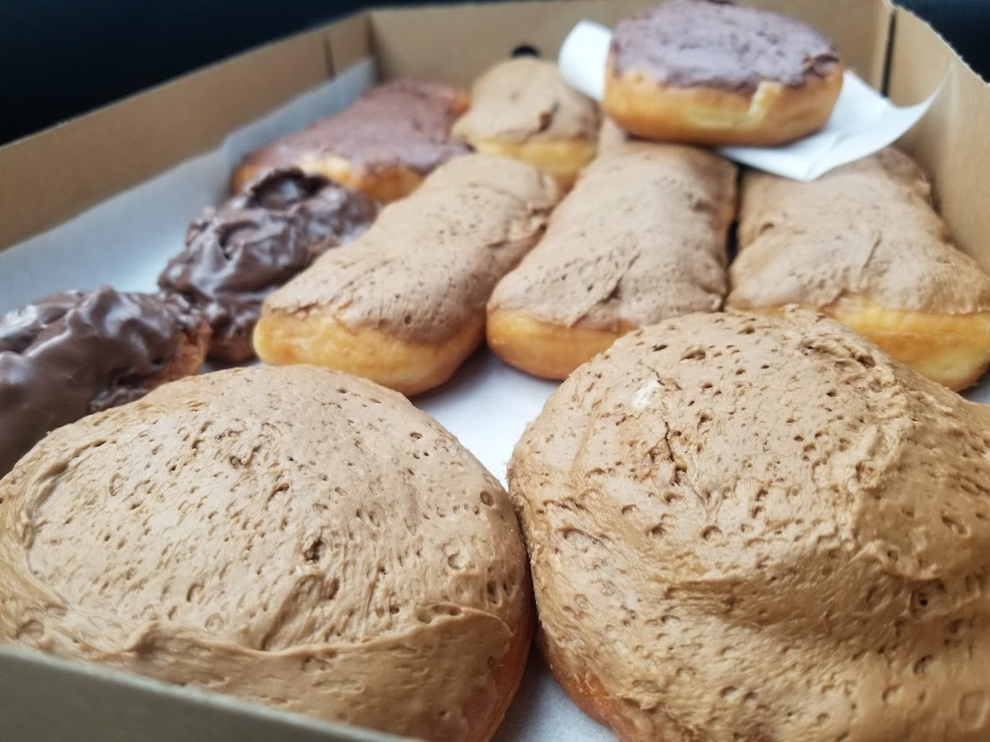
We stopped for donuts at our favorite spot en route to Longmire, Luke’s in Puyallup (try the fritters). If you have time, I also highly recommend Chuck’s in Renton, which have the best maple bars in the state. After we had picked up our permits, we enjoyed the day exploring Paradise and Narada Falls. Like us, I recommend spending the night close by: get walk-up or premeditated reservations for Cougar Rock campground if you can. If you cannot, try dispersed camping on public land at Skate Creek Road, just on the outskirts of the park in Gifford Pinchot National Forest (make the turn from Ashford, WA). Dispersed camping does not require reservations, but the National Park campgrounds are significantly more scenic and convenient, and have more amenities.
Day 1 9/3/20 – Longmire to North Puyallup River Camp (19.5 miles)
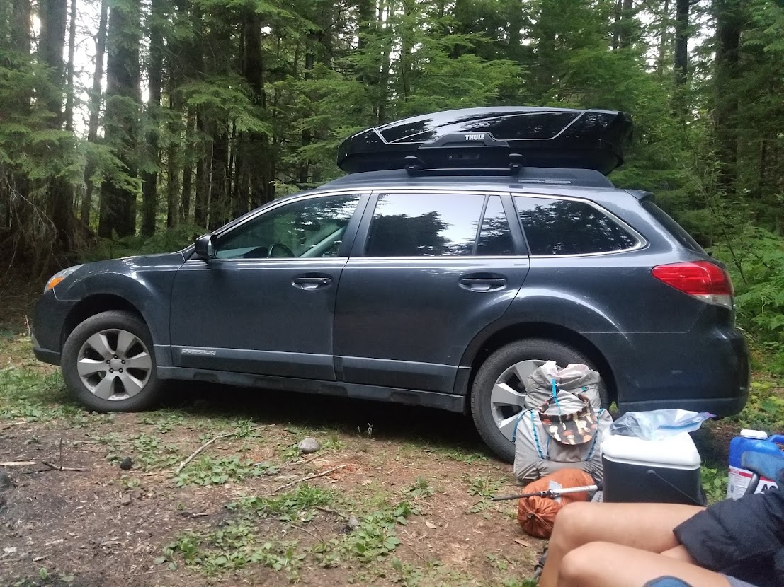
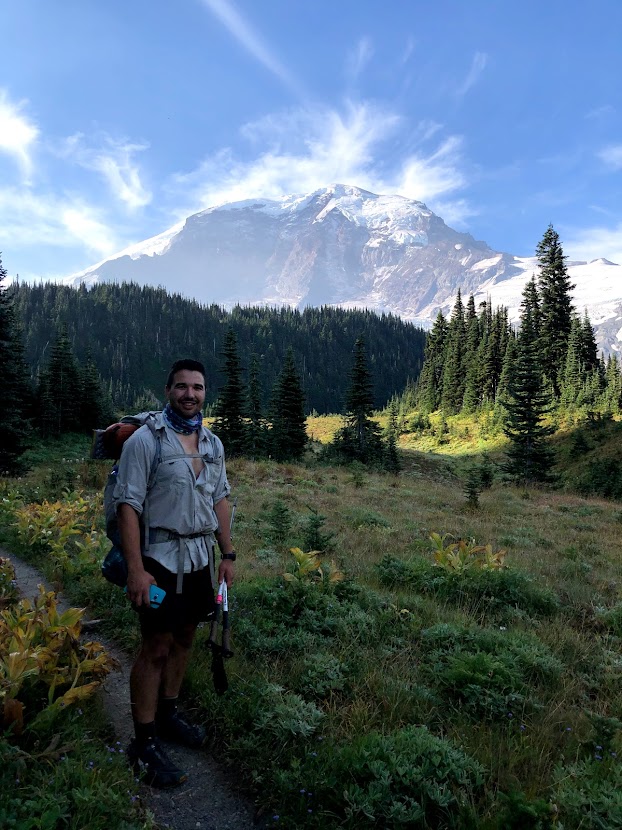
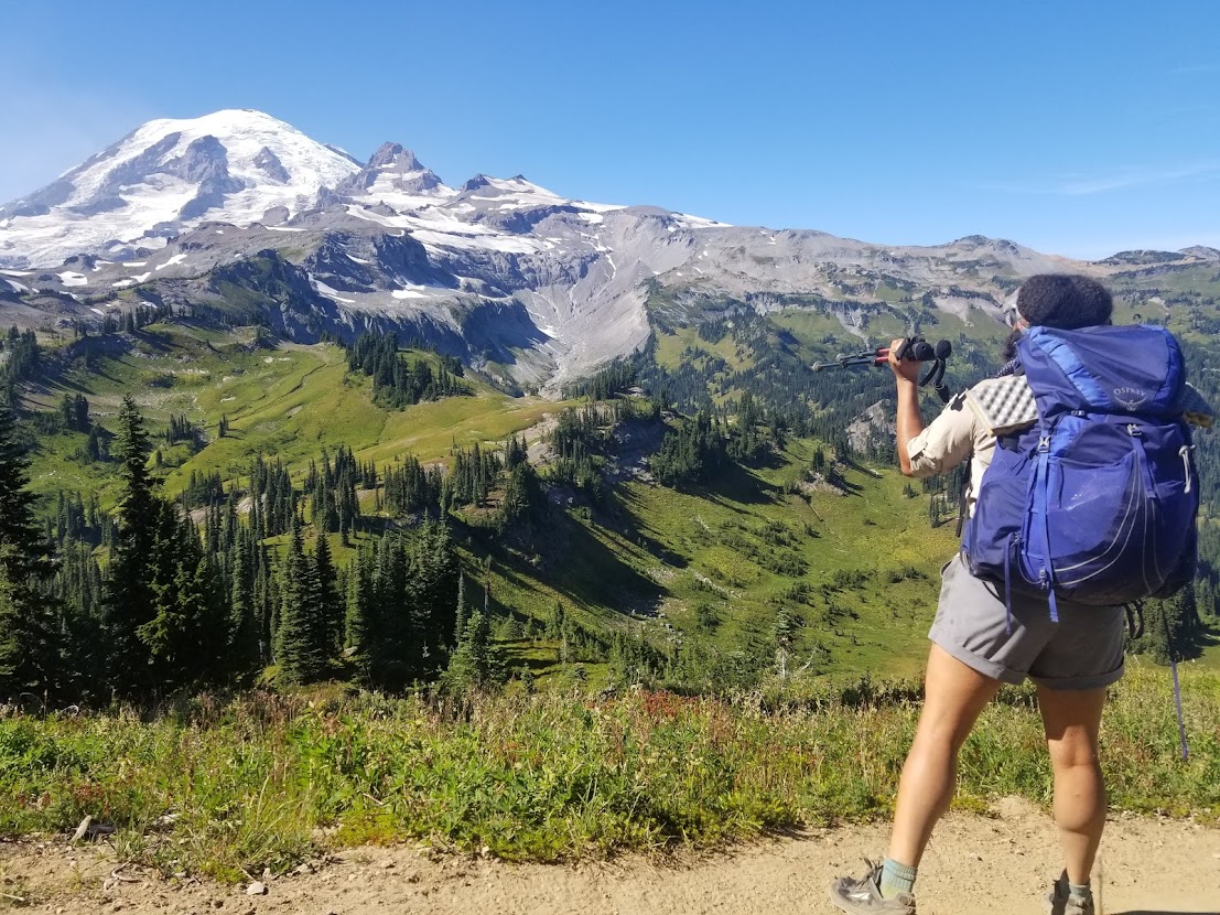
We woke up early and left our NFS campsite to make the short drive to the Longmire parking lot, where my Outback would be sitting for the next few days while we circumnavigated Mount Rainier. The beginning of the day would see relatively warm temperatures, and we headed clockwise on an ascent towards Pyramid Creek and Devil’s Dream campsites. Tynesha and I had completed the Loowit Trail, Timberline Trail, and PCT Section J in preparation for this trek, and it felt so darn satisfying to be on the groomed trails of the park without any worries. We joked and munched on Lenny and Larry’s cookies, enjoying delicious views of the mountain along the way.
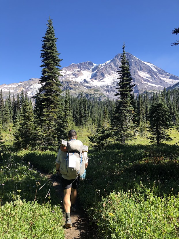
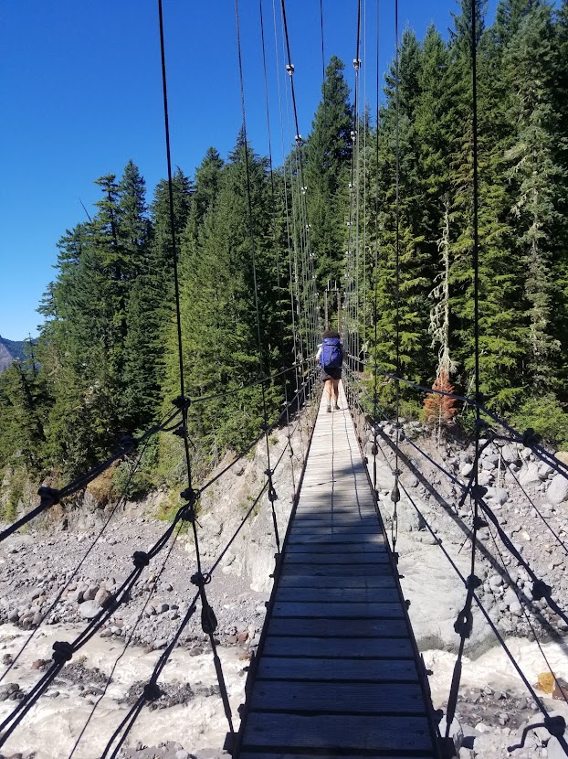
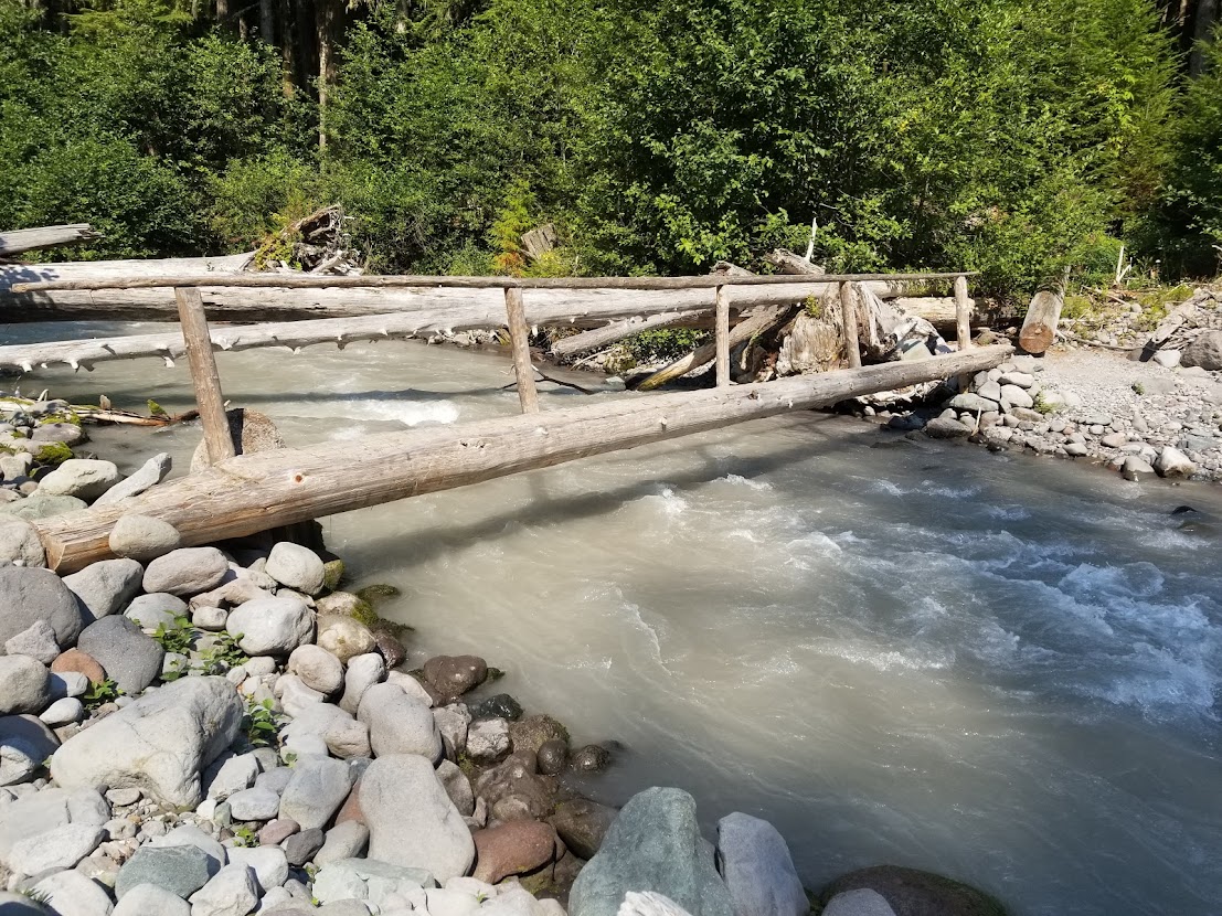
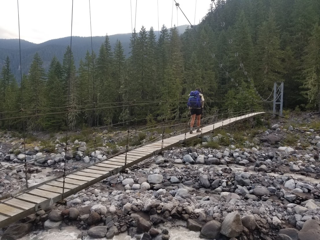
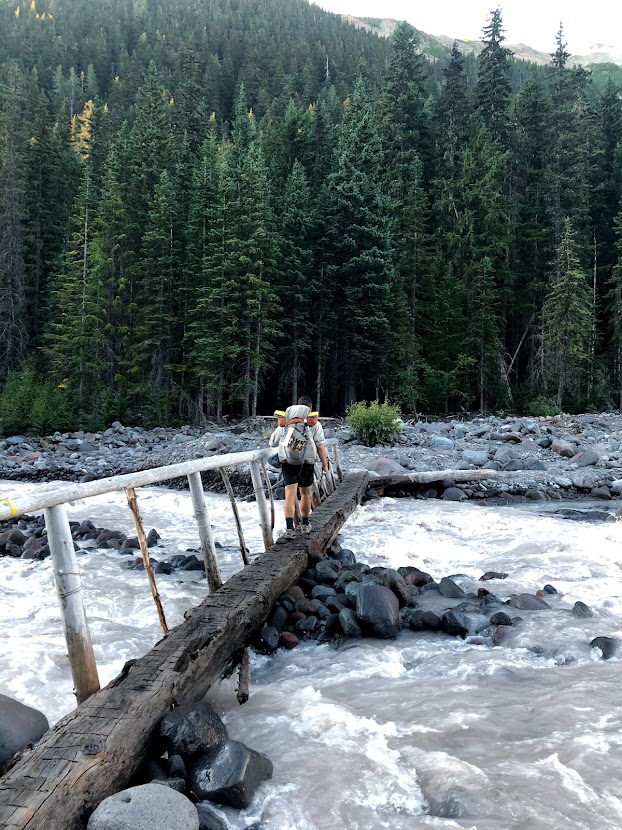
The trail would soon descend toward the first of the Wonderland Trail’s two suspension bridges, each of which have some level of daring charm to them. Tynesha went first and I followed, and soon we were climbing our way out of the gully. Shortly later we found ourselves on a exposed, sun-drenched section of trail that stretched below the Puyallup Glacier. This gave way to Emerald Ridge, which is a popular day hike in the park. We enjoyed a lunch of cookies and peanut butter wraps before dropping down toward South Puyallup River Camp.
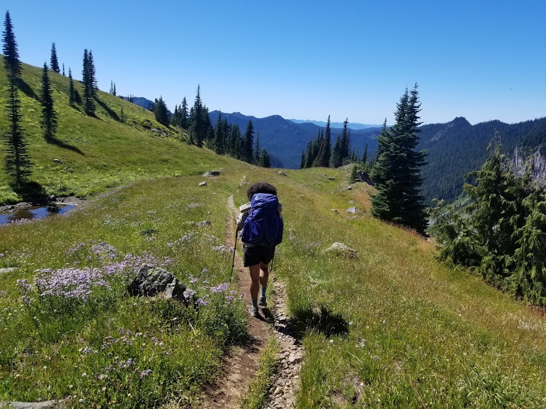
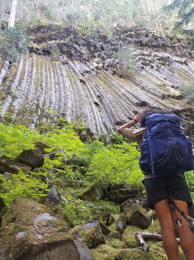
We made a quick stop at South Puyallup River camp to use the restroom and enjoy the basalt columns that protruded from the mountain. The only thing I’ve ever seen that’s similar to this is Devils Postpile, located deep in the Sierra Nevada. The trail now deviated from the southern fork of the Puyallup River and pushed northward, up a steep climb to Klapatche Park. Klapatche is one of my personal favorite views along the trail, and we enjoyed a quick snack here in the afternoon.
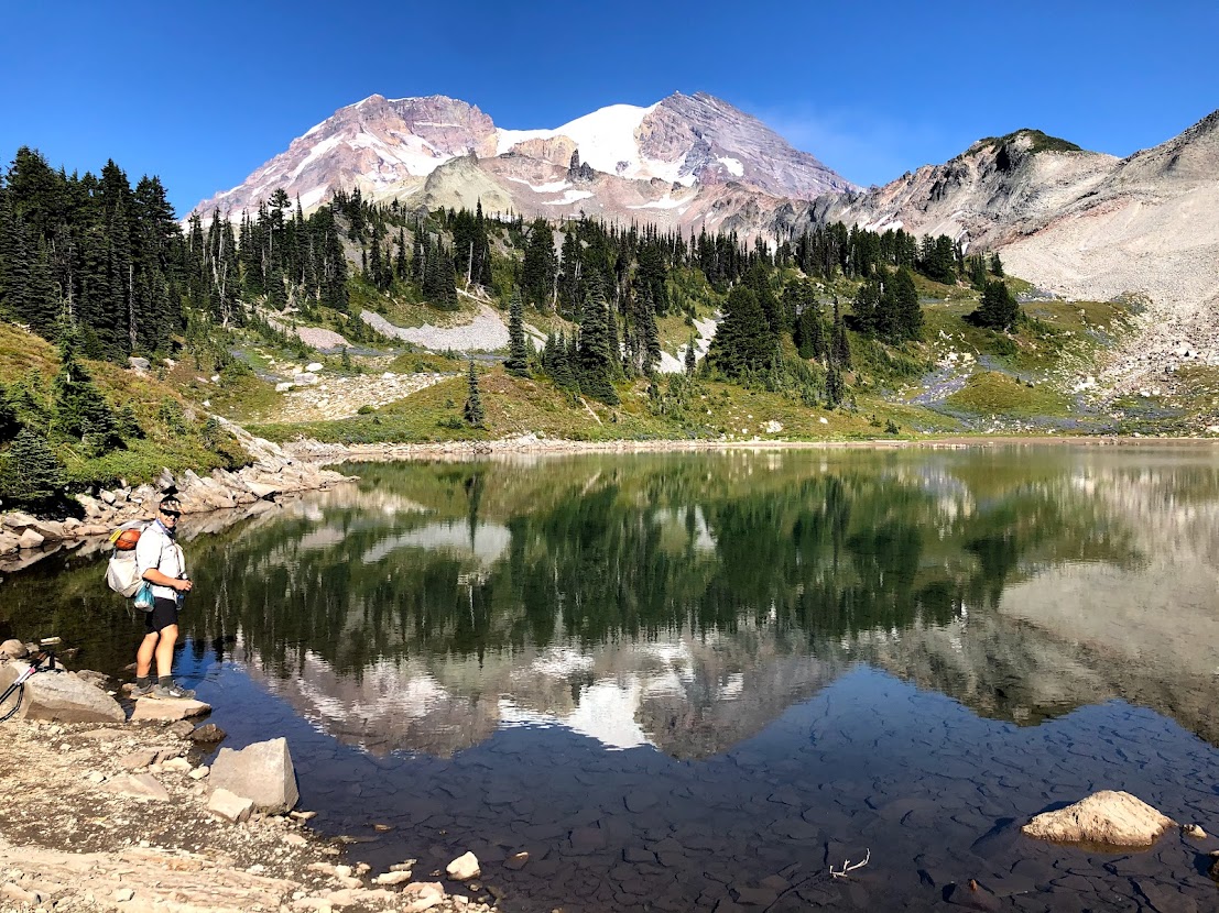
The walk to Klapatche Park would be our last climb of the day, and the rest of the afternoon was spent descending to our campsite for the night: North Puyallup River camp. The gentle and well-groomed trail made for easy walking, and the dramatic views of the western side of the mountain certainly didn’t hurt. Once at camp, we briefly socialized with some counter-clockwise oriented hikers who were our neighbors, and were soon lulled to sleep by the noise of whitewater rushing down from the mountain.
Day 2 9/4/20 – North Puyallup River Camp to Carbon River Camp (22.8 miles)
Nearly 20 miles on trail had us tuckered out, and we slept quite well that first night. The next morning would start us on an incline to Golden Lakes Campsite. Weather had been beautiful the previous day, so naturally this morning was bathed in golden sunshine as we trekked through a small burnzone. We noted plumes of smoke far in the distance (we would later learn this was a major fire brewing in Oregon) before dropping down to the South Mowich River campsite for a mid-morning snack and bathroom break.
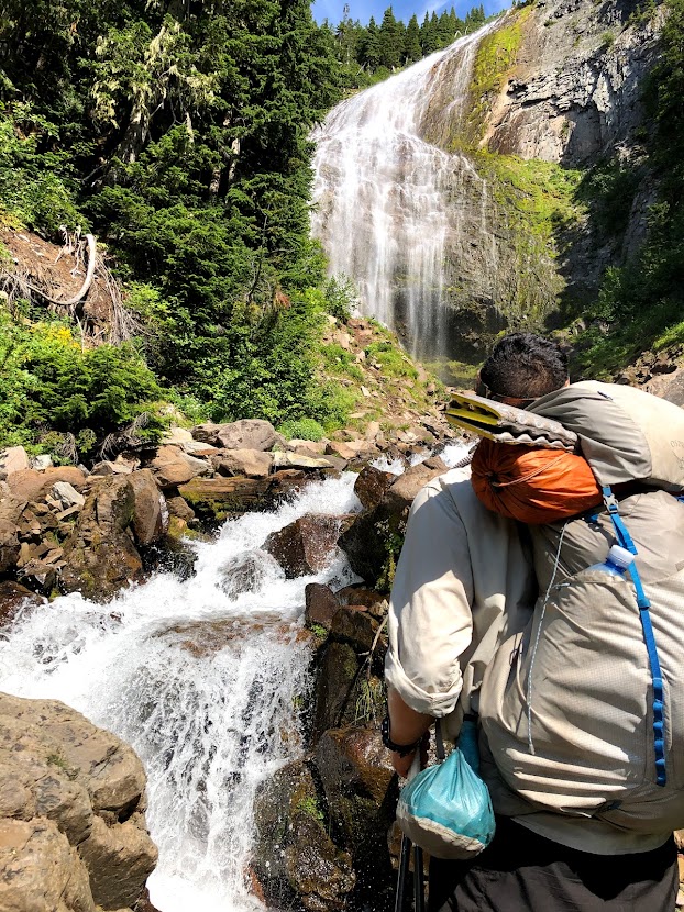
The hike out of Mowich River is one of the steeper sections of the trek, and the coniferous canopy left the air with a heavy, wet feeling. While enjoying a snack at the top of the climb, we came to a crazy decision: we would forgo hiking the traditional Wonderland Trail route near Mowich Lake and Ipsut Creek, in favor of the Spray Park alternate. During my previous Wonderland hike, I felt rather underwhelmed by the Mowich area and following miles. I heard rumor that Spray Park, which is of similar distance to the true Wonderland, was drastically more scenic. Not only did it offer sweeping views of the mountain, but it also offered a short side trail to Spray Falls. Our campsite was nestled at the trail junction of the eastern side of the Spray Park Trail and Wonderland anyway, so it wouldn’t take us off-course. We were not disappointed.
Up and over the pass separating Spray and Seattle Parks we went, relishing in hoary marmot encounters and wildflowers alike. There were a few rotten snowfields in this section, even in September, but nothing very challenging to navigate. Mosquitoes were abundant here, so we walked at a brisk pace over the open ground before descending back into the foliage of the forest. The remainder of the day brought us past Cataract Valley, another campsite along the alternate. Our feet were beginning to bark by the time we finally made camp for the night, high above the banks of the noisy and murky Carbon River. At over 42 miles deep, we were nearly halfway through our circumnavigation of Mount Rainier.

Day 3 9/5/20 – Carbon River Camp to Sunrise Camp (13.5 miles)
I’d stayed at Carbon River Camp while completing the Northern Loop in Mount Rainier with my friend Tyler back in August of 2019, but that trip entailed drippy skies and muddy trail. This time we were fortunate to have dry conditions and bluebird skies, making tearing down camp quick and painless. Today would be our shortest day on the trip at a measly 13.5 miles, meaning we had time to sleep-in and smell the roses before departing for our destination.
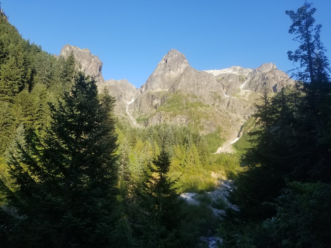
The trek out of Carbon River toward Mystic Pass is regarded as one of the steepest on the entire Wonderland Trail (with the exception of the counter-clockwise climb out of Indian Bar). We trudged past the Carbon Glacier, disheveled with grit and sediment, before being rewarded with the breathtaking serenity of Moraine Park. We snacked our way along the meadow before continuing the climb over the pass towards Mystic Lake, which is one of the larger campgrounds along the trail. With the hardest part of the day behind us, we took off our packs and shoes to enjoy lunch at one of the empty tentsites.
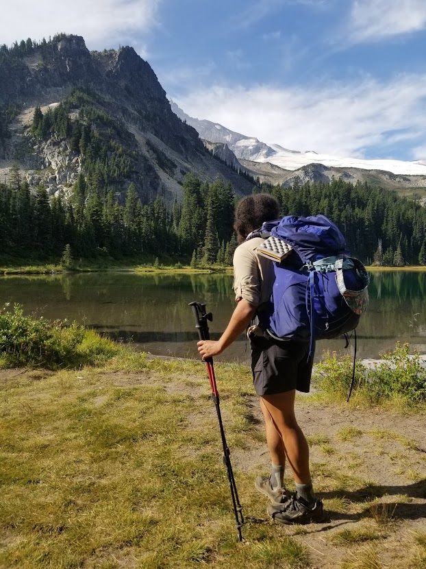
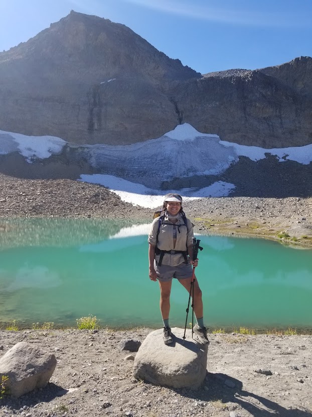
Over another glacier the trail would take us. We toiled uphill while hearing the echoes of cascading boulders ricocheting down the river, moved by tons of slow-moving ice as the glacier eroded its way downhill. Tynesha and I went at a slow clip, making sure to save our strength for the following day, which was sure to be our longest on trail. Shortly after passing Granite Creek Camp, we pushed up and over the saddle and onto Sourdough Ridge. One of the highest elevations on the Wonderland, Sourdough Ridge offers magnified views of Tahoma herself. If you’re lucky (we were), you might see the resident herd of mountain goats grazing between the rocks.
It was barely afternoon by the time we finished the climb. Amidst the tourists on trail (we were getting close to a popular trailhead, Sunrise), we were fortunate to spot some goats as we munched on pop-tarts. Only a few miles away we would reach our destination for the night: Sunrise Camp. This is a densely populated area as far as Mount Rainier National Park goes, and every campsite near us was full before too long. In the mid-afternoon we went to a small pond a quarter mile away to splash around and get clean, grateful for the respite the short day offered. After dinner we hopped into our tent, ready for an early wake-up the next day.
Day 4 9/6/20 – Sunrise Camp to Maple Creek Camp (24.7 miles)

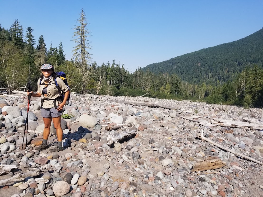
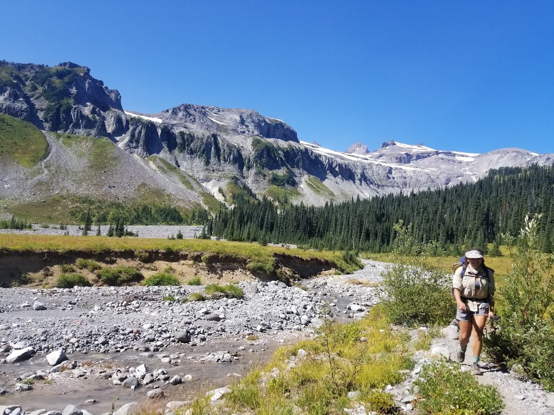
Tynesha and I had hiked a handful of 20 mile days together on shakedown hikes in preparation for the Wonderland Trail, and this was the big day we had in the back of our minds the whole time. Not only would we be attempting over 24.5 miles; we would also be covering a significant amount of elevation change. We broke camp early in the morning to get a few hours on the sun, and by the 5 o’clock hour we were descending toward the White River. By the time we crossed the White River, the sun had began to dominate the western landscape. We hastily made our way over the rushing river and into the forest, grateful for our first stretch of flat elevation profile on our trip.
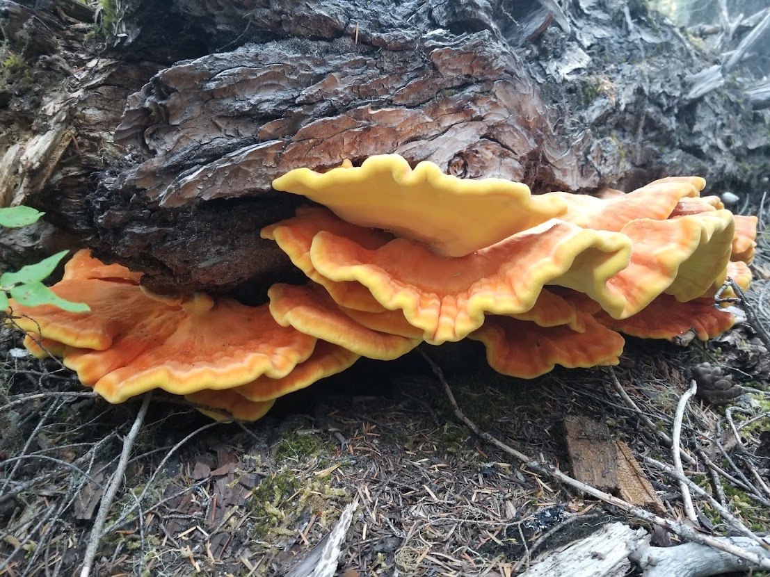
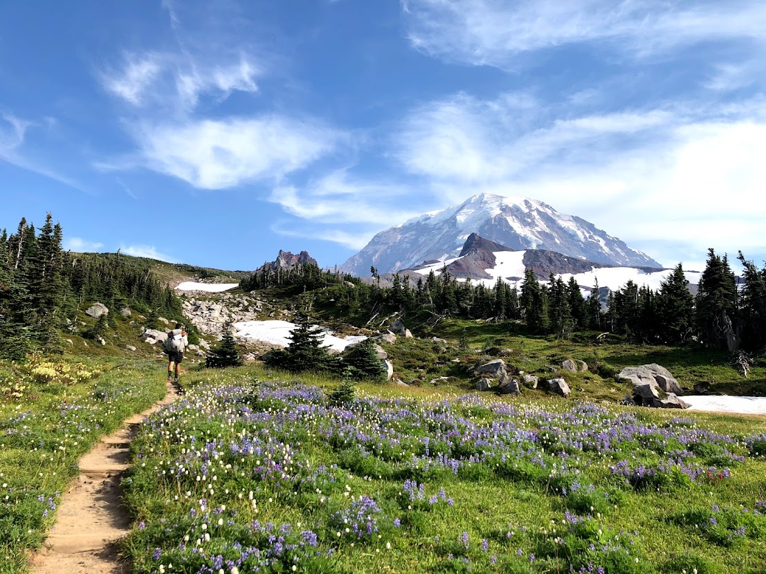
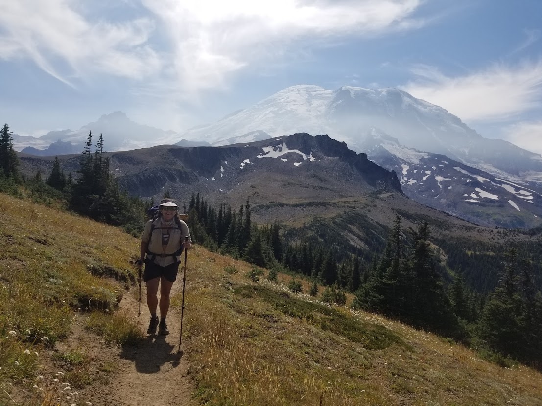
The next 17 miles or so are my favorite on the entire Wonderland. Out of White River we would hike through old growth fir woods, teaming with edible and beautiful fungi alike. After a few short miles we would begin to climb in elevation, eventually peeping out of the trees and into the subalpine zone near Summerland. By now we were around 10 miles in, so we broke our fast at the campground shelter to catch our breath. The sun was creeping higher in the sky, and we wouldn’t see much shade until the mid-afternoon. It was a weekend, and we could see day hikers (who had woken up even earlier than us) ahead, like ants, in the distance. We made our way over glaciated steams running down the mountain and into the alpine zone, where dramatic views would be plentiful.
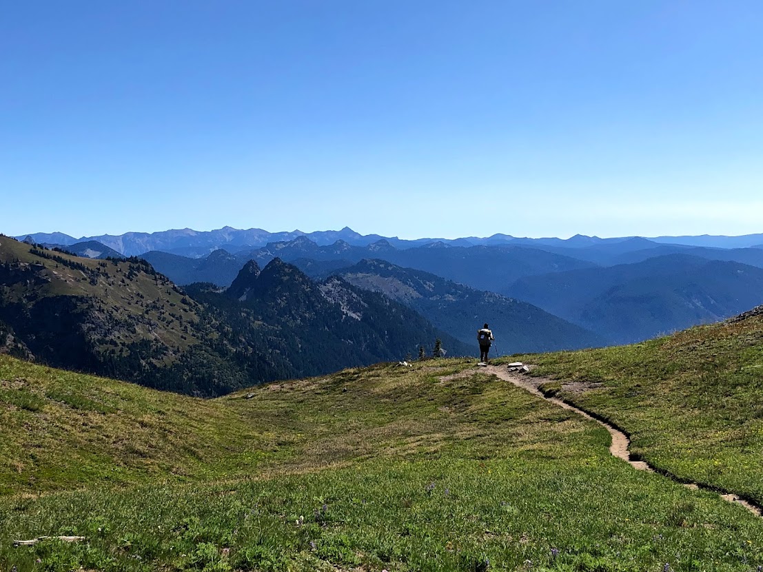
The sun-bleached alpine zone on the eastern slopes of Rainier are riddled with loose rocks and glaring sun, but are also accompanied by a myriad of waterfalls and glaciated pools. At our apogee we crossed Panhandle Gap, highest elevation on the trail. We scarcely saw any hikers for the next 5-6 miles as we rode the gentle footpath, hugging the contours of the mountain. Without a trailhead anywhere near, this was perhaps the most remote stretch we had come across, and we were thankful for it.
We stopped for water about halfway across the alpine section. The two of us would then enjoy a lunch break on the ledges of the cliff that faces the Ohanapecosh Glacier. Only a mile or two from the most fabled campsite on the trail, Indian Bar, we braced our knees for an incredibly steep descent into the valley. We were in the high teens in terms of mileage by now, and our feet were beginning to bark from all the downhill. We found Indian Bar as scenic as ever, with its rustic backcountry shelter nestled among the gargantuan cliffs of the mountain. The campsites and shelter were crowded with other hikers, as expected, so we filled up on water, had a snack, and moved on.
The climb out of Indian Bar was short and sweet by comparison to what we had already endured that day, but by the afternoon we were tired, and it felt like a slow-going. Verdant grass and a gentle breeze graced us as we hiked in silence up the final ridge of the day. We enjoyed a juicy perspective of the elusive Tahoma before descending back into the fir thicket of the forest, eager to get to camp soon.
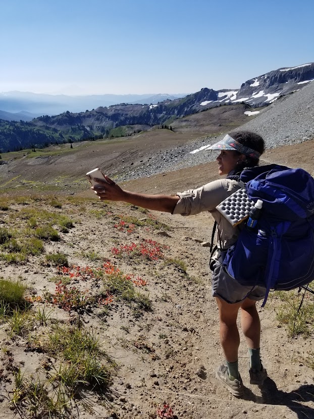
We slowly counted down the remaining miles as they sloughed off the bone. The latter afternoon hours would be spent trudging through mottled sunlight, passing Nickel Creek Camp and Box Canyon along the way. That afternoon we ran into our neighbors from North Puyallup Camp whom we had met a few days earlier. We exchanged some trail stories, they commented our on our sweet mushroom visors, and we never saw them again. In the early evening, at about 25 miles on the day, we finally arrived at Maple Creek Camp. After changing clothes and hanging our sweaty garments up to dry, we finally ate dinner and got settled into bed. 83 miles down. Only one more day left.
Day 5 9/7/20 – Maple Creek Camp to Longmire (10 miles)

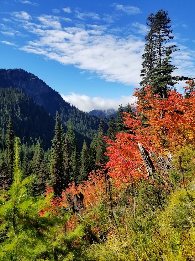
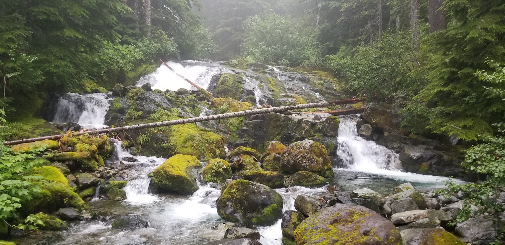
We felt stiff and sore on the morning of day 5. The previous day had been the longest I’d hiked in almost a year, and I was slow to put my shoes on and tear down the tent. It would only be another 10 miles until we reached the car, so there wasn’t much incentive to push the pedal to the metal. On the flipside, the sooner we got back to the car, the quicker we’d be able to get home, and the prospect of beating traffic in Puyallup sounded attractive. The immediate miles were relatively calm, hugging Maple Creek under the shade of some mixed conifer-deciduous forest. We admired the fall mushrooms in fruiting and a couple of waterfalls before beginning the final climb of our hike.

The two of us enjoyed some light snackage near Reflection Lakes, a popular drive-up destination right on the Wonderland Trail. As with the rest of our miles that day, Mirror Lake was crowded with tourists and day hikers, eager to get a glimpse of mighty Tahoma. We dodged some unruly children and began our slow descent toward Longmire, taking brief moments to check out Narada Falls and a few other waterfalls I cannot recall the name of. Eventually we would come across Paradise River Camp, a new campsite installed by the National Park, before the homestretch on the epic Wonderland. We arrived back at our vehicle, took some photos at the false terminus, changed our clothes, and took off for home.
Closing Thoughts on the Wonderland
I’ve hiked a mile or two in my day. One of the benefits to trekking in National Parks is that National Parks are arguably held at the highest possible level of conservancy and land management, at least in a recreational sense. This means pit toilets at backcountry campgrounds, incredibly well-groomed trails, stunning and unique geographical features, and restrictions of foot traffic. For these reasons, National Park oriented trail systems can feel suburban to recreationists who crave a wilder, off the beaten path experience. On the flip-side, it also takes some of the annoying logistics away from trip planning, and enables those of us who don’t mind a more mild adventure to maximize our experiences. The Wonderland is no exception to all of the above.
For my money, the Wonderland Trail is mile-for-mile one of the most scenic hikes I’ve ever done (honorable mention to JMT and High Sierra Trail). Sure, it has some challenging climbs tossed in, but overall the trail is smooth as butter and has ample shade and opportunities for water replenishment. If you’re lucky, the mountain will be out (ironic as it is the main feature of the park), which provides outrageously dramatic views at every corner. It’s worth noting that in 2020 we had crystal clear skies, but in 2019, I faced a few miserably wet days. Water features can be found every few miles, and the entire park is quite literally a fungi kingdom. After two thru hikes, I can honestly say that the hype is 100% real on the Wonderland. I encourage all scenic trail enthusiasts and Pacific Northwesterners to apply for permits as soon as you can!