About
From the Appalachian Trail Conservancy:
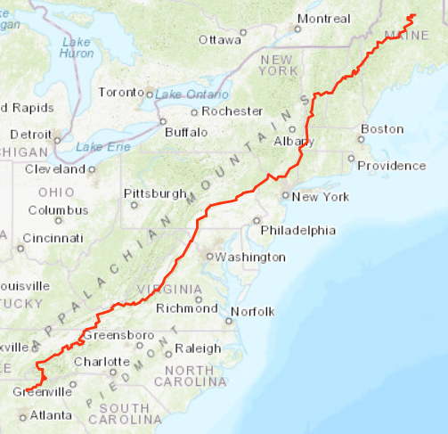
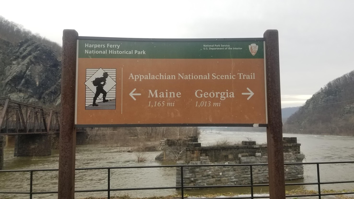
The Appalachian Trail is the longest hiking-only footpath in the world, ranging from Maine to Georgia.
In my eyes, the Appalachian Trail (or the AT, as it is commonly known) is perhaps the greatest walking pilgrimage in the US. Encompassing over 14 states and 2,189 miles, it is one of America’s oldest long trails and is an iconic staple of outdoor recreation on the East Coast. If you have even dipped your toe into the world of long-distance hiking, chances are the Appalachian Trail is the first name you will hear.
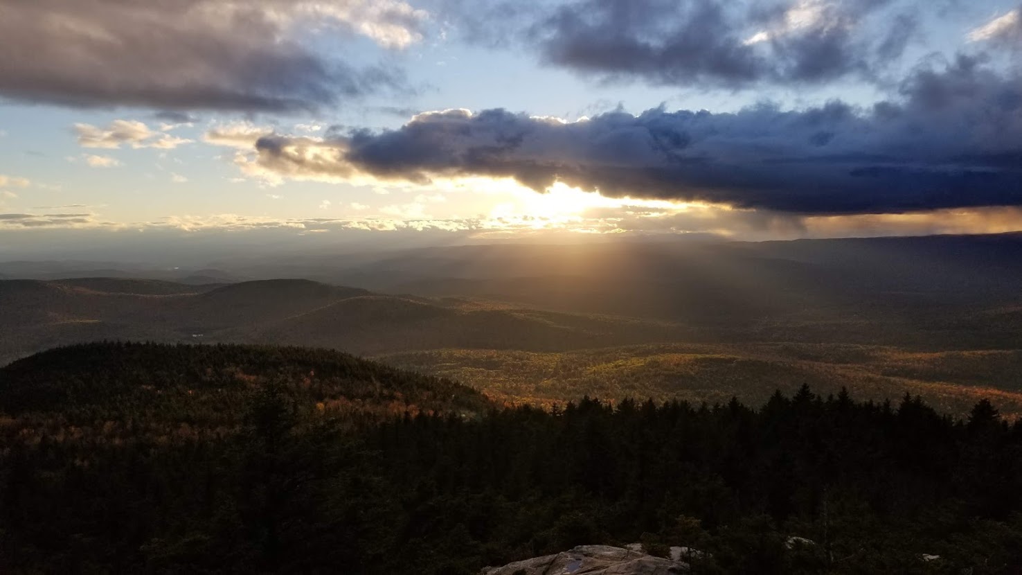
Looking East

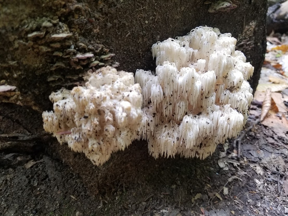
It was February of 2018, and I was in the throws of mushroom season in Northern California. I had ended the previous year with thru hikes of the Tahoe Rim Trail and Arizona Trail, respectively, and was looking forward to the prospect of another sunbaked summer guiding in Yosemite National Park. I enjoyed many aspects of guiding, but there was one thorn in my side: guiding season coincided directly with thru hiking season. There’s an inside joke in thru hiker circles that a hiker will either go one-and-done with their thru hikes, or immediately aspire to complete as many as they can, including the infamous triple crown. I have some thoughts on the “status” of the triple crown, but I’ll save that for another post – for now, just know that since completing the PCT, the Continental Divide had been top of my thru hiking wish list. If I were to aspire for the triple crown, then I wanted to complete it on the CDT, not the AT: I just didn’t think the notoriously non-scenic AT would be a fitting end to a legendary journey. Additionally, the CDT wasn’t hikeable until May-July, whereas huge portions of the Appalachian Trail were relatively snow-free throughout spring. The mountains out east are small, and elevation would be relatively low for the entire journey. The Appalachian Trail is also the shortest of the ”big 3” thru hikes in North America… theoretically, you could thru hike it in 100 days by averaging a measly 22 miles per day. I just averaged 25+ miles per day on the AZT only a few months earlier, so how much more challenging could the AT be? In terms of work, many guests I guided in the west were from the east coast, and the Appalachian Trail, Great Smoky Mountains National Park, and New England were frequently mentioned – perhaps I could develop my professional perspective by exploring somewhere new. Finally, I had made arrangements with my employer to begin guiding in Yosemite on 6/1/18; if I hiked fast, I could greedily fit in an entire thru hike before the summer season had even started. And so, my plot to travel east was hatched, with northbound plans from Georgia to Maine beginning on 2/18/18.
Georgia, North Carolina, and Tennessee (467 miles)
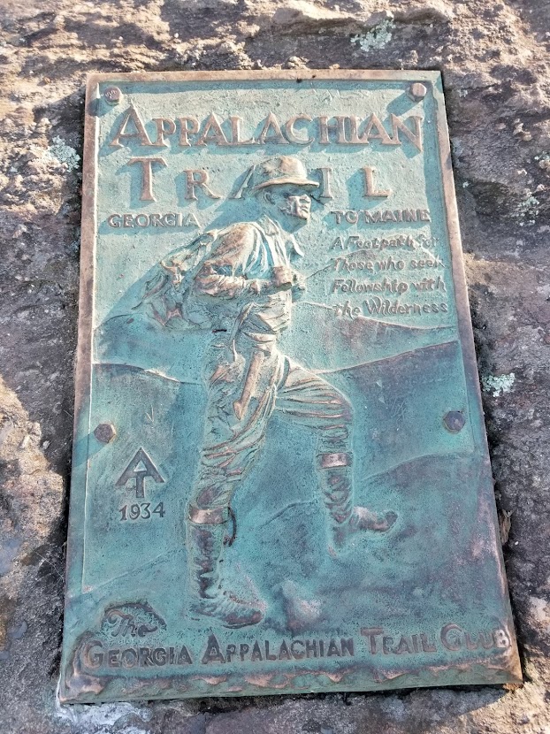
One week I was foraging for yellow foot chanterelles on the Pacific Ocean, the next I was on a plane to Georgia with my mom and dad (I am such a lucky son). Upon arrival in Atlanta, we acquired a rental car, enjoyed breakfast, and made our way to our overnight hotel for resupply. Utilizing the power of the Forerunner we had rented, my mom and dad drove me to the Springer approach trail, where the southern terminus of the AT would be awaiting less than 2 miles away. In retrospect, it would’ve been significantly easier logistically, and more fulfilling recreationally, to hike up from Amicalola Falls. Alas, I had heard from friends who had hiked the AT that Amicalola Falls wasn’t anything special – shame on me! I said goodbye to my dear parents and was on my way, but was not alone for long: my coworker Terrence would be waiting for me at the terminus. I’d met Terrence the previous spring while guiding trips in Phoenix, and he had hiked the AT two years earlier. The good man brought beers for the two of us, and after we took our obligatory photos at the monument, we were on our way.

At this point I’d like to make a quick disclaimer. The AT is infamous, and many aficionados of the trail will relish every twist on the path, every white blaze they see, and every spindly tree they pass. Coming from the west, most of these features were unremarkable to me; besides, I was on a mission to hike 22 miles per day. I simply did not afford myself enough time to bask in every mundane nuance I came across. For this reason, I hope you will forgive me for not recalling the name of every single shelter, gap, mountain, or river I encountered.
We decided to take it relatively easy in the beginning. The miles melted by as Terrence and I caught up on work and life, and before long we had hiked 15 or so miles and arrived at a shelter that looked good for the night. The southern Appalachia was already crowded, and rather than cram into the shelter with all the other NOBOs, we opted to tent in the mud on the periphery of camp. The following morning, we hiked a few more miles before Terrence was picked up by his girlfriend at a local trailhead. Thanking him for his friendship and support, we said our goodbyes and I was on my way. Before long I came across another trailhead, this time relatively crowded: a trail angel dispensing trail magic! This is where I would meet Fresh Grounds, a former thru hiker, who runs the Leap Frog Café. Little did I know, as I enjoyed my fresh pancakes, that I would run into Fresh Grounds several times between now and the Great Smoky Mountains.
I was taking it easy in the beginning, only hiking 15-20 miles per day to ensure my body had time to adjust. I spent time with the good folks at Mountain Crossings and a couple of other hostels as I pushed through Georgia. The trail was thick with clay-like mud and dead leaves, obscured by fog and the seemingly omnipresent noise of running water. At times the air was so thick with moisture, I wasn’t sure if I was better off wearing a jacket and sweating, or hiking in my shirt and succumbing to the faint mist. This was only the beginning of my weather woes in the AT, but it was to be expected, as it was only February.
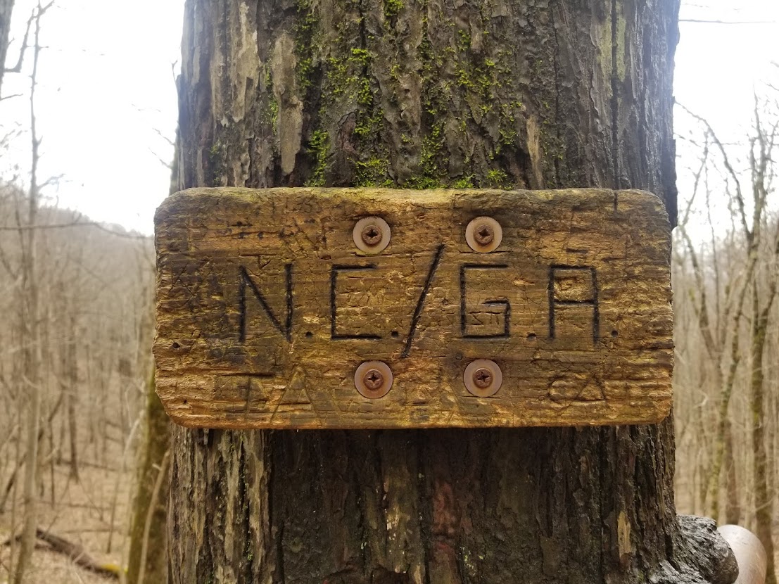
Only a few days in I reached my first border at North Carolina. Boy, what a weird feeling. I’d crossed several borders in my thru hiking journey at this point, but usually it would take 450 miles at a minimum. I took a moment to chat with some of the hikers celebrating their accomplishment before pushing forward. Now that my feet were beginning to get back in hiking shape, moving my way towards 20-25 miles per day seemed prudent. In southern North Carolina I came across a few more former hikers who were spreading trail magic (usually donuts and OJ out the back of their car at a trailhead). It was clear to me that this was an incredibly social experience for most people, which I was expecting, but I don’t think I was fully prepared for how chatty folks really were.
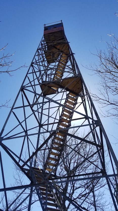
In North Carolina I also began to see my first fire towers, which dot the length of the AT. These are usually atop a mountain and a few flights of stairs high, offering sweeping views of the surrounding forest for miles around. I made sure to climb these every chance I could, as well as stop for a quick bite to eat at famous rest-areas, such as at the Nantahala Outdoor Center. From the NOC, as it is often called, it was only a couple of short days until Great Smoky Mountains National Park. The Smokys is the most visited park in the nation, and I was eager to see what the hype was all about. I acquired my Smokys permit near Fontana Dam, NC, still less than 200 miles from my starting point in GA. Already, the hiking crowd had thinned out, and I’d only see a handful of northbound thru hikers a day.
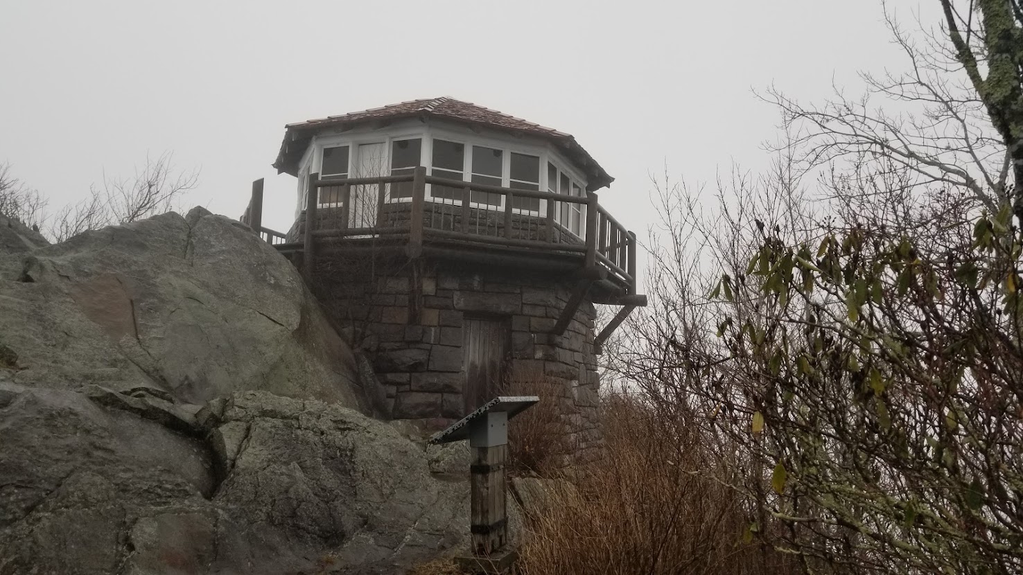
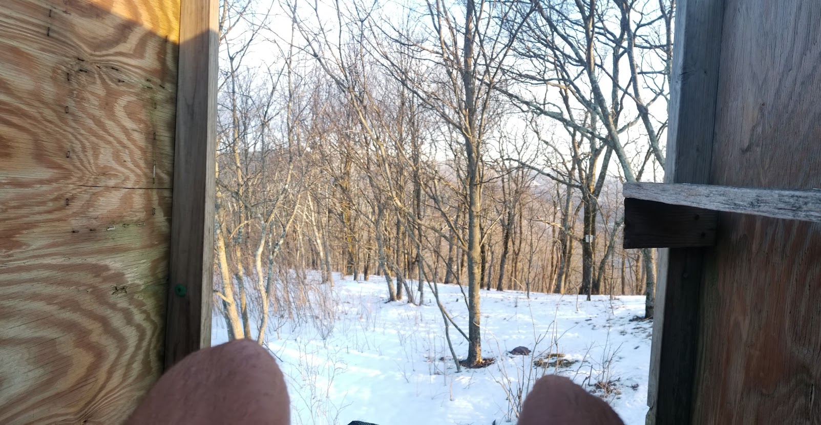
The Smokys were neat, but really more of the same: rolling green hills and muddy trail. By now it was clear that the lack of views was why many hikers referred to the AT as the “green tunnel”; woe is me. Only a day and a half through the park I had reached Newfound Gap, which denoted the border between North Carolina and Tennessee. The AT stretches for several hundred miles between the border of the two states, and I’d be hopping between each for the next week and a half. This afternoon the weather turned for the worst, and soon I was being pummeled by rain showers as I trudged ever forward, making a new high on the AT of 27 miles. On day 3 in the park, I reached Clingmans Dome, which at a measly 6,643 feet, is disappointingly the highest part of the AT (clouds obscured my view). I met some college kids on spring break that afternoon, and soon I was on the northern fringes of the park. I decided to spend the night at Mt. Cammerer Shelter, which Terrence had recommended to me earlier in my trip. The Mt. Cammerer Shelter lacks the amenities of other shelters I’d find further north, but it made up for it in uniqueness and dramatic design.
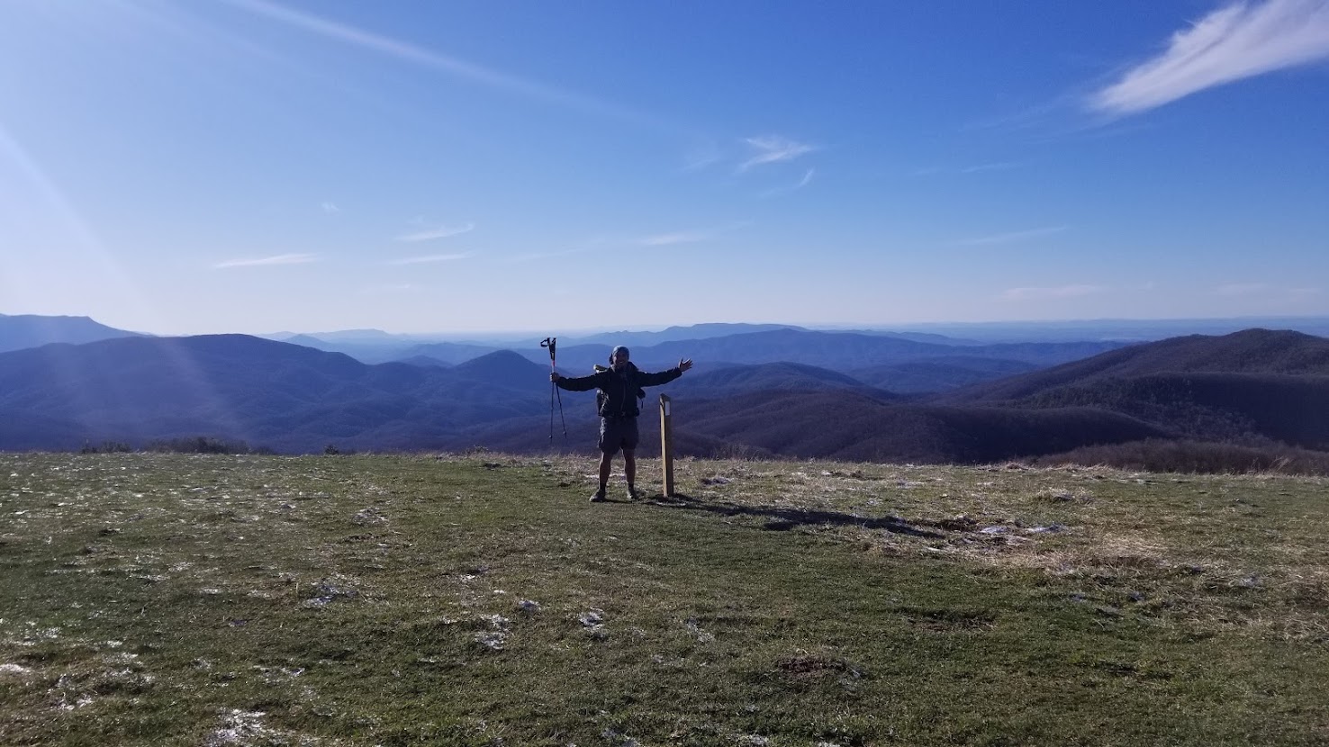
After a sleepless night on the mountain (shout out to powerful winds and James Taylor) I exited Great Smoky Mountains National Park with a 9 mile hike the next morning. I made my way to Standing Bear Farm Hikers’ Hostel to pick up new shoes and some food: the fella operating the lodge had only a handful of teeth and sold me expired cheese. I do not recommend this destination as a resupply location. I was eager to get out of there, so I made haste and moved onto the next iconic section I’d heard so much about: Max Patch. Apparently in the southeast, because their mountains are so short and vistas undramatic, these exposed mountains with solid views (called “balds”) are super famous. This one, Max Patch, drew in crowds from miles around. To me, it was reminiscent of local day hiking trails in the Bay Area, albeit significantly more glorified. I made my way over the patch and into a rhododendron thicket (which wouldn’t let up until the Mason-Dixon line, almost 800 miles away). This evening was my first sign of snow on trail. I neglected my jacket that evening and soon became dangerously cold. I felt myself growing lethargic as I reached my shelter for the night, so I quickly wolfed down the expired cheese, threw on my puffy jacket, and hopped into my sleeping bag.
It was a cold night, which meant a cold morning to match. With a brisk pace I set out from underneath the rhododendrons and through Hot Springs, NC, which is apparently a popular spot for many hikers. The next few days were relatively uneventful, and I didn’t see one other thru hiker the whole duration. I spent the night at a civil war memorial (the first of many), and soon I was bearing down on Erwin, Tennessee. In Erwin I took a shower and did laundry. Here I met a troupe of hiker trash at the local hostel: they didn’t even have one bed available. Many of the hikers I met here had been at the hostel multiple days already with no intention of leaving (the liquor had been flowing). Most of the gossip was around the bad weather the region was expecting over the next 24 hours. I learned long ago to take hiker gossip with a grain of salt, as fear mongering runs rampant and many geographical hurdles are only relative to each hiker’s respective physical ability. After a pint of ice cream and a beer, I took off for another 7 miles, pitched my tent under some powerlines, and got cozy.
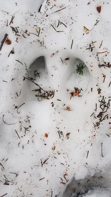
I woke early the next morning in anticipation of getting some miles. Several inches of snow had come down overnight, and my fingers were numb by the time I had packed my trusty Tarptent Protrail away. I’d hiked through the snow on the PCT, but that was different: a spring varietal of rotten snow that was crusty in the morning and rotten in the afternoon. This snow left the landscape deafly quiet. I saw a coyote as I pealed off my puffy jacket when the sun came up, my only companion in what seemed to be my personal winter wonderland. Shortly after I’d come across a solitary tent, and I felt amused to know the other hiker wouldn’t be packed up by the time I walked by. I broke trail that day in frigid temperatures all alone until early in the afternoon. After lunch I found fresh foot prints accompanied by massive paw prints, and part of me wondered if I had stumbled upon the tracks of a hungry black bear, following the scent of hikers in order to get some grub. The tracks led up the incline of Roan Mountain, one of the tallest peaks on the AT in this section. In the early evening I reached Roan Mountain High Knob, a double decker shelter nestled high on the mountain. There was a spring nearby that I filled up water reserves with before entering the shelter… inside were at least 6 other hikers! Two section hikers there were, and five thru hikers: Night Train, Opa, and Black Beard were a trail family (3/4s of the “Four Horsemen”, as they fancied themselves) and Research, who was a professor at a university who was hiking with the company of her Great Pyrenees, Atticus (I quickly deduced the “bear tracks” were his). The night would be as low as 14 degrees Fahrenheit, and snow came in through a hole in the roof. I’d made a marathon that day, and was ready for a night of cold, bad sleep.

The hikers I met in the shelter were good company. Frankly, I was happy to mingle with them that day. The snow flurries blotted out the sky as we descended the mountain, humping our packs over the occasional snow-swept bald. After roughly 16 miles we made it to the next road and corresponding hostel, which was a BnB style accommodation with a bunk house. Walking from the trailhead to the hostel meant dodging the corpse of a road-killed dog, which broke my heart, and a large house waving a confederate flag proudly, which made my pace quicken. We all resupplied and spent the night there. This particular hostel was known for a trail-famous breakfast, which the others indulged in the next day, but I pushed on, eager to make up my 22 miles per day that I missed out on the previous day in the snow.
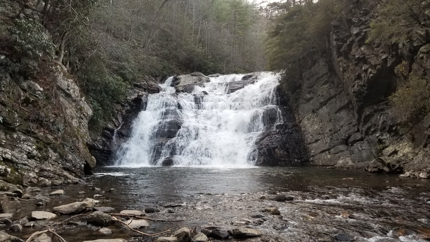
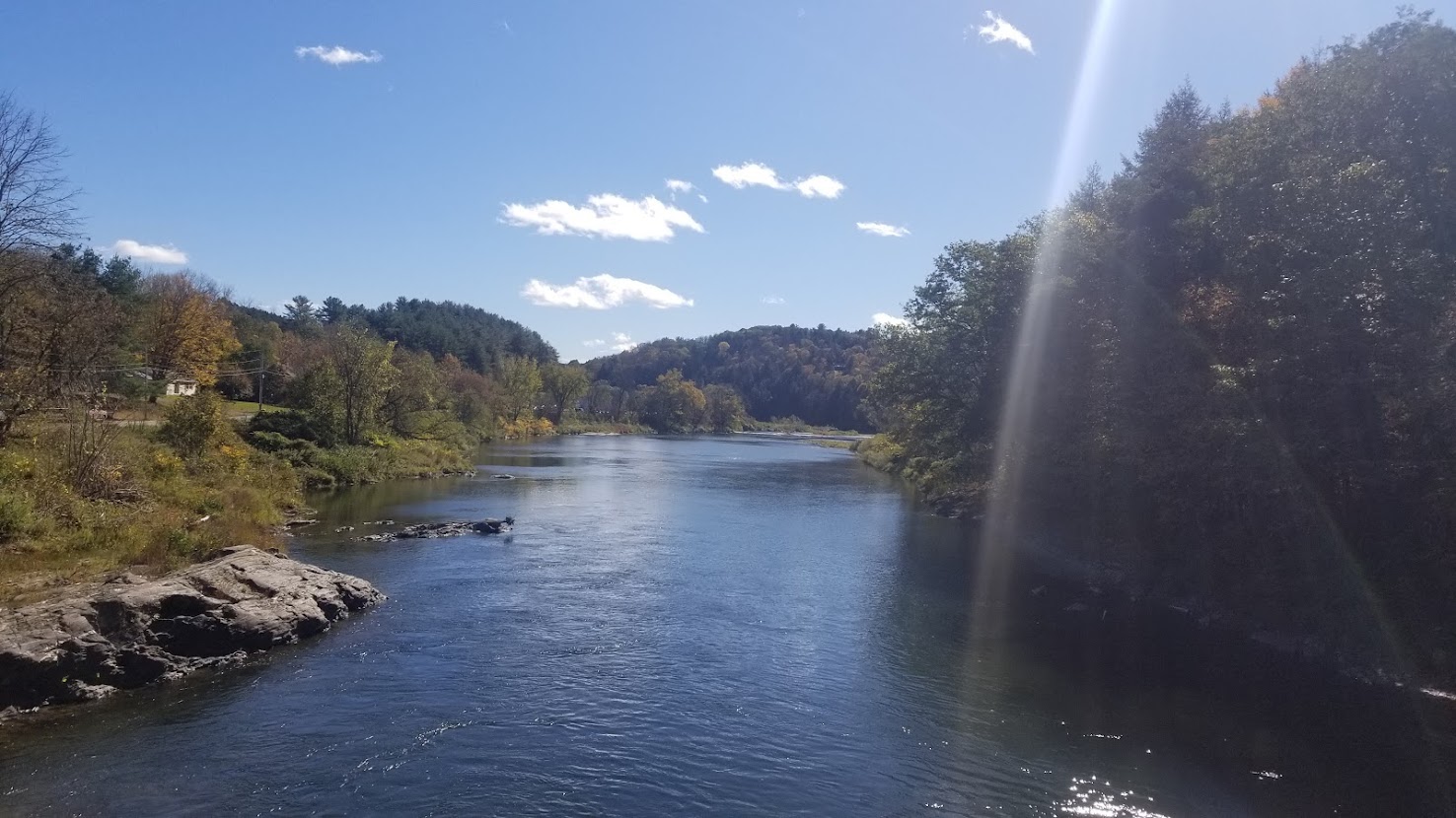
Trail would be quiet the next few days, and I was making good miles over viewless hills obscured by trees. This section boasted a beautiful waterfall, several farm patches, and even a rundown old shack. There was a lake somewhere in the section, but I didn’t have much time to enjoy it: I was now over 445 miles through the trail, and was eager to make it to the next state. After my first 30 mile day, I spent a final night in Tennessee at a nondescript shelter with chagrin, since it was cold and wet and I had gotten my sleeping bag zipper stuck. Motivated by the prospects of a warm bed and fresh food, the following morning I pushed to what I would consider to be my first major milestone on the Appalachian Trail: Virginia.
Meet Virginia (556.7 miles)

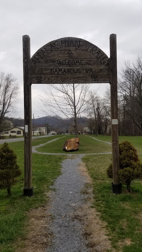
I crossed the Tennessee/Virginia border on the 22nd day of my thru hike. Until this point, I had averaged over 21 miles per day for at least 467 miles; considering I’d need to average about 21.8 for 100 days to meet my goal, I was off to a solid start. In the early afternoon I arrived in Damascus, VA, which is an iconic town known for hosting the Appalachian Trail’s annual trail festival every year. Obviously, I was far too early for the fare, but I enjoyed my visit nonetheless. While in town I stayed at Woodchuck’s hostel; I believe Woodchuck was considering retirement, so I’m unsure if the accommodation is still around. After resupplying, I mingled with a few of the other hikers. At this point some trail families had already formed, and hikers were relatively cliquey and unwilling to chat. There were two people, however, who I managed to connect with: Scoutmaster, who was one of the first and most affluent YouTube Vloggers on the AT that year, and Handy, who was the host of Angels Rest Hiker Haven Hostel in Pearisburg, VA and was doing some magic for another hiker (SOBO). I can’t recall why Scoutmaster was in Damascus, as he had already completed this section and was further up the trail than I was at this rate. Regardless, I caught up with my girlfriend back home on the phone, resupplied and did my chores, and finally got some good rest.
Following my stay at Woodchuck’s, I hit the trail bright and early, with my sites set on a shelter 28 miles away. Weather was rough that day, and I hiked in the solitude of falling snow for most of the midmorning and afternoon. Before dusk I arrived at Thomas Knob Shelter, which was a double-decker abode on the edge of Grayson Highlands State Park (known for its ponies, none of which I encountered). There were a few section hikers, and at least one thru hiker, Scratch. The night was blistering cold and frost entered through the open wall of the shelter… luckily, I had pounded a full bag of white chocolate mini-Reese’s peanut butter cups before bed, and stayed relatively warm. Scratch and I felt it prudent to hike with one another for a while, as the snow had fallen precipitously through the night and we were quickly post-holing our way through the Grayson Highlands. Scratch wasn’t overly fond of the snow, and in the afternoon, he notified me that he had phoned another hostel at the next road to come pick him up. I was glad to join in, and was happy to stay at Sufi Lodge Halal BnB, which offered many wellness amenities (including a bidet). It felt like luxury to spend nights in hostels so close to one another, but was glad for it when Scratch and I once again walked into the snow the next day.

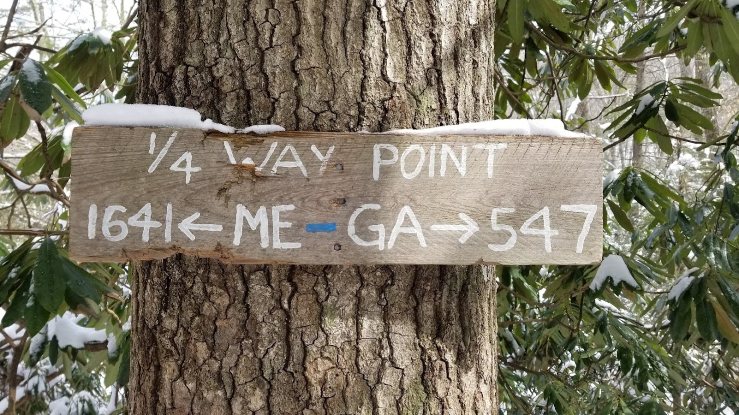
Scratch was good company and a powerful hiker. We spent the day chatting while pushing past another 20-mile marker before stopping near Millboro, VA, where we spent the night in an old school house from the 1800s that was open to hikers. There were lots of old buildings like these on the AT, and it was fun to learn about the region’s history. Scratch and I parted ways that morning in favor of me acquiring a bit more miles. The day was challenging: once again alone and breaking trail through snow was tough. I began to feel a nagging pain on the inside of my calf, right above the ankle. This injury intensified and replicated itself on my other leg, making each step as arduous as ever. My experience with tendonitis on the PCT told me this was an overuse injury, likely due to hiking with Altra Lonepeaks for the first time. Much of the Appalachian Trail is within cellphone reception, fortunately, and using my smart phone I was able to self-diagnose myself with posterior tibialis tendonitis, which I promptly treated via stretches and strengthening exercises I found on YouTube over the following days. Otherwise, I was bolstered through the frosty rhododendrons by a new trail sign: at 545 miles in 26 days. I had completed ¼ of the trail!
The following days were tough, but productive: I continued to nail my mark of mid 20s throughout the state, despite still battling (and fortunately, overcoming) my tendonitis. In mid-march, after another lonely day, I was surprised to come to a shelter where I finally encountered other thru hikers again! This time it was Old Soul, the aforementioned Scoutmaster, and Funsize (who was finishing up her Triple Crown). Given the utter lack of thru hikers this far north, I was shocked to meet a full-on trail family. I spent the next day hiking with them, learning about their backgrounds, and in the case of Funsize, chatting about the PCT (we had hiked it the same year and knew some of the same people). We hiked a full day, and I was glad to exchange less miles for good company. The following day, after about 18 miles, we arrived in Pearisburg, VA, where we relaxed at the comfortable Angels Rest Hiker Haven Hostel. Waiting for us there was Handy, the host who I had met at Damascus days earlier. This was probably my favorite hostel so far, as the amenities were lush, and Handy and I got along great. The next day the four of us hit the trail again, and hiked together for about half a day: in the early afternoon the remaining three decided to shoot for about 22 miles, whereas I wanted to hike an extra 7. We said our goodbyes and once again I was on my own.
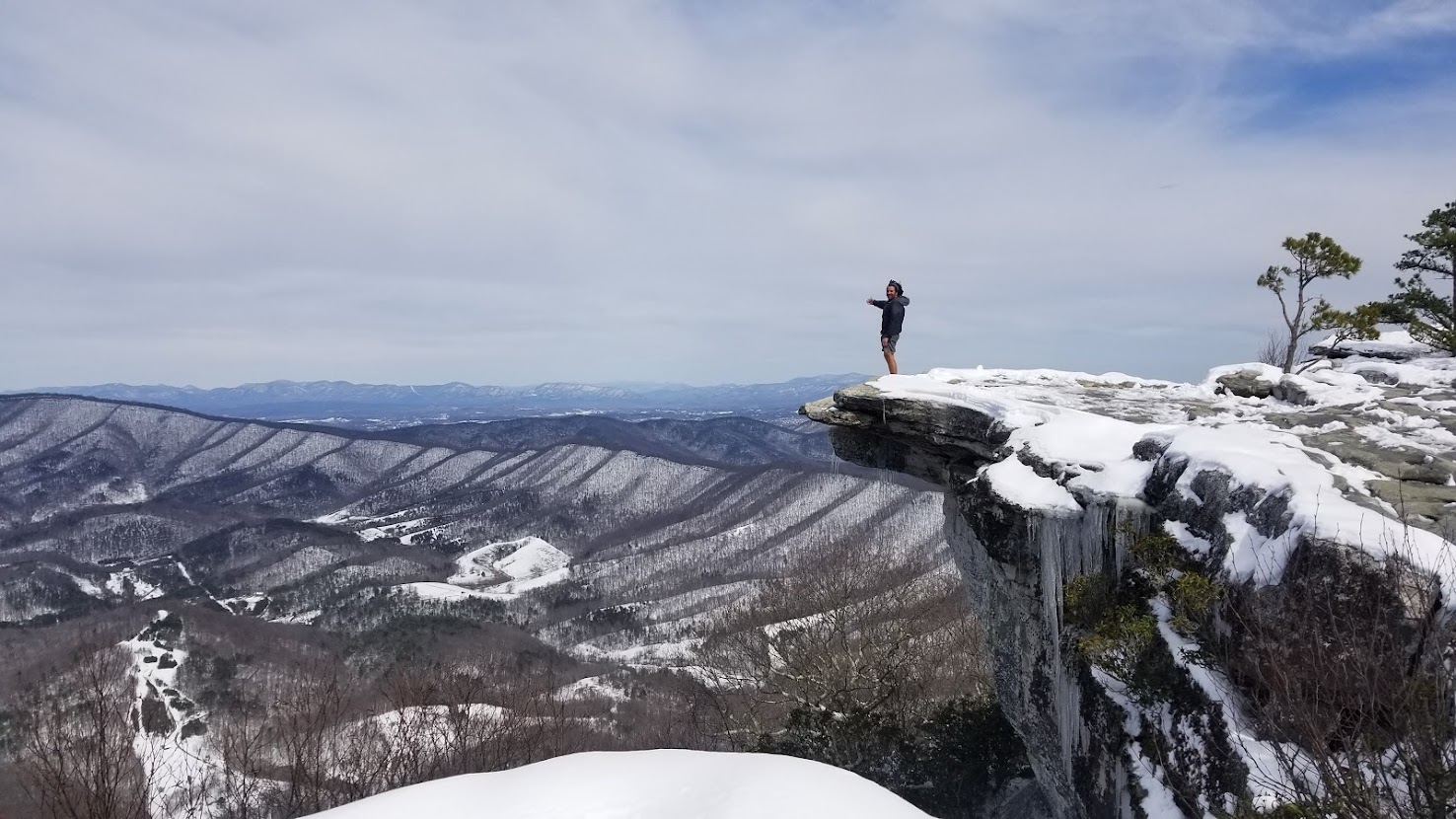
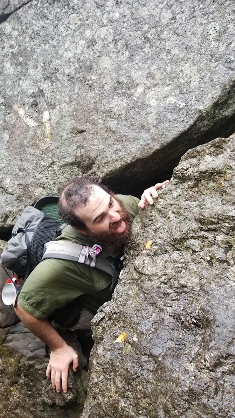
The night gifted me a fresh 7 inches of powder. The knot I had tied to secure my Ursack (bearproof bag I store my food in) to a nearby tree was frozen solid to the point where I needed my lighter just to get it loose. Between route finding and breaking trail, that day was both physically, as well as emotionally, taxing. In the afternoon I climbed up the “Dragon’s Tooth”, an iconic rock structure in mid VA, where I got reception. I had had enough, and made the call to Handy in Pearisburg to ask him to pick me up. He was waiting for me by the time I had descended, and I enjoyed another night at Angels Rest. Fueled by banana pancakes, the next morning I was dropped off trail, and hiked through the morning with the gift of some sunlight (finally). Before lunch I climbed the infamous McAfee Knob, which is said to be the most photographed spot on the entire Appalachian Trail. This section was blasted with day hikers hoping to get a glimpse of the iconic view. Ever on my odyssey, I pushed past Tinker’s Knob, another nice lookout, before making camp for the night.
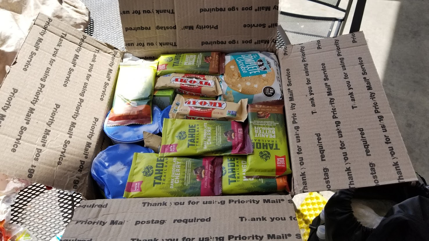
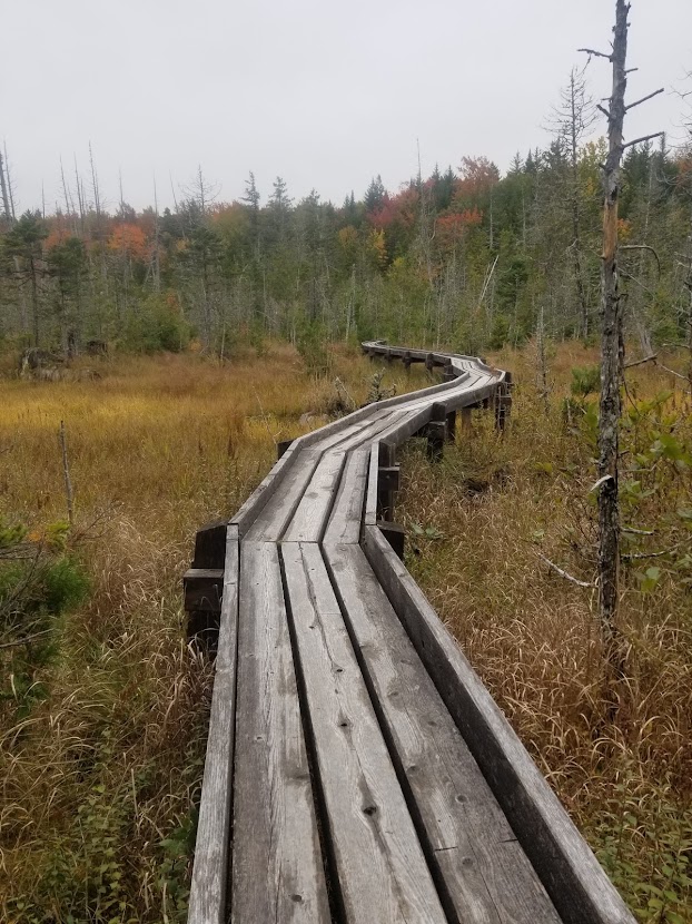
Putting the snow fiasco behind me, I made my way into Daleville, VA, and picked up a resupply that had been forwarded to me from Chico from my good friend Cleansweep. Renewed and excited to have vegan goods in my backpack, I spent the next few days making back my miles in the mid to high 20s. By late March I reached Waynesboro, VA, where I resupplied once more. The following section, and last leg of Virginia, was infamous for being the second and last national park on trail: the Shenandoah. On normal years, Shenandoah NP is riddled with hikers and tourists, all hoping to enjoy the scenery along the Blue Ridge Parkway. It’s said that trail magic and free food flows wildly into hiker’s gullets in this section. I was so early, I was barely able to find open campgrounds, let alone trail magic. No problem – the Shenandoah offered very mild terrain, and I was able to push through the park in only a few short days. The remaining miles after the Shenandoah in VA were a relative blur: I enjoyed a stay overnight in Front Royal, VA at Mountain Home BnB on Easter, and crushed the last few miles into the month of April and the state of West Virginia.
West Virginia, Maryland, and Pennsylvania (272.6 miles)
Many hikers like to sleep on the edge of Virginia, then plow through West Virginia and Maryland in order to make it to PA all within a day. It is a big day of hiking, but otherwise entails multiple states, and is often regarded as a challenge. With my current schedule, I was already pushing miles on the daily (much more than the average AT hiker), and I didn’t feel I was in a place to indulge. The West Virginia section of the Appalachian Trail is only a handful of miles long, but contains the historic town of Harpers Ferry, which is known as the unofficial halfway point. I spent the afternoon in Harpers Ferry walking the historic downtown before adjourning to a local hostel for the night. The next day, in the company of section hikers and SOBO flip-floppers, I enjoyed a pancake breakfast before crossing the mighty Potomac River. The trail followed the C&O Canal for a bit, and I made solid time through Maryland (only 40 some-odd miles in its own right). The trail texture began to change from the relatively polished dirt of northern VA into intermittent rocks; but I was 46 days in, and over 1,000 miles deep, and I’d gotten my hiker legs at this point.
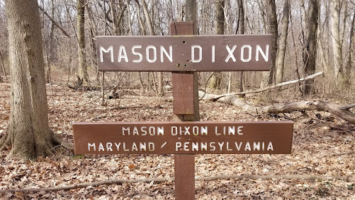
Maryland came and went after my first full day in the state. The trail from here through the rest of the mid Atlantic would bring me through more cities and cow pastures than it had previously, and the miles melted away with good weather as I arrived to the Pennsylvania border AKA the Mason Dixon line. That was a funny day for me, as the night previously I had slept at a shelter with some section hikers who mentioned they had seen two thru hikers the day previously. I was amazed – another pair of thru hikers, this early, and this deep on trail? Their names were Peanut Butter and Jelly, and they were a couple who had started on 1/1/18. Shortly before arriving at the Mason-Dixon line, I had met them while fishing for a littered Mylar balloon (my arch nemesis). It had been several hundred miles since I last hiked with anyone, and I got the impression the same was true for them. We enjoyed each other’s company over the next couple of days as we stretched into southern PA.
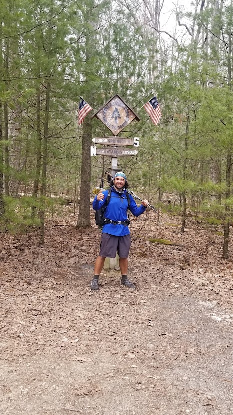
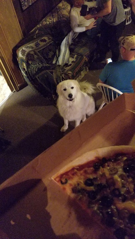
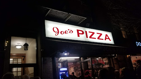
On day 48 I made it to the official half way point of the Appalachian Trail, averaging a whole mile per day more than necessary to make my 100-day mark. PB & J and I enjoyed a pizza lunch (for you west coasters out there, the pizza is better out east) in Boiling Springs, PA, before I bid them adieu: my stringent schedule prevented me from slowing down, much to my chagrin. This was a lesson I would learn the hard way throughout the duration of my journey. The following day meant easy walking through farms and cow pastures through the Cumberland Gap, which is widely regarded as the flattest section of the entire trail. Around this point my daily mileage began to stretch from 20-25, to 25-30+ fairly consistently. Shortly after Duncannon, PA, the texture of the trail began to live up to the not-so-glamorous nickname of “Rocksylvania”. Those rocks I had seen back in Maryland seemed like child’s play now, as each step brought a wincing pain induced by knife-like rocks that protruded at impossible angles on every inch of trail. Somehow, despite snow, the rocks, and the occasional tick, I still managed 25+ miles through northern PA. Near the NJ border I stayed at the Blue Mountain Dome Home, where I enjoyed free beers (really, free!) at the birthplace of Yuengling in Pottsville, PA. The next day, on the evening of 4/13/18, I got a medium (more like X-large) Stromboli and a liter of Coca Cola at the Delaware Water Gap. I wasn’t George Washington, but I did cross the Delaware into the interesting state of New Jersey.
New Jersey, New York, Connecticut, Massachusetts, and Vermont
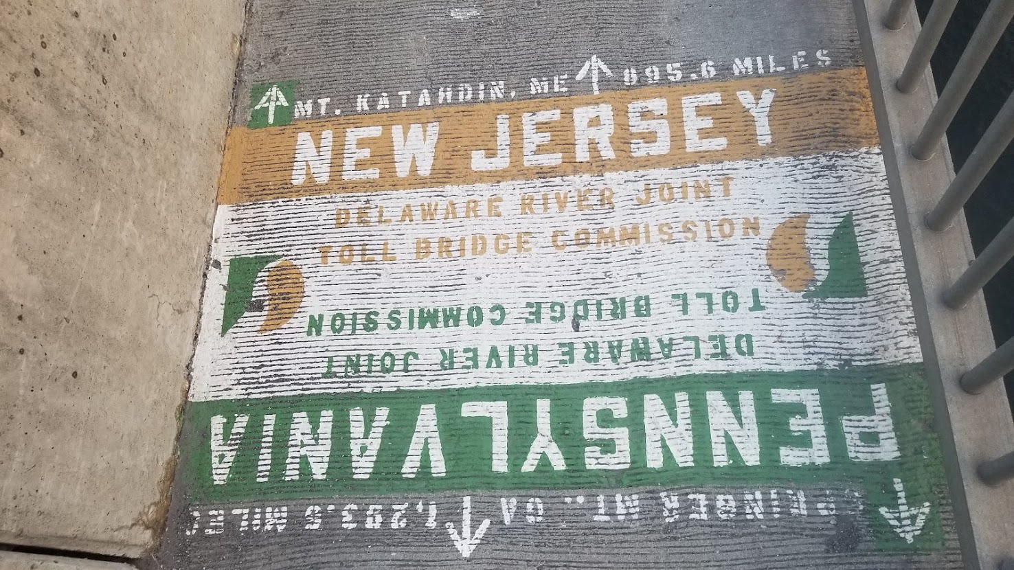
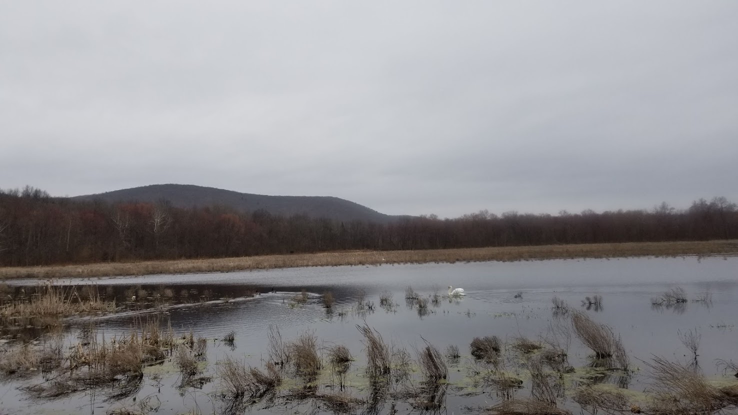
New Jersey, at last. I’ve lived my entire life in the US, but the East Coast always had felt a world away. Even after traversing the southern states, my myopic western perspective never fully associated things with being “East Coast” until this moment. Sure, I had signs I was approaching Jersey – the ridiculous portion sizes and flavors of Italian food, the increase in garbage on trail, and the thinning level of confederate flags (which I assumed would have disappeared in Maryland, but I was wrong about that) – but crossing the Delaware River really made it feel legitimate. Over the oncoming days I would see beavers and swan, two animals I hadn’t come across in the west. I crossed the border around sundown, and walked a few miles in the dark before finally making camp for the night.
Without knowledge of the social media presence of any other thru hikers further north than me at this point, and not expecting to see anyone catch me from behind, I faced the realization that the rest of this hike would be cold and alone. It was a lonely feeling. I felt tied to this premeditated idea that I needed to complete the trail within 100 days to make it back to CA for work, but it had become clear that as I increased my mileage to average about 30 miles per day through the mid-Atlantic, that my mileage was outpacing the rate at which the weather would warm up. I blew through the relatively un-rocky state of New Jersey with quickness. In about 2.5 days I hiked over 71 miles to cross into the Empire State of New York, but it wasn’t without cost. This section of trail introduced stretches of huge, slick segments of rock, which can sometimes entail using your hands to climb safely. A Nor’easter hit New England that week, and the AT section I was on saw rain levels of over 2.5 inches in just a day. I battled the most bitter cold and rain I’ve ever experienced. It made the snow and freezing rain I had previously encountered feel like a balmy summer’s day. The hike was excruciatingly uncomfortable. I wept deeply, tears running down my cheeks and mixing with the frigid downpour. I developed a shiver that reverberated through my body and quivered in my spine. It is a shiver I’d never felt previously, but I now still feel today when the temperature drops. The same day, my mother texted me that our family dog had taken a bad turn in her epilepsy, and that my family wasn’t sure how much longer she’d have. I’m happy to say, with the support of my family, our dear pup (Asta) lived another 2 years. However, my day in the flash flood conditions stays with me: even as I write this now, I feel some level of fear or PTSD when faced with the prospect of hiking in intense rainfall. I was at my wits end and at my lowest point. I holed up in a privy at a shelter and chewed on poptarts between tears. After a measly 17 miles, I decided I wouldn’t quit on a bad day – so I took a bus into Warwick, NY, and got a hotel for the night.
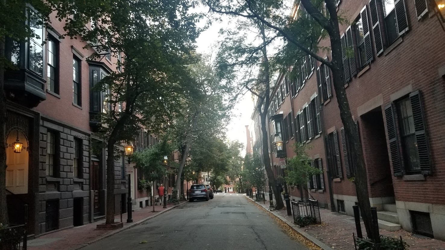
I spent the night at a hotel. Getting some good rest and calling my girlfriend in CA helped my spirits. The weather forecast mentioned the rain would letup the following days, which was a tremendous relief. The next morning, I grabbed a bus and intrepidly leapt back onto trail, eager to see what New York had to offer. My brother lived in Manhattan, and I knew that if I could last another day or two, I could reach a train station on the Appalachian Trail near Pawling, NY, and take the Harlem line into NYC. With hope in my heart, I pushed hard the next day to make it to my goal. It took a short hitchhike and an easy train ride, but before I knew it, I was in the fabled city of New York, New York. After exiting the train, I met my brother, who took me to his office in the Freedom Tower. I met his colleagues and enjoyed the view before grabbing dinner and getting comfortable in his apartment on the lower east side.

By the time I made it to NYC, I had hiked 61 days straight for about 1,450 miles. I was now averaging over 23 miles per day, and was ahead of schedule. The intense labor I had put in over the previous weeks of 30 miles per day had paid off. Having now hiked the AZT, the TRT, and over half of the AT without a zero, I felt it prudent to take a day off trail and really enjoy my time exploring New York City in the company of my brother, and cousin, who lived in Brooklyn. I spent the next two days relaxing and sightseeing, which included eating over 12 Dunkin Donuts to the face in one sitting, catching Black Panther in a movie theater, and indulging in a NY slice of pizza. Before I left, I made sure to enjoy a short jaunt in Highline Park, and on the third day, I grabbed my train ticket and headed back to trail.
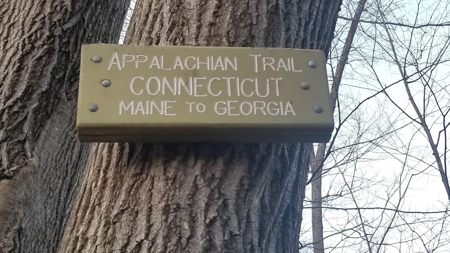
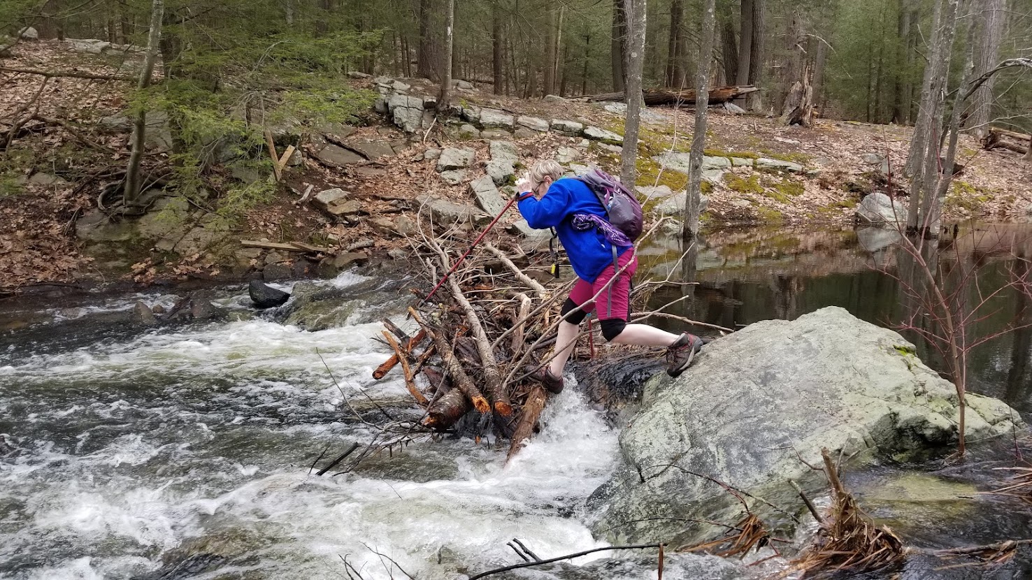
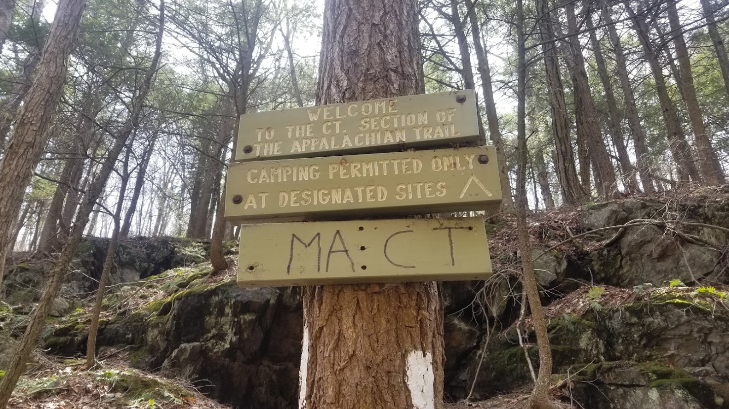
Within only a few short hours from departing the train station I had arrived at the Connecticut border. 9 states down – only 5 to go! Connecticut is a measly 48 miles, and less than 48 hours from that point, I had passed into Massachusetts… now 10 states down, only 4 to go. With 1,500 miles complete, I was getting close to being ¾ of the way done with the trail. Having recently seen family, and a enjoying a couple of zero days in the Big Apple, the finish line was looking sweeter and sweeter daily. The CT/MA border brought a dramatic change in trail texture: immediately I needed for ford a small stream. Up until then I had done a good job of rock hopping and balancing over these overflowing waterways, but I had no option other than getting my feet wet for this crossing. The icy cold fluid ran through my shoes and into my bones. I changed my socks and continued, noticing how now, for the first time on the Appalachian Trail, I was walking among a coniferous forest instead of mixed deciduous trees. Pine duff littered the ground below me, sometimes crusted with frost, and narrow, deep gullies seemed to shadow the trail going northward.

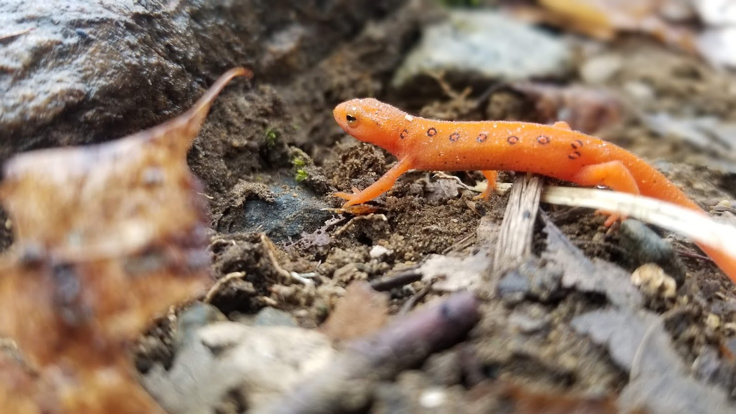
If I thought the mid-Atlantic was bereft of hikers, then the beginning of New England was truly barren. Sure, I saw two section hikers – retired gentlemen hiking SOBO whom I would never see again – but most of the time, I hardly even saw day hikers. I did, however, see plenty of newts (which I can only assume were entering mating season), and many historic monuments. The trail took on a ruggedness I hadn’t encountered thus far. Rumor on other long trails about the AT is always “Just wait. The White Mountains are unreal, unlike anything you’ve ever seen. They’re so dramatic and incredibly rugged. You’ll be lucky if you even hike 15 miles a day”. Well, the Whites were in New Hampshire, some several hundred miles away, and I was only in MA. Already I was coming across flooded trails and intense blowdowns, shaving off miles from my average every day.
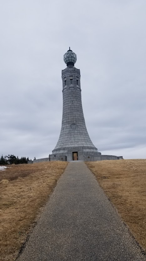
In northern MA I finally ran across section hiker. His name was Nature-Al, and he was a section hiker from the Bronx. With his Boston Terrier by his side, we walked through northern MA, but our hiking friendship was short lived, as he stopped around 16 miles in the afternoon. Dutifully, slaved to the schedule, I pushed on, feeling sadder than ever. On day 69 I climbed the slopes of Mount Greylock, the highest point of the state of MA. Close to the top I began to battle a thicker layer of snow than I had seen this far – in fact, I needed to utilize my microspikes for the first time since North Carolina. Hiking down from the mountain I encountered freezing rain and felt my emotional strength waning. Slipping on a rock, bruising my rear-end, and ripping a hole in my gloves only added insult to injury. I called my mom and dad back home for encouragement – and what encouragement they gave, filling my heart with warmth and confidence. Truthfully, I was on the verge of quitting at this moment, having been tired, lonely, and sad since PA. I simply wasn’t having fun anymore. After a short while on the phone with my parents, I lost reception – I was heading back into the wilderness, where the Vermont border was only a few miles away.
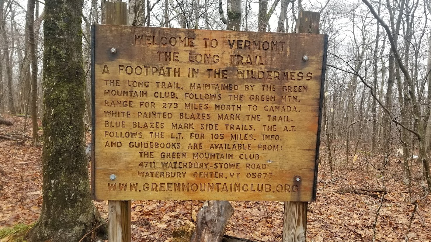
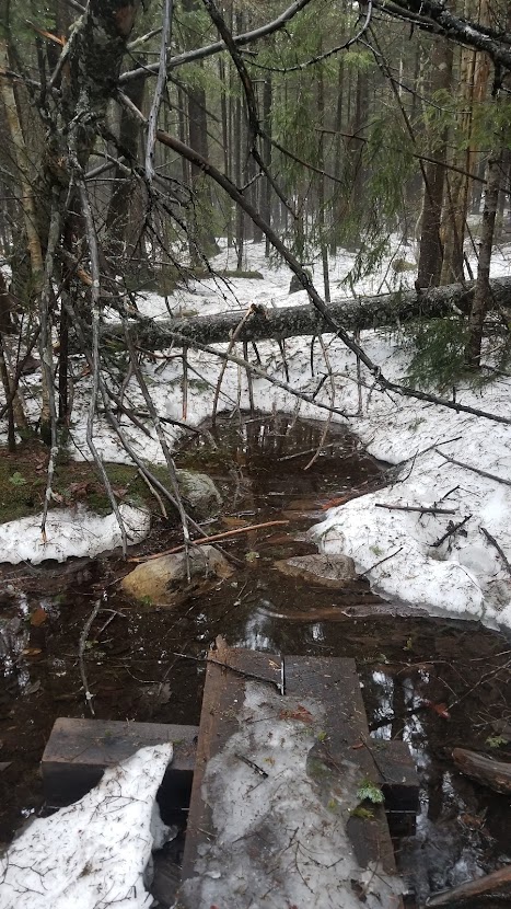
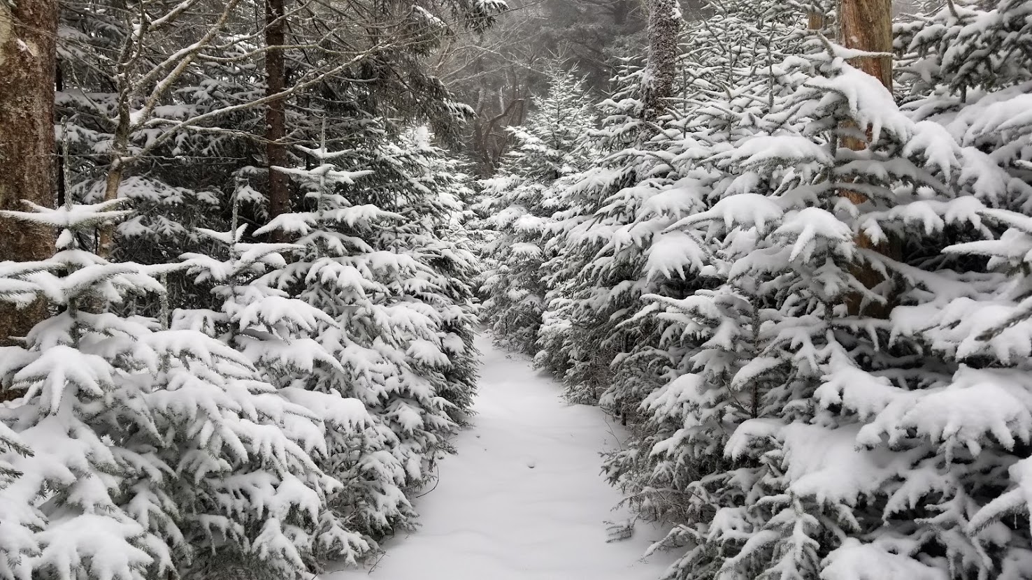
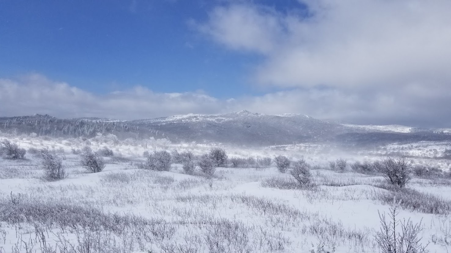
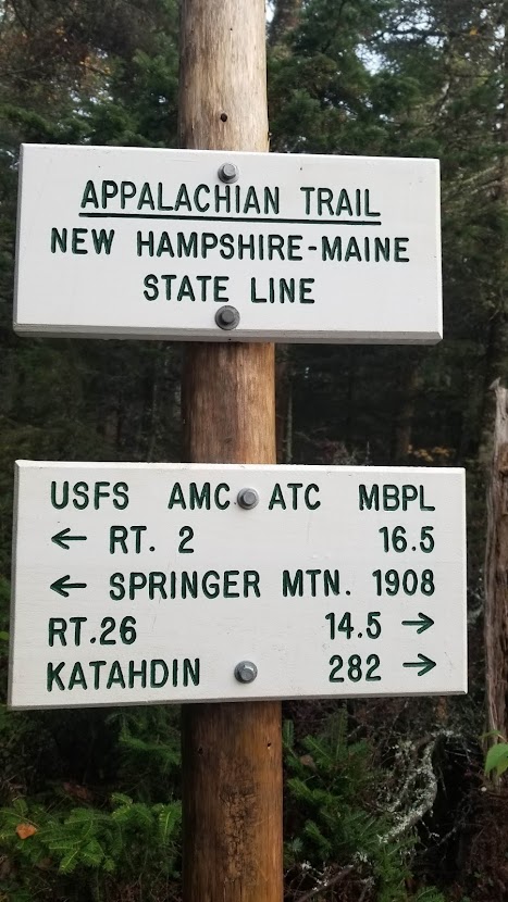
The Massachusetts/Vermont border is a bit of a milestone on the Appalachian Trail, as it also marks the southern terminus for the Long Trail, a 272-mile trail that stretches to the Canadian border. Almost immediately my path became brutal. Deeper snow, thicker blowdowns, and murkier ponds dotted my path now. I had managed 20+ mile days through the thick of MA, and even VT on this day, but it sure wasn’t easy. The temperature seemed to plummet into the afternoon, and soon I was coming across icy lakes. Up until this point, I had regularly braved uncomfortable weather. Subfreezing temperatures on numerous occasions, torrential downpours and potential floods, freezing sleet, you name it. But now, the sky was dark and there wasn’t a patch of dry land as far as I could see. Moreover, I was alone. That night felt like the peak of my misery, and for the first time on the entire trip, I began to become curious about my safety. Doubt seeped into my synapses and I second-guessed my own ability… was what I was doing safe, if even doable? Did my 100-day goal matter if I hated the way I felt?

I wasn’t feeling much more confident the following morning. I felt bitter cold, and still soggy from the previous evening. I set off with a brisk pace, less due to motivation, and more for generating body heat to keep me at a bearable level of comfort. I had slept next to a frozen lake that day, too weary to go on… but only a few miles away was a shelter. In retrospect, I could have, should have, and if I could do it again, would have pushed to this shelter. Once there, I met a section hiker! I can’t recall his name, but he had section hiked the previous year, and was most certainly part of the “party crowd” on the Appalachian Trail. He had a lost, cloudy look in his eye… but could hike fast in spurts, and I was grateful for the company. We lamented the weather and asked us if we were crazy for being this far north in late April. Together we ascended Stratton Mountain and enjoyed a lookout lunch. It was a long, arduous slog through the snow, but felt somewhat manageable; the northern slope of the mountain was a different story. In North America the north face of a mountain usually has more snow, due to the tilted axis of the Earth, and Stratton was no different. We quickly found ourselves struggling to find the trail through the snowpack, and were postholing up to our hips. It was at this moment that the true realization of my situation dawned on me: Stratton Mountain was only the shortest peak for miles to come in Vermont, let alone the White Mountains in New Hampshire or the rugged wilderness of Maine. I struggled to even hit 23 miles in these conditions – how would I possibly be able to navigate the rest of the trail if it was anything like this moving forward?

I took my time that evening at the shelter with my companion. I sat down, made a big dinner, and looked through all of my Appalachian recordings up until that date – every photo, playlist, daily mileage, and memory. I had hiked 1,626.1 miles in only 70 days, meaning I was at 23.23 miles per day. If I were to continue, I’d undoubtedly need to either wait a week or two for snow to thaw, or acquire snowshoes. Perhaps both. When I crunched the numbers necessary to make my 100-day commitment to my employer, things just didn’t add up. Moreover, I felt broken – physically exhausted and emotionally disinterested. I was not having fun, and why the hell would I be vagabonding through winter conditions on the opposite side of the country from my home if I wasn’t having fun? It was a sobering moment, but I’m glad I had it. With peace of mind, I decided right then that I would be getting off trail. I was going to go home.

My companion agreed; things were way too brutal outside to continue hiking in good conscience. Utilizing the GPS options on our phones, we walked another 7 miles before heading off on the closest forest road we could find. Several miles later we reached a more developed road, and after a few miles of trudging through falling snow, we eventually managed to hitch a ride with a questionable man driving a pick-up truck. The driver eviscerated “left wing lunatics from California” as he drove us into town… I was happy to exit his vehicle and acquire lodging for the night. After a meal I called my mom and dad to notify them of my decision, which in their infinite grace, they naturally supported. The next day, I got on a bus and headed to NYC, where I hopped on a flight and headed back to the San Francisco Bay Area. Just a hair behind ¾ of trail, 71 days and 1,631.2 miles later, my AT journey had concluded.

Intermission – Summer of 2018

I arrived back to the San Francisco Bay Area to be greeted by my beautiful girlfriend, who drove all the way to SFO to pick me up. I’d spend the next month in California soaking in sunshine, spending time with family, and having fun on the Pacific Coast. Come June I headed to the Sierra, where I would spend the next three months guiding backpacking and camping trips in Yosemite and Sequoia National Parks. Despite the bad fires that kept business and play to a minimum, I tried to make the best of my time, summitting Half Dome, navigating the Grand Canyon of the Tuolumne, and foraging for summer mushrooms at high altitude. Around late August I got a crazy idea… what if once the season was finished in California, I headed back to the AT? Sure, it was late September and conditions would soon get nasty in New England, but if I started in Maine and hiked southbound, would I be able to finish the trail? I only had about 550 miles left and was coming out of a season of backpacking, so with any luck I’d be able to make quick miles before the season changed for the worst. On my NOBO attempt I had gotten myself into trouble by putting too much of a time crunch on my trip; despite my better judgement, I booked my tickets to Bangor, Maine, and prepared to hike southbound back to Vermont.
Maine, New Hampshire, and Vermont Again (372.3 miles)

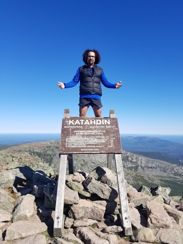
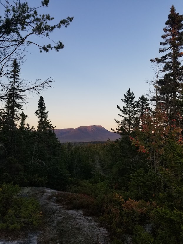
I made arrangements to be picked up from the airport in Bangor by one of the hosts at the Appalachian Trail Lodge. I spent plenty of money there, between the overnight and the shuttles between the airport and Katahdin. Immediately it was clear that this wasn’t the same trail I’d experienced earlier in the year: the hostels were bustling with hikers of all sorts and the trails were crammed to the max. Once dropped off at Baxter State Park, I made the appropriate arrangements with the local rangers to summit Maine’s highest mountain and the Northern Terminus of the Appalachian Trail. Much had been made of how dramatic and dangerous and rugged Katahdin was… and sure, it was beautiful, but I felt the hype was a little unfounded. Granted, I was just coming off a summer in the Sierra, where Katahdin would be one in dozens of nondescript granite peaks, so I have a heavy does of western privilege working against me.
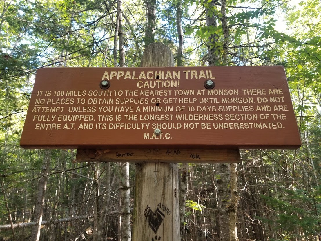
The climb had some marginally technical components, but I made short work of it. At the top I took my photo with the legendary sign, making sure to give thru hikers their time in the spotlight. On the way down I went fast, hoping to have plenty of time to make miles in the afternoon on my southbound journey. On one particular rock-hop I landed a little harder than I meant to, and I felt my leg quiver a bit as I recoiled from the dismount. After making it off the mountain I set-off on the trail southward and out of the state park. Shortly after Baxter is a notorious stretch named the “100 Mile Wilderness”, famous among thru hikers for being one of the longest portions of trail without resupply opportunity or accessibility to visit town. 100 miles was child’s play in comparison to most of the stretches I was doing on a regular basis on other long trails, and I quickly found out that the “wilderness” still had ample dirt roads, the occasional vacation home, and recreational paddle boats on the rocky shores of lakes.
That first day back on trail I hiked over 22 miles before making camp next to a lake. I had never heard the call of a loon before, and as they clamored through the wee hours on the water, I didn’t get very good sleep. The following day I hiked another 25.4 miles, passing the gaunt faces of thru hikers who, enamored by the tunnel-vision prospects of finishing their hikes, spurred by me without a second glance – to them, I was a dweeb, a section hiker who hadn’t known the toil they’d endured. About 7 miles from my goal shelter for the night the outside section of my knee had began to hurt. I did some light stretches that night and shared a crowded shelter with some NOBOs before drifting off to sleep to the sound of light rain. Shortly after sunrise I saddled up and hit the trail again, only to find that my knee pain had not subsided. It was a bit startling, since most minor overuse injuries I had sustained up until then tended to get a little better overnight. The pain increased dramatically, and within 5 miles I felt jolts of pain shoot deep into my lateral knee, occasionally catching on some invisible notch deep beneath my skin. This hitch in my step brought my pace to a screeching halt. Luckily, only 7 miles in that day, I reached a road which marked the halfway point in the 100-mile wilderness. Here, the people from the Appalachian Trail Lodge occasionally do pick-ups and food delivery for hikers, so I grabbed a ride back to Millinocket at the first chance I could.
I spent the night back at the hostel, and the next morning I was able to visit the urgent care facility at the hospital in town. Due to the “catching” or “hitch” I felt tugging at my knee, the doctor ultimately informed me that I had a partially torn meniscus, but wasn’t 100% positive. Stubborn and fearful to quit the trail again, this time before I even got started, I immediately bought some ibuprofen and got the first ride I could back onto the trail. Doped up by the vitamin I, I hiked over 15 miles that afternoon. Not half bad, and the following day I did another 19. The pain wasn’t exactly subsiding, obviously, and despite my body’s objections I kept pushing. Another 21 miles fell the following day before I finished a measly 3 miles to reach Monson, ME, home to Shaw’s Hiker Hostel, which is arguably the best overall hostel on the entire journey. I rested and enjoyed pancakes, but found it difficult to interact with the other hikers… so close to the finish, they were incredibly cliquey and I felt like a total outsider.

Pretending to be having fun, I hiked 22 miles out of Monson before crunching another 14.7; I would’ve hiked more miles, but I had reached the shores of the Kennebec River, which is dangerous to cross (due to the water levels being controlled by a dam upstream) without a ferry. The ferry was closed for the day by the time I arrived, so I stayed at a local hostel overnight. While resupplying, I ran into a familiar face at the grocery store – it was none other than Handy, whom I had spent time with in Virginia so many months previously. I’m sorry to say he didn’t have a social media presence, as I’d really like to keep in touch with him. The next day I crossed the Kennebec River and managed another 22 miles, this time crossing multiple mountains (which I learned were called the Bigelows) while munching on Honeybuns.
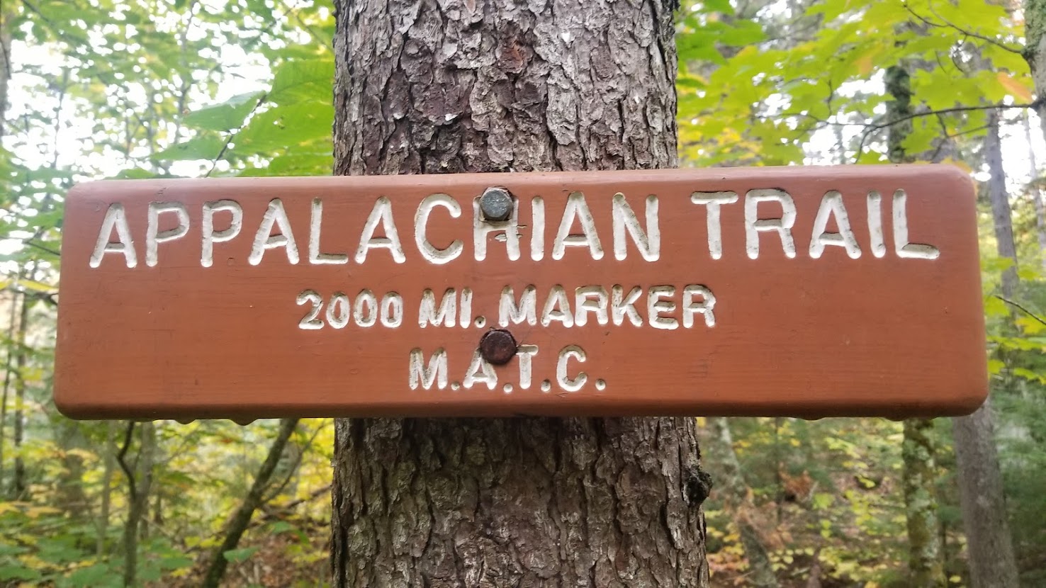
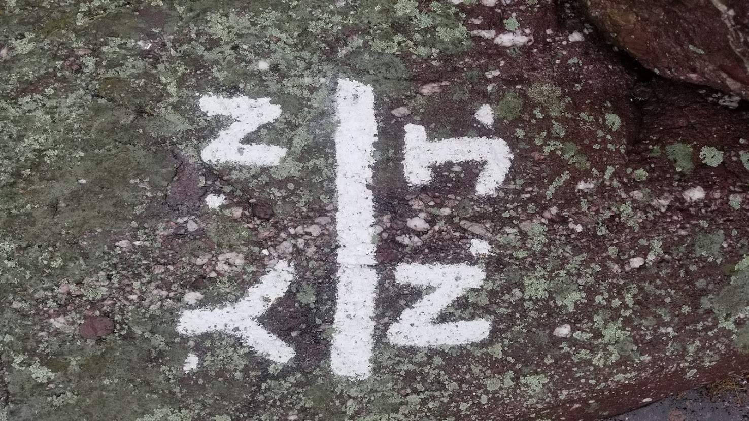
Coming down from one of the Bigelows on the next morning I passed the NOBO 2,000-mile marker. I couldn’t help but laugh – I didn’t expect to see the sign under this context, after all! This meant I had hiked over 180 miles in 10 days, which was a solid, but not great pace, mostly due to my nagging injury that wasn’t healing properly. It was incredibly painful at times, but I managed to hike low 20s everyday for the rest of that week. By southern ME the NOBO crowd had thinned out considerably… it was the second week of October, and if a NOBO hadn’t reached the peak of Katahdin by now, they likely never would. The AT has many redeemable qualities, but I could never understand how many hikers could possibly hike it so slowly. The joke is on me, I suppose, as those hikers weren’t limping with a painful knee…

One afternoon I met another SOBO hiker, which was uncommon this time of year. His name was Caveman, was a Californian, and had experience doing trail work out west. We got along well enough, despite him preferring a slightly slower pace than me. As they say, you go further together. While this is true, the going still wasn’t very quick: New Hampshire and Maine on the AT are widely regarded as being incredibly difficult due to the ruggedness of the trail. “Trail” is a noun used loosely here, as the path navigates so many nonsensical routes up and over mountains, deep into jagged canyons, and through dumbfoundedly complicated talus jungle gyms, that it can hardly be called a trail at all. Rather that a brisk walk with trekking poles, many areas you are required to full on climb over or under rocks, take your backpack off, and leap across small chasms.
After a few short days of miles in the high teens, we eventually broke through the northern border of New Hampshire. I had now walked across 12 out of 14 states on the AT, with the remainder of Vermont and all of New Hampshire ahead of me. Caveman and I reached Gorham, NH, where we holed up for the night. My knee pain had gotten considerably worse while crossing over the rocks in southern Maine, so I took up a local hostel proprietor on their offer to “slack pack” me through the Wildcat mountains in northern ME. They dropped Caveman and me off on the southern section of the small range, with the promise to pick us up once we had completed the 21.1-mile northward trek; I completed it by early evening, and Caveman eventually made it back closer to midnight. Even with ibuprofen in my veins and a light backpack on my back, I realized my knee wouldn’t allow me the opportunity to properly finish the trail at this rate. Rime ice was already beginning to collect on the mountains in New Hampshire, and traversing the presidential range, notorious for its unforgiving climbs and record setting weather, just wasn’t something I could pursue in good faith. The last thing I wanted to do was potentially perish or suffer a maiming injury, second only to causing a huge hassle for my family and Search and Rescue. This realization was a nail in the coffin, so to speak, about my prospects on finishing every mile of trail in 2018. Desperately clinging onto any chances I had of hiking as much trail as possible, I made arrangements to transfer about 80 miles southward, to the other end of the White Mountains to resume my hike.
At this point I felt a bit all over the place. Georgia to Vermont, Vermont to California, California to Maine, now northern New Hampshire to Southern New Hampshire. I attempted to pick-up as if nothing happened, now just trying to hike as much as I could in a day comfortably, but no longer striving to adhere to by 22-mile average. I managed 14.6 miles after the shuttle, then a grueling 17.7 the next day. I wanted to hike further than 17.7, but the hitch in my step returned worse than ever before. It was all I could do to backtrack a mile to the nearest shelter before collapsing. As another doctor would explain to me later back home, a small flap of my meniscus was getting caught when this happened, resulting in deep discomfort and lack of range of motion. I bunkered down for the night – luckily, I had service, and managed to stream an episode of the Sopranos to stymie my rotten mood.
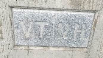
The good news is that I was within a day’s walk of Hanover, New Hampshire. I limped 13.3 miles into town that day before arriving in the historic city. I didn’t realize it until I arrived, but Hanover is home to Dartmouth, an Ivy League institution since the 1700s. I recharged there and explored options to get back home. Given the most recent change in my knee, there was simply no way I could even make it back to where I had gotten off trail in April. After a few hours I had a plan: the following day I would hike about 7 miles in order to cross the New Hampshire/Vermont border. These miles would bring me over 2,000 miles; while it was a far cry from the 2,180 I had intended, 2,000 miles was good enough for me.
On day 94 (day 23 of my southbound experience) I walked 7.4 miles from Hanover, NH, to Hartford, VT. There, on the banks of the White River, I stopped my journey at 2,003.5 miles. With content and peace in my heart I stuck my thumb out and hitched a ride into town, where I then hopped on a bus and headed to Boston, MA. I spent the following day exploring the historic city of Boston, trying to squeeze the last few drops out of my trip to New England. I enjoyed a day of limping around town, exploring all of the most touristy locations, before going to a comedy show with the hostel I was staying at.
At the end of my SOBO section, I had hiked 372.3 miles in 23 days, for a meager 16.18 miles per day. Overall, counting the mileage from my NOBO attempt, I hiked 2,003.5 miles in 94 days, resulting in an average of 21.31 miles per day. I had set out with the intention of hiking the AT within 100 days… but started far too early for it to even be possible, due to weather. It was a stupid, ignorant mistake. On my SOBO attempt, I got over-eager and injured myself on the first day. Once again, not saving my stamina for the long haul, and overlooking the fact that fall in New England can be as brutal as spring.
I still do not believe that the Appalachian Trail is as difficult or half as beautiful as most AT hikers think it is, but I have grown to have a deep appreciation for it. The Appalachian Mountains have a rich history full of soul and flavor, and I daresay they left a deep impression on my heart after a few short months. I would very much like to revisit the AT, to hike the sections I missed, and to stroll more slowly among its crowded trees… but that will be an adventure for another time, when I’m older and wise enough to appreciate it.
