About
From the Pacific Crest Trail Association:
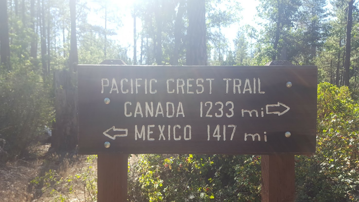
The Pacific Crest Trail spans 2,650 miles (4,265 kilometers) from Mexico to Canada through California, Oregon, and Washington. It is a National Scenic Trail. It reveals the beauty of the desert, unfolds the glaciated expanses of the Sierra Nevada, travels deep forests, and provides commanding vistas of volcanic peaks in the Cascade Range. The trail symbolizes everything there is to love—and protect—in the Western United States.
Untold thousands of hikers and equestrians enjoy this international treasure each year. Some only travel a few miles, while others complete every mile in a single season. Tying the trail together is a community of volunteers and passionate outdoor enthusiasts. Together, we explore, create and support one of the best experiences on Earth.

My first Thru

In 2016 I made definitive plans to pursue a thru hike of the Pacific Crest Trail. I obtained my long distance hiking permit, my CA fire permit, requested a leave of absence from my place of work, and set a plan in place: from January to May I went on three training hikes and ran a half-marathon. Two trips to Big Sur, one to the Lost Coast, and a visit to The City, and I felt I was ready to hit the Mexican border. It’s hard to put the experience into one cohesive narrative, but it’s safe to say that from 5/4/2016-9/14/2016, my life would change forever.
The Desert (700 miles)

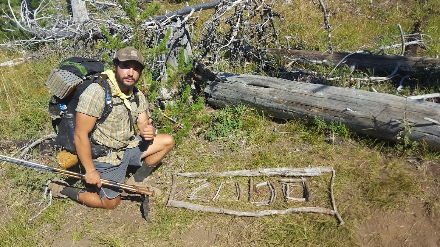
Unless you’re an ultra-marathoner, are you ever really ready for your first thru hike? Despite the premeditated steps I took to ensure a safe and timely trip, I was blasted out the gate. Being a native Californian, I was privileged to have family who was willing to drop me off at the southern terminus. We drove from the Bay Area to San Diego on 5/3/16 and spent the night at a Best Western near El Cajon. The next morning I hit the trail: cramped leather boots on my feet, several gallons of water, and an oversized load that was pushing my Osprey Exos 58 to its absolute limits (hell, I had campshoes, a pack towel, and an enormous tent).
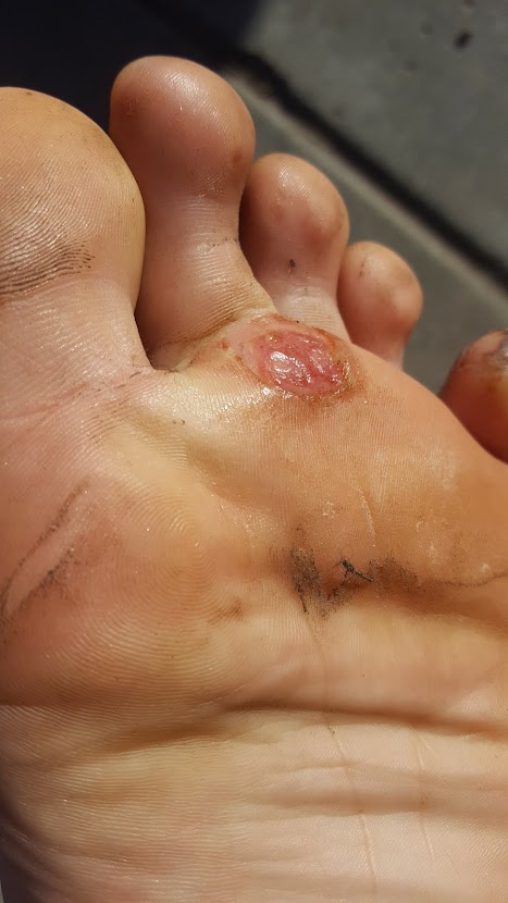
The going was slow. Making reasonable mileage was incredibly difficult for me out the gate, and with a baseweight around 25 lbs., I was quickly battling Achilles tendonitis and some gruesome blisters. On the morning of day 5 I distinctly recall waking up and staring at the ceiling of my tent with dread in my heart – how in my wildest dreams could I possibly hope to hike 20 miles today? It was the poisonous inkling of doubt. I had invested in this trip for months – saved funds, made arrangements with family, traveled across the state… it can’t end now, can it?
In retrospect, the doom and gloom was for naught – it was only the second week of May, and I had months of time to make it to Canada if I were to complete my thru hike. I rested a few days in Julian, CA, and got hard to work on “trail” physical therapy and blister prevention for my barking dogs. Within the reaches of good faith, I decided then and there I wouldn’t mind taking the time I needed to rest, nor would I pass-up the generous offers of the trail community to help PCT hiker trash: hitchhikes, free slices of pie, trail magic, or otherwise.
The support from the community doesn’t just come externally, however – my fellow hikers helped bolster my spirits as well. Although I don’t believe in trail families, and while I loathe the cliques that inevitably form along the way, I hiked with some individuals who left a lasting positive impression on me in the desert. Primarily, I hiked with or leapfrogged with Sarah, Dom, Katie, Toasty, and Cleansweep (the first three would acquire trail names later on). If not for them, I’m not sure how far I’d have plodded along.

At this point, the difficulties of hiking in the desert should be obvious. It’s hot. There’s not much shade. You’re thirsty and the water hauls are long. With that said, the longer you endure, the easier the desert gets. Not only did I and my fellow hikers gain elevation as we approached the mountains to the north, but we became stronger hikers as well. Only a few hundred miles in an 20 mile days were guarantees. Afternoon siestas were brutal, but night hiking was fun. I had my trail legs, finally, and was ready for the next leg: the mighty Sierra.

The Sierra (300 miles)

It’s important to note that in colloquial PCT hiker terms, when the community refers to the Sierra, they’re not referring to the actual Sierra Nevada Range, which stretches about 700 miles and is one of the longest unbroken mountain ranges in North America; they’re usually referring to a section from Kennedy Meadows to Sonora Pass. Tahoe to Oregon is commonly referred to as Northern California.
Around mile 700 I reached the unofficial “gateway” to the Sierra: Kennedy Meadows South. I took a few days to rest up here to get ready for the next stretch. I met up with my parents, enjoyed some In-n-Out Burger, and adjusted my gear list to accommodate the new terrain I’d be entering. The climate began to change: exposed granite, plentiful water, and higher elevations awaited me in the following weeks. With the change in ecosystem, so came a change in me: I was growing leaner. My body had recovered from the Achilles injury. My feet were tough as leather, and I was growing a hunger to hike independently from the bubble.
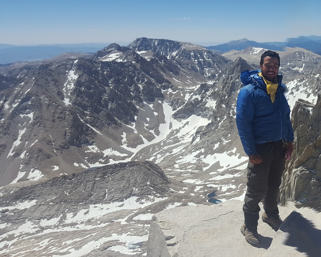
The Sierra honeymoon was well-received, but short-lived. Only a few days into this stretch and it happened again: I now had Achilles tendonitis in my other ankle. I bailed off trail through Horseshoe Meadow to rest in Lone Pine, CA, before hitting the trail again. I was faced with a tough resupply decision: some former teachers of mine meeting me at Vermillion Valley resort with a resupply box (shout-out to Mr. Bailey and Mr. Parr!), but that was about 8 days away at my pace. I could camel up with supplies and push, or I could get off trail at the treacherous Kearsarge Pass in a few days. The way I saw it, going up and down Kearsarge would take a day each way, which would need to be accounted for regarding food. In addition, I was also planning to climb Mt. Whitney, the highest mountain in the lower 48, which would take about a day extra as is. I decided to pack as much as I could and push on.

With Whitney out of the way, I now had the opportunity to enjoy the John Muir Trail (JMT), which is widely regarded as the most scenic portion of the PCT as well as the crown jewel of North American hiking. Truth is… the hype is 100% real. Call me a biased Californian, but never have I (to this day) experienced grandeur on par with the majesty of the jagged peaks and lush valleys in this remote section of the Golden State. The sublime comes with a cost, however: even as I write this, years later, this had to be one of the most difficult sections I’ve ever hiked. The elevation change (Forrester, Mather, Glenn, Muir, and Pinchot passes) punched me in the mouth. I’d never hiked at such altitude, and the snow was difficult for me to manage. While some hikers glissaded down the northside of the passes, I warily and meticulously descended with painstakingly slow steps. The drop from consistently hitting marathons on the daily, to struggling to make 17 miles, was humbling to say the least. Fortunately for me, each pass moving northbound dropped in elevation, and much like the desert, I continued to grow stronger.
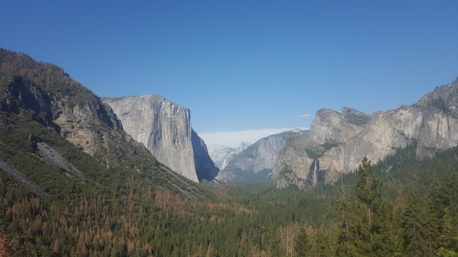
After a zero day with good company at Vermillion Valley, I was ready to hit the northern section of the JMT. It ended up being drastically easier than the southern half, and within a few short days I had finally reached Tuolumne Meadows in Yosemite National Park. Once there, I was met by a family friend who brought me a resupply and a new sleeping pad (mine had broken around Pinchot Pass). The hike through the northern section of Yosemite was mosquito-laden, but relatively uneventful. Having guided several seasons in the park since PCT completion, I have still yet to revisit this section of trail: it felt rural, less traveled, and easy on the legs. The remaining passes were small hurdles, and besides, I felt rejuvenated after relaxing in the High Country for a day or two… that is, until reaching Sonora Pass. What Sonora Pass lacks in elevation, it makes up for in danger. On the surface it looked like any normal path through the snow, but on my way down I saw multiple hikers slip and slide down the rocks and snow several hundred feet. Luckily my footing held, and I made it down safely. Finally, over 1,000 miles deep and with the highest elevations behind me, I had reached Northern California.
Northern California (678 miles)

They say most hikers come down with the “California Blues”. This is probably because the state alone is around 1,700 miles, and the final stretch if Norcal lacks the luster of the Sierra, nor the initial excitement of starting the journey in the desert. Truth is, I didn’t mind Northern CA at all – I was pretty much hiking alone from here on out (besides the occasional leapfrog or 2-3 day stretch of hiking with someone else). The trail evened out in elevation considerably and by this time, I felt pretty confident I had gained enough experience to be confident in my chances of reaching Canada. By the time July rolled around, I had reached Tahoe (around mile 1,100) and I was fortunate to hole up with a former coworker for a zero – while there, I weighed myself and was shocked to see I had lost over 35 pounds since beginning! I was feeling emaciated from the Sierra, and over the next few weeks, I would increase my caloric load to build some strength. After all, I had just completed my first ever 30 mile day on trail, my tendonitis injuries had finally fully healed, and I was excited to see areas of my home state that were still unexplored to me.

After Tahoe, things were relatively uneventful for a few hundred miles – sure, there are highlights like the swimming hole in Sierra City, or the half-way marker (woohoo!) near Belden, but it wasn’t really until Lassen Volcanic National Park that things got exciting again. For one, Lassen was the first prominent Cascade Volcano to appear on the horizon. Growing up in the Bay Area, higher elevations were only ever a few hours away, but it was different – I was accustomed to walls of granite, and this stand alone spectacle was enough to quicken my pace. Besides, Lassen was another fun opportunity to hike through a new National Park to me, however brief. Shortly after Lassen was the Hat Creek Rim: infamous for being the driest and hottest section north of mile 700, it was a section I’d heard hikers chatter about for weeks. Luckily at this rate I now felt comfortable pushing myself to the occasional 30 mile day when there was need. Views of Mount Shasta in the distance motivated me to blast through the Hat Creek Rim in only half a day before arriving on the door step of Burney Falls State Park.

Burney Falls State Park is either one of the best kept secrets in the great state of California, or it’s simply too far in the boondocks for most tourists to make the drive. Regardless, once there I enjoyed ice cream from the general store, a coin operated shower, and an incredibly brutal ramen bomb. Here’s the thing about California in late July though – even though I was far north, it was damn hot. Days were sweltering, and my skin began to itch for a change of scenery. I’d soon learn that the Feather and McCloud rivers would offer cooling comfort in the oncoming miles, but my real goal were Shasta, where my Mom and Dad and some scouting friends would be waiting!

Mom and Dad brought beer, a change of clothes, and good vibes, but took with them my bear can (most hikers get rid of theirs around Sonora Pass – I hiked several hundred extra miles with mine). It was a fun and well deserved zero day in their company. At this point in the journey I had been taking less and less zero days. Not only was I motivated in moving forward, but I didn’t feel half as beat up as I had previously. The last stretch was easy in comparison to the rest of the state. Some small ups and downs, maybe a hundred miles or so, and eventually I arrived at Seiad Valley, which is the last town in CA before Oregon. I crashed at the RV Park in town to wash up a bit before enjoying some of the trail-famous pancakes at the diner in town. To put things in perspective, not only had the northbound crowd significantly thinned out, but on my way out of Seiad I met my first southbound hiker of the trail! Things were going to be different moving forward, and I was officially in the Pacific Northwest.
Oregon (460 miles)
Oregon is often regarded as the easiest section of the PCT. It isn’t very long, the terrain is relatively flat, trail texture is soft (more on this later), water is abundant, elevation is low, and views are good. Some hikers attempt the Oregon Challenge: hike the entire state in two weeks. In terms of my own Oregon goals, well hell, I was just happy to be there and exploring a new region. Huckleberries were beginning to flush, nearly every day offered a new lake to jump into, and the end of the trail was beginning to grow nearer. At this point, it was hard not to hike 25+ miles every single day.

After taking a night to rest in Ashland, OR I received a tumultuous hitch back to the trail. The southern section of the state was drier than I expected, but offered lingering views of Shasta, and upcoming views of Mount Thielson. Despite the excitement of my first border crossing, an unforeseen challenge made itself known: blowdowns. Trail maintenance is something many entitled thru hikers, especially those who are uninitiated to the larger aspects of land management and public land, take for granted. Some blowdown thickets take a considerable amount of time to navigate through or around, which can drastically alter your daily scheduled when you’ve grown accustomed to averaging a specific mile per hour, mile per day pace.
On the flipside, at this point in the trail the herd had drastically thinned out. Hikers were still abundant near town, but anyone I met at this leg of the journey who had started from Mexico like myself was legit: they were weathered, fatigued, and determined. One of the benefits of less hikers is more wildlife – although I had seen countless deer already, and even a couple of bears, now I was seeing coyote and stags on the regular.

Crater Lake gets less notoriety from an “adventure” perspective than other parks on the PCT, but I found it to be most rad. I stayed at Mazama village for a night, picked up my resupply, and took the Rim Trail alternate (it’s ironic it’s an alternate, as most hikers take it anyway). Pushing northward through the driest section of Oregon (than you trail angels who supply water caches) I began to slowly increase mileage. By the time central Oregon came around, the landscape began to change. Every day there was a new volcano on the horizon and the days of Californian granite were long gone: the rock was still igneous, but it was of a rougher texture. My daily mileage as now in the high 20s at a minimum, with many days growing into the mid to high 30s. On one particular day I decided to push for a 40 miler on my way to Bend, but was quickly derailed as I navigated Sisters Wilderness. This section is notorious for its porous igneous rock (shout-out to Obsidian Falls, which is pretty cool). I was about 33 miles deep when I hit this lava-rock section, which absolutely shredded my feet and energy. Disappointed I missed 40, but satisfied with my progress nonetheless (36 miles), I made camp for the night before heading into Bend the next day to resupply.
From Bend to the Columbia River was a fairly straight shot. I hit the trail with renewed vigor, per usual after a hotel stay and shower, and pushed onward toward Mt. Jefferson. At this leg of OR I began to notice hikers were getting less friendly. Their cliques were airtight, and few individuals were willing to look my way, let alone make conversation, when I passed them on trail. I don’t blame anyone too much at this point in the journey… we were all tired. I think most folks were starting to get tunnel vision.
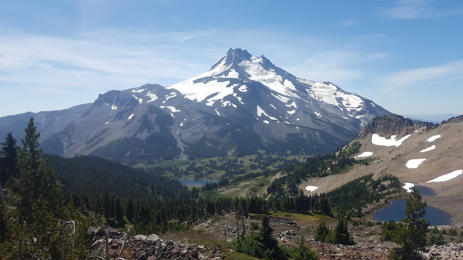
I’d heard about Mt. Hood (Wy’east) and the Timberline Lodge since day 1 on the PCT, but what I wasn’t told about was Jefferson park – wow, what a beauty that mountain is! Mt. Jefferson was easily a top 3 section in the state, and I was happy to bask in its glory for about a day before bridging the gap to Mt. Hood. On a Saturday I pushed a 38 miler to get within striking distance – on Sundays the Timberline Lodge served its infamous breakfast, one of the best on trail. I crushed every delicacy I could get my grimy fingers on, quaffed down the most gourmet hot chocolate I’ve had in my entire life, then guzzled 1 (maybe 3) large beer(s) before plodding off into the sunset towards Washington. Highlights of Mt. Hood were Ramona Falls, as well as distant views of Mt. Jefferson and the Three Sisters.
A couple of days later I took yet another alternate (once again more highly trafficked than the proper PCT) through Eagle Creek and Tunnel Falls, before finally arriving to Cascade Locks. Once on the Columbia, I managed to hitch a ride to the Portland Airport, where I then took an Uber to stay with my brother, who lives in eastern Portland. Once there I was treated to vegan delights out the wazoo, before eventually making my way back to Cascade Locks a couple of days later. By now it was late August and I had one thing on my mind: Canada or bust.
Washington (512 miles)
If I knew less about Oregon, then I knew the least about Washington. Day 2 on the PCT hikers were gossiping about the name of the resupply towns in the state: names like Stehekin, Snoqualmie, and North Cascades. Long gone were the days of towns on the map that started with the words “Los” or “San” – this new climate was about as different to me as the names, which paid homage to Native peoples and the land stolen from them, along the way. To add to the Washington mystique, the trail community believed this last leg to be the most challenging section, outside of the Sierra of course. The remoteness of the state meant less town stays, and a more mailbox-oriented resupply strategy. It is safe to say that Washington provided verdant foliage and dramatic peaks that I had incorrectly assumed I’d see in Oregon. Knowing fall was only around the corner near the Canadian border, the heat was on for me to push to the finish.
The first day and a half was relatively easy before arriving to Trout Lake, WA for a quick snack. I hiked out that afternoon and crashed near a meadow not far away from Mt. Adams, the first of Washington’s volcanoes. Back at Timberline Lodge I recounted my story of a failed 40 mile day to a hiker at the bar… when I mentioned I might try a 40 in Washington, she scoffed in my face at the notion that I’d be able to pull it off. Fast forward back to Mt. Adams: I awoke that morning earlier than normal, at 4 AM, with intentions to get some hours on the sun. The plan worked, and by lunch I was already 21 miles into my day. After a 30 minute lunch break, the rest of the day went by fairly quickly, ripe with plump huckleberries, boggy lakes, and intermittent clouds. By late afternoon I was already over 30 miles and nearing the Goat Rocks, one of the iconic portions of southern WA. I made dinner on trail, guzzled another two liters of water, and made my way through the outstanding Goat Rocks just prior to twilight. Distracted by mountain goats in the distance (a new wildlife sighting for me), I didn’t realize that I had finally reached by goal of a 40 mile day! With only 20 more miles to my next resupply at White Pass, I made camp for the day, satisfied I had reached a new personal record.

I was tuckered after my 40 mile day, and the remaining 20 miles into White Pass were sluggish. Fortunately the scenery was as good as ever, offering outstanding views of Mt. Adams, as well as Mt. Rainier (Tahoma), along the infamous “knife’s edge”. While overnighting in Packwood, WA, reality hit me: I was nearing the border and needed to obtain my permit to enter Canada by foot. Leaving Packwood I was hit by the first rain I’d experienced in weeks. This section skirted the border of Mount Rainier National Park, but also shared several miles with private land. Huckleberries were truly outrageous at this point in the journey, and with purple stained lips and fingers I began to increase my daily mileage more and more – at this point until the border, I averaged somewhere between 32-38 miles per day. Section I was soon in the rearview, and I eventually made my way to Snoqualmie pass to pick-up resupply before pushing to one of the most scenic stretches of the whole trail: Section J.

Snoqualmie Pass to Stevens Pass begins with an immediate uphill toward the vaunted Kendall Katwalk, which didn’t end up being as remotely sketchy as rumored. However, the following miles more than lived up to the hype – this was one of my favorite sections thus far! I had overcast weather for most of this section, so I didn’t end up enjoying a dip in any of the lakes, but man were there some great swimming opportunities (this section runs through Alpine Lakes Wilderness, after all).
At this rate it was full tunnel vision moving forward, and within a few short days of 30+ miles I reached Stevens Pass. Once there, I resupplied in the towns of Skykomish and Leavenworth (an infamous Bavarian style town east of the Cascades) before pushing onto Section K, which is allegedly the most challenging portion of the entire state. While Washington maintained blowdowns that made the ones I encountered in Oregon look like a cake walk, elevation and trail texture no longer seemed very challenging. Every day was 35+ miles moving forward as I approached the final of 7 National Parks on the trail: North Cascades.

This section brought me through the verdant reaches of Northern Washington and near Glacier Peak, which would be the final of Washington’s volcanoes that was easily visible. Grouse seemed to outnumber section and day hikers 10 x 1, and every ounce of me felt wild. On this section I celebrated my 23rd birthday by hiking in my, well, birthday suit for about 10 miles (most hikers hike naked on summer solstice, but I was never one to follow the crowd).
Within about 150 miles of the Canadian border I finally entered North Cascades National Park, which is infamous for a few reasons: for one, it is perhaps the least visited National Park on the entire journey. For two, it is the last good spot to resupply before the border. Finally, it is home to Stehekin, which, on the banks of Lake Chelan, is only reachable by float plane, boat, or foot. I resupplied here (being sure to take full advantage of the famed Stehekin Pastry Company, which I’d heard about for the last 4 months). Leaving Stehekin I pushed a 30 mile day through the rain, which I didn’t think was half bad, considering I left around lunch time. I enjoyed trail magic and a beer in the parking lot of Rainy Pass, hoping to get in a full night’s worth of sleep, before the last few days of trail.

I woke up early that morning and the gravity of the situation hit me: I was nearly done with my pilgrimage. Everything I’d worked toward since January had culminated into these last handful of days. What would life be like after trail? How would I find satisfaction in the mundane of every day life? Is it possible to fully move on? The experience had been transformative; from my soul to me body, I was a very different person now, than I was at the beginning.
These thoughts helped spur me up Cutthroat Pass in the wee hours of the morning as my vision continued to narrow into the myopic pinpoint that was the northern terminus. Conditions were good that day, and I felt fine… so I kept on hiking. I had hit Harts Pass, the final road before the border (this is where most SOBO hikers are dropped off) in the mid afternoon. The days are long in Washington, and before long I realized I could break my personal record of 40 miles, this time on my second to last day on trail. With a final hour of twilight hiking I broke 42.5 miles for the day and pitched my tent at what would be the final campsite on my journey.

At this point I was only a matter of hours away from Canada. I packed up my belongings and made my way northward, relishing the final, and arguably most scenic, stretch of trail. About ten miles away from the end I got a hairbrained thought: I hiked nude before, why not do it again? After all the steps I had taken, this was my final chance to be free, to be wild, to be unapologetically me. And so I did. When I arrived at the sweet, beautiful terminus, there were a handful of hikers celebrating who had arrived before me. After awkwardly standing in the buff, waiting for a group of hikers to do a full on calendar-level photo shoot (who could blame them?), I finally snapped my own photos, put on my clothes, and enjoyed two mini bottles of liquor I had carried since Mexico: off-brand tequila, and Famous Grouse whisky.
The remaining walk from the border, to Manning Park in BC, was relatively uneventful and unchallenging. I floated on cloud 9, basking in the euphoric gratitude that not only did I now get to stop walking every day, but that I had the opportunity to pursue my passion to begin with. Red-eyed and exhausted, I arrived at Manning Park and took a Greyhound to Seattle, WA, where I met with some section hikers I had met in Oregon for some sightseeing. Shortly after, my Mom and Dad (who, if you’ve followed this far, you’ll notice have been my rocks all throughout the trail) picked me up for a joyous reunion and family wedding in Eugene, OR.
To this day, I’m not sure I’ll ever have an experience like my first thru. Those 134 days were unlike anything I’d ever experienced. Like a fiendish addict, I’ve chased the high on other long trails, but nothing is ever quite as sweet as your first. The future was now once again uncertain, but I knew one thing: I wanted to get others outside.