This page details my first thru hike of the Tahoe Rim Trail in 2017. For my 2024 Tahoe Rim Trail thru hike, I invite you to explore my YouTube channel, Footsteps & Foraging.
About

The Tahoe Rim Trail is a 165-mile path that circumnavigates Lake Tahoe. Like Lake Tahoe itself, the trail runs along the border of California and Nevada. Per the Tahoe Rim Trail Association:
The Tahoe Rim Trail is a multi-use trail open to hikers, bikers, and equestrians for much of its length. However, mountain bikes and equestrians are prohibited from some sections of the trail.
The only location on the Tahoe Rim Trail requiring a permit for day use is Desolation Wilderness. Permits are free, self-issued and available at all trailheads entering the wilderness.
A Long Trail in the Northern Sierra

I was deep in the throes of guiding season in Yosemite National Park in the summer of 2017. It was the high life: work was spent sharing the glory of the Sierra Nevada with eager travelers, and play was spent running granite ridges and splashing in alpine pools. By late August it dawned on me that my summer in the Sierra wouldn’t last forever, and that I had to make the best of what free time I had away from work. The guiding calendar came out about two weeks in advance those days, and I noticed I was set to have about a week off during late August/early September. The prospect of hiking at any speed faster than the crawl of guided travelers was intriguing to me, and I soon realized I could complete the 165-mile trail within my window so long as I had a brisk pace. I wouldn’t need a permit, outside of Desolation Wilderness, and the drive from my home to Tahoe was relatively short.
So, I did what any sensible thru hiker would do… I called up my buddy Cleansweep and made plans to hit the trail. Having hiked a portion of the Tahoe Rim Trail (TRT) while on the PCT the year before, we had an idea of what to expect for the western section. We decided to hit Desolation Wilderness last, appreciating the likelihood it would probably be the most scenic section. The plan would be to leave my car on the southern end of Highway 50, just south of Echo Lake Chalet. From there, we would hike counterclockwise, ensuring we would finish our hike going through Desolation proper.
Hitting the Tahoe Rim

On 8/28/2017 I drove from Mariposa, CA, up Highway 50 to our meeting spot. Cleansweep was already waiting for me; it was my first time seeing him since I had injured my Achilles near Mt. Whitney on the PCT, and it was great fun to visit with him again. It was late afternoon, so we secured my car and hiked around 3 miles south and into the wilderness area. We found a good campsite and called it a night.
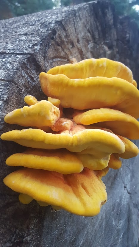
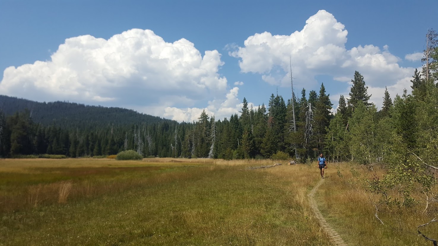
We broke camp the morning of day 2 and were on our way. The day started with a gentle climb toward Showers Lake, a beautiful spot I distinctly recalled on the PCT when I had hiked into Lake Tahoe. Along the way we spotted young fruiting bodies of chicken of the woods, which we had verified by a section hiker we met going the other direction. We’d later find more chicken of the woods as we meandered northeast, now off the PCT and on the TRT proper. Cleansweep didn’t have the benefit of guiding all summer in the mountains, so he was a bit anxious about the idea of us pushing 20+ mile days out the gate. Despite our better judgement, we felt good, and by the evening we had hiked 25 miles. We spent the night high above a subalpine lake, enjoying my first wild mushroom and a tall can of Lagunitas.
Litter-picking is Cleansweep’s MO (hence the trail name), and it’s a habit I am grateful he hooked me on. As such, collecting trail garbage was a main theme of our hike. The TRT is relatively close to roads, has large stretches open to mountain biking, and runs along several ski resorts that are popular in the winter. The garbage was abundant, and we took our time throughout to collect micro trash and big litter alike.
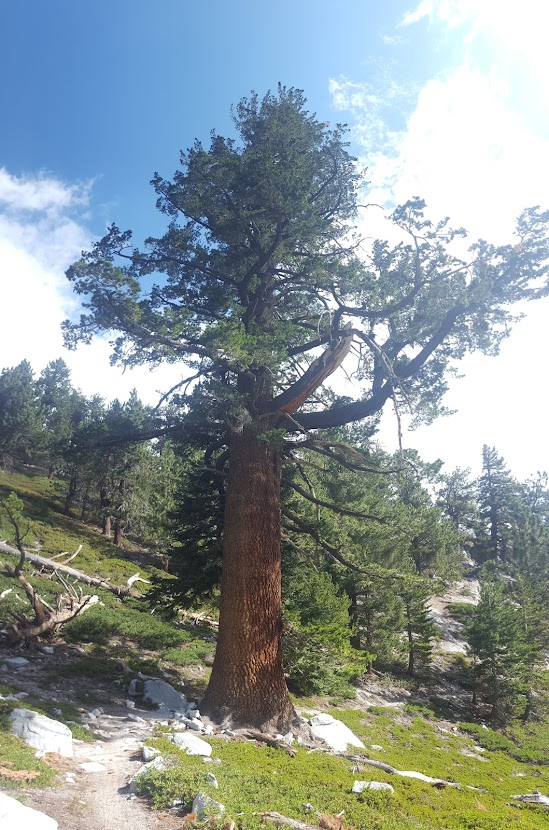
Day 3 started with a fill-up at a scenic lake. We would walk through intermittent showers in the southeastern Sierra the rest of the day. Among the highlights were more alpine meadows and massive western junipers. Midday we stopped at a ski chalet near Stateline that was serving lunch in the offseason. I nabbed a few onion rings and before too long, we crossed the border into Nevada. Trying to take it easy on our bodies, we enjoyed the rolling hills while noticing how the eastern side was tangibly drier than its western counterpart. We settled for around 21 miles and called it a day.
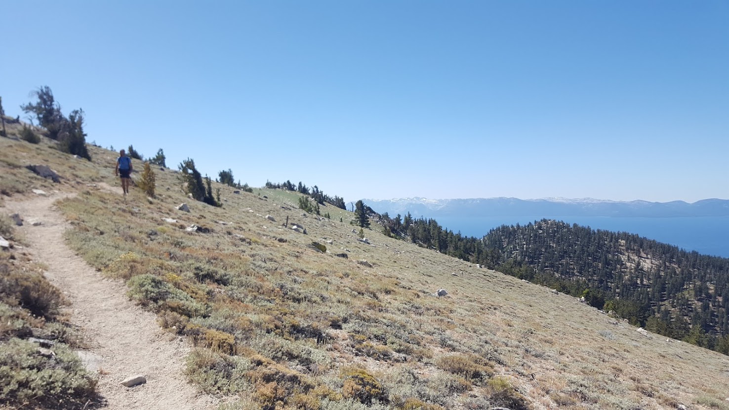
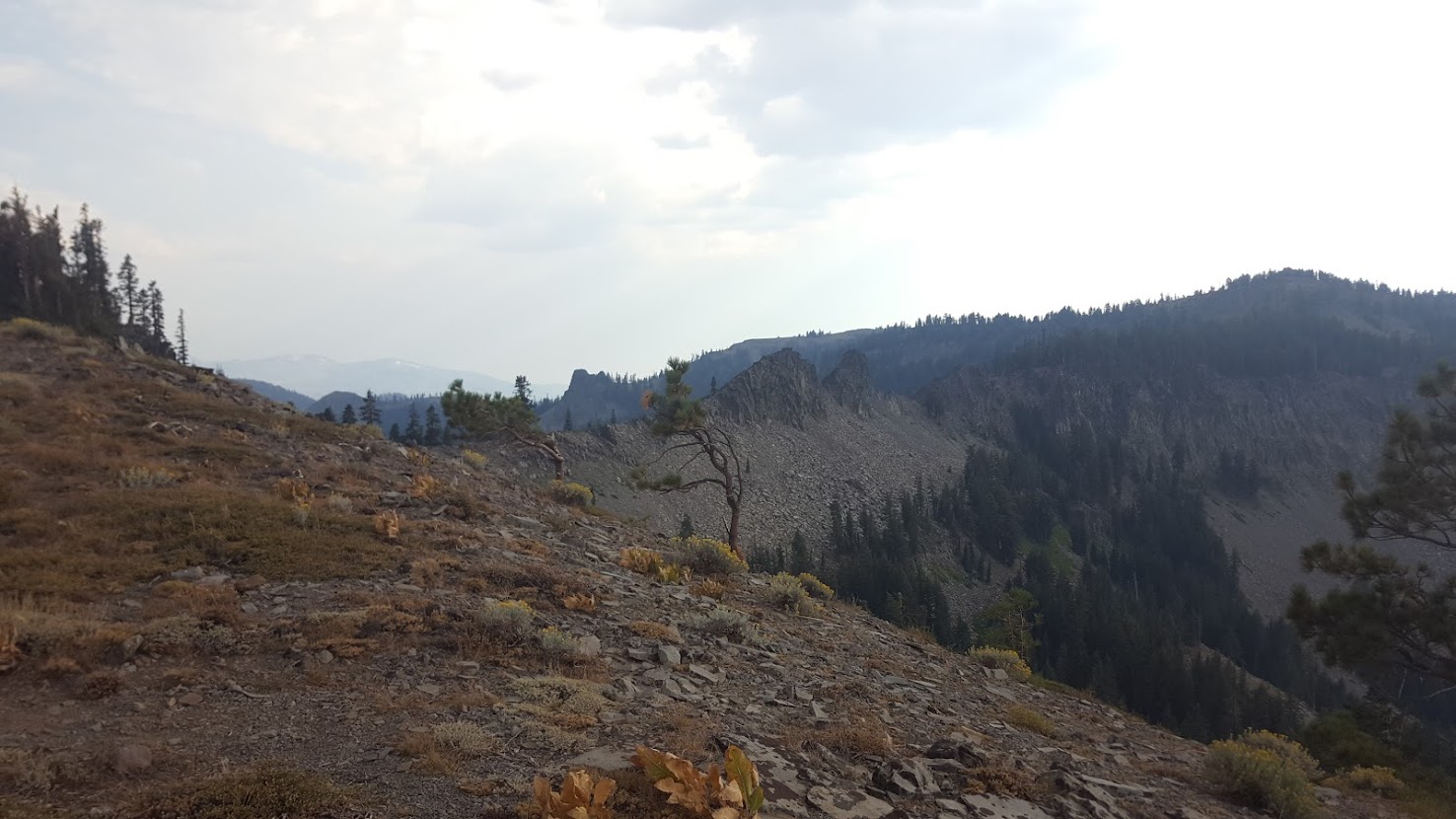
Day 4 would bring drier conditions, and water sources were few and far between. We ran into a handful of clockwise oriented hikers while appreciating dramatic views of Lake Tahoe from the peaks of the Carson Range. At lunch, I peeled off my shoes and socks and gave the soles of my feet a good, long scratch… something about hiking 20s just really makes my Fred Flintstones itchy. Due to lack of good water options on the east side, we made a dry camp around 20 miles deep and settled down early. We had plans to go into Reno the following day for resupply and wanted to be conscious of our water situation.
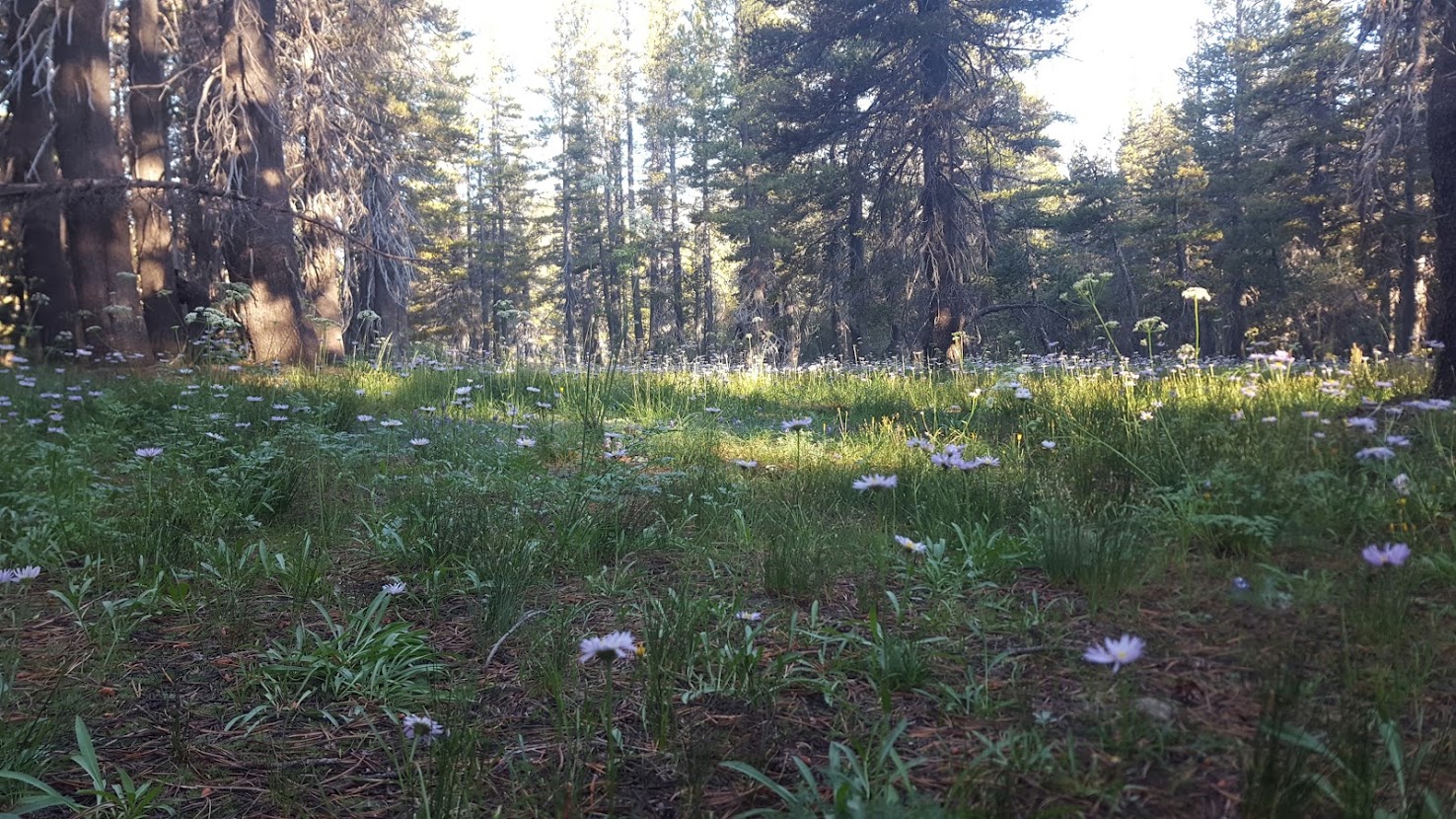
We enjoyed some wildflowers on the morning of day 5, happy to be moving toward fresh water sources on the horizon. We reached Highway 431 in the late morning, near the northeastern section of the lake. Once there, Cleansweep’s sister picked us up and brought us into Reno, where we took advantage of opportunities to shower and do laundry. Although the TRT isn’t very long, we were already halfway through, and spirits always rise when you get cleaned up a bit. We stopped at Wholefoods to resupply and grab hot lunch before making our way back into the mountains.

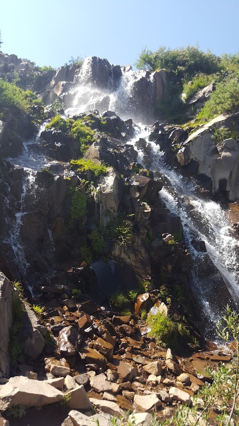
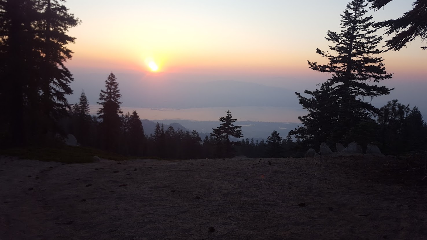
Hitting trail again, our direction took us on an immediate incline up Relay Peak, one of the highest sections on the entire trail. Normally it might’ve been a slog in the hot sun, as this section feels sandy and crowded with day hikers, but we were spurred along by our recent replenishment and by the lovely view of an ephemeral waterfall. The day hikers trickled away as the sun began to set and we ventured deeper from the trailhead. Before long it was time to hop into our sleeping bags again, with prospects of a big day on the horizon: a 30 miler.
It was the morning of day 6, and we broke our camp a couple of hours before sunrise. We had received word in Reno the day before that my parents would be meeting us in Tahoe City, on the western shores of the lake, the next day. Tahoe City was only around 31 miles away, and we had successfully crunched mid 20s up until now… why not shoot for 31 in one day?
We enjoyed glimpses of a sunrise over Lake Tahoe while meandering over shale in the early morning. This section of the TRT is popular among the local mountain biking community, and soon we were keeping our eyes peeled for MTBers, eager to bomb their way down trail. Around lunch we realized this section of trail wasn’t overly scenic, so in hindsight it was a good idea to choose this for a 30 miler. In the afternoon we took a pack-off-shoes-off break, and within 30 minutes I had fallen asleep. Stirred by Cleansweep getting his pack back on, I woke up, and together we pushed the remaining miles into town. We enjoyed a vegan dinner at the local Thai restaurant in town upon arrival. Still… I hadn’t hiked 30 miles in almost a year, and we were exhausted. Fortunately for us, Tahoe City seems to be the epicenter for thru hikers starting and finishing their hikes, and thus there was a massive parking lot nestled among the trees. We stealth camped in the bushes between cars and dozed off as soon as we laid down.
My parents wouldn’t be in Tahoe City until 11 AM or so, so we spent the morning at a coffee shop grabbing breakfast and recharging our electronics. It takes much less time to drink a cappuccino than it does to charge an external battery pack, so we were sensitive to keep our tab open as long as we could. We would finish charging at some outlets outside of Safeway in town while we waited for my mom and dad.
My parents soon arrived bearing gifts – a delicious picnic spread of chips, cold fruit, beer, fresh bread, vegan cheese, and tofurkey slices. The four of us explored the town and enjoyed some of the local monuments. It was a glorious day on the lake: Tahoe was displaying its sparkling deep blue that makes it famous, and the sight was too juicy for me to pass up. I jumped in and splashed around while we hung out on the beach.
In the early afternoon Cleansweep and I remembered we weren’t on a leisurely vacation – we still had to get some miles in! We said our goodbyes to my folks and hit the trail, lightheaded and bloated with sweets and beer. We crossed Paige Meadows in the late afternoon and made camp, content with our 16 miles on the day.
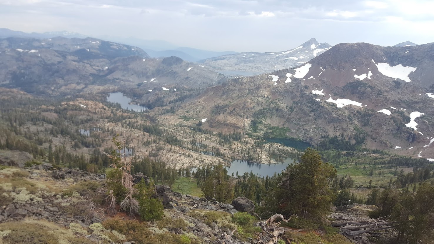
Day 8 brought us back to old friends: Granite Chief Wilderness, Desolation Wilderness, and the Pacific Crest Trail. Due to the restful nature of the day before, we felt like we had bounced-back from the fatigue of our 30-mile day, and we made good time in the morning. Granite Chief wilderness brought back fond memories of my first consecutive 30-mile days on the PCT a year before, and it made for light, easy walking. In the afternoon we broached Desolation Wilderness, famous for its barren landscape laden with glaciated granite and stunning alpine lakes. We enjoyed lunch near Velma Lake before we pushed up the gap of Dick’s Pass, one of the last climbs on the trail. We didn’t see many hikers while we navigated the wilderness, but it was of no mind to us: we were almost back to my vehicle and complete with trail. The night was spent near the shores of Lake Aloha (a local favorite for many Desolation aficionados).

The end of a long trail is always a bittersweet feeling. Yes, I’m usually excited to get clean and get good sleep, but I am also disappointed for my experience to be over. It was for this reason that Cleansweep and I decided to take a dip in Lake Aloha. The crisp, cool water soothed my aching feet and sobered my greasy head into an alertness that only the mountains can bring. The remaining handful of miles took us south by Echo Lake, and its corresponding chalet, before crossing Highway 50 from the north. We returned to my vehicle, safely untouched (thankfully), and prepared to leave the Tahoe region. We had planned the trip somewhat conservatively in terms of pacing, and by 9/5/17, I am pleased to say we finished a day quicker than expected. This unfortunately disrupted Cleansweep’s logistics a bit, so rather than drive back to Yosemite, I made a stop in Sacramento to drop him off. His girlfriend would pick him up a few hours later. I took the extra time to go back to the Bay Area to hang with my parents for a few more days, grateful to have had their support on trail.
What was originally an afterthought, a hopeful squeeze into a small stretch of days off, ended up being one of the highlights of my summer. The trail wasn’t outrageously scenic, but I thought it provided a tremendous value: resupply strategy was easy, the trail was well maintained, and it offered enough miles to feel like I was disconnected from work for a bit. Overall, I highly recommend the Tahoe Rim Trail to anybody hoping to try their luck at their first long trail, or even for casual backpackers who want to explore more of eastern CA. It was a delicious example of the recreational potential the region offers for those of us who don’t ski.
