About
From the Arizona Trail Association:
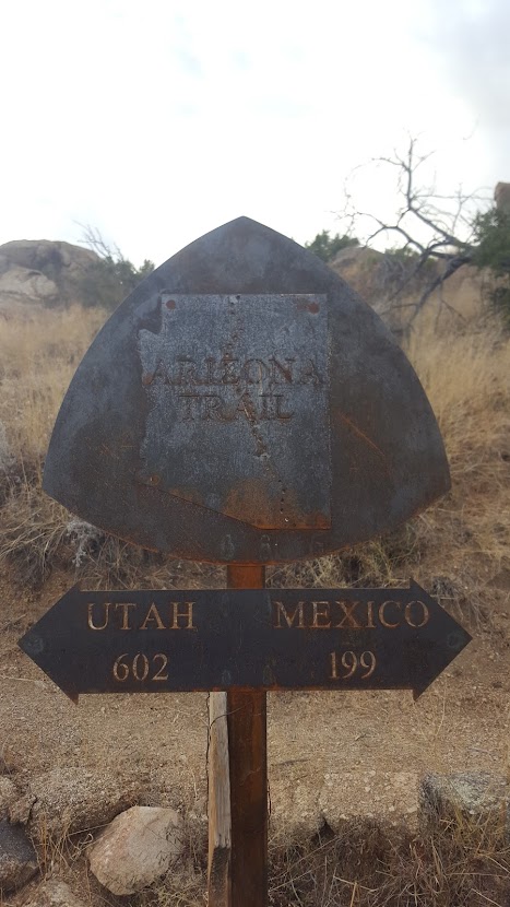
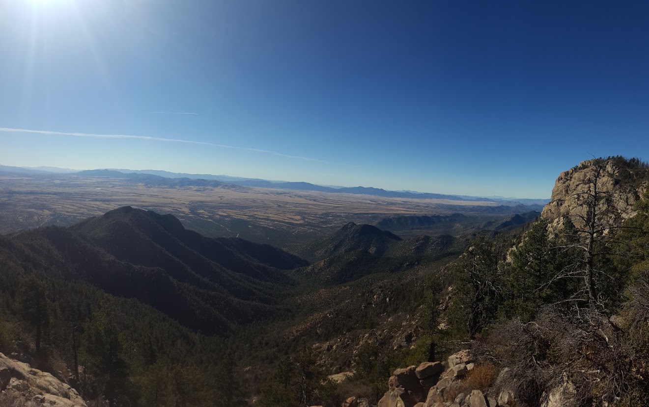
The Arizona National Scenic Trail stretches 800 miles across the entire length of the state to connect deserts, mountains, forests, canyons, wilderness, history, communities and people. This non-motorized trail showcases Arizona’s diverse vegetation, wildlife and scenery, as well as unique historic and cultural sites. The route provides unparalleled opportunities for hikers, mountain bikers, equestrians and other trail users.
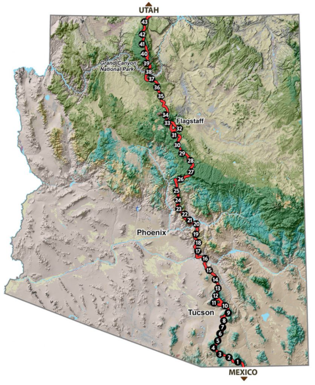
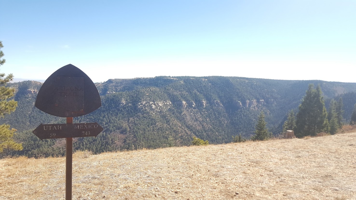
Starting at the U.S.-Mexico border, the path climbs and descends from one “sky island” mountain range to another, gaining and losing thousands of feet in elevation and traversing biomes ranging from desert to boreal forest. Continuing across the Sonoran Desert, the route crosses the Gila River, winds through the Superstition Mountains and the Mazatzal Wilderness on its way to the Mogollon Rim and majestic San Francisco Peaks. The trail north takes travelers across the Grand Canyon through billions of years of geology. Topping out on the North Rim, conifer forests dominate the Kaibab Plateau, eventually giving way to red bluffs dotted with sagebrush as the trail nears the Utah border on the edge of the Vermilion Cliffs National Monument. It is the backbone of Arizona.
Arizona calls

After my first full season of guiding backpacking and hiking trips in 2017, I was excited to finally be finished with work and be able to focus on personal endeavors. By mid August, both Cleansweep as well as Squeaks (former PCT and AT hikers, respectively) had expressed interest online about hiking the Arizona Trail. On paper, the trail was only about 800 miles long and seemed relatively mild; additionally, I had professional experience hiking and guiding in southern Utah as well as northern Arizona. If all went well, it would be a smedium thru hike that would satiate hiking my appetite as North America transitioned into fall and winter. On 10/26/2017, I’d find out what it meant to be a desert rat.
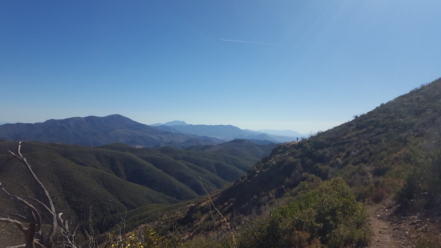
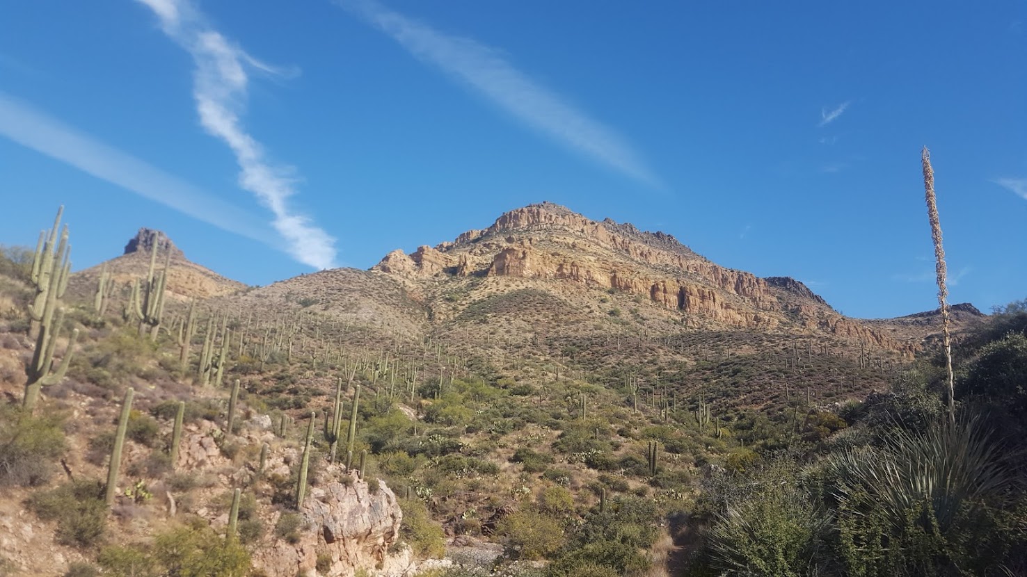
Northern Arizona (343 Miles)
I had hiked the Tahoe Rim Trail just a couple of months prior, and was already in Arizona to finish up guiding season. Squeaks had been doing trail angel coordination online, whereas Cleansweep was planning his vegan resupply at crucial points throughout the journey. Come late October, I picked up Cleansweep at Sky Habor in Phoenix and drove to Flagstaff, where we picked up Squeaks. The three of us, our backpacks, and all of my possessions for the guiding season crammed into my 2000 VW Golf and pushed through to Kanab, UT. Once there, we spent the night at the home of some lovely trail angels (who I don’t believe are still in business for hikers). They were generous in offering us not only a ride to the trailhead in the morning, but were also willing to allow me to leave my car in their yard for the duration of our journey!
Day 1 we set off from Buckskin Gulch, in the shadow of Vermilion Cliffs National Monument. We were quickly pleased to see that outside of some rolling the hills, the trail was relatively flat. Naturally, it became apparent that water was few and far between on the AZT, which was obviously expected. Luckily I was already accustomed to long water hauls, drawing from my experience along the first 700 miles of the PCT. From cow-pond to water tank we hopped. Before long we had transitioned from wide open vistas to a thick belt of Ponderosa Pine. After about 22 miles we made camp, and were soon greeted by PerBear, Kirby, and Righteous, who had recently completed their PCT hikes in 2017. They must have been only hours behind us, as they rolled in as soon as we had gotten into our tents.
The next morning we reached the Country Store at Jacob Lake, which is home to stellar baked goods and milkshakes. At the bar sat a triple crowner (the name of which I cannot recall) who was also thru hiking the AZT. Unfortunately we never saw him again for the rest of the hike, as I’d have liked to pick his brain a bit more before we continued southward. Squeaks was fresh off the AT, where shade and fellow hikers are abundant, and about midday she mentioned she was feeling the effects of the sun and lack of trail traffic. She decided to hang tight at a water spot while encouraging Cleansweep and I to move on. This would be the last we would see of Squeaks until Flagstaff, and as we later found out, she soon would get off the AZT for good. Unbeknownst to us, Cleansweep and I would leapfrog with the “PCTers” (as we dubbed them) for the rest of the hike.

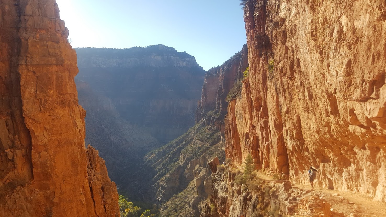
Mornings were below freezing in northern AZ, which made for brisk miles in the early morning. On the evening of day 3 we made camp near the North Rim of the Grand Canyon: the Rim2Rim (26 miles) is a highlight of the trail, and we had been chatting about it for days. Since we didn’t have a permit to camp within the Canyon itself, we woke before the sun in order to cross the other side before sundown. Immediately we battled crowds of tourists as we descended down the North Kaibab trail and into the Big Ditch. The walls of the canyon, illuminated by the gold of the rising Arizonan sun, displayed brilliant colors developed by millions upon millions of years of geological compression (DUDE – deposition, uplift, downcutting, and erosion, for all of you geology nerds).
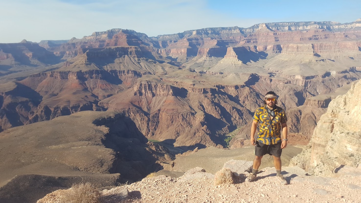
While the elevation dropped, so did the temperature increase. We enjoyed wildlife encounters with big horn sheep, as well as the geographically isolated Grand Canyon Pink rattlesnake, before arriving at Phantom Ranch for lunch. Phantom Ranch, which is located on the Colorado River, offered some shade and fresh water. We weaved our way through cacti and hikers alike before crossing the Colorado River on the Black Bridge and making our ascent up the South Kaibab trail. The going was steep, but in comparison to the mileage we had already obtained, the climb was relatively short. My hiking partner and I enjoyed snacks while enjoying views at Skeleton Point, and as we neared the South Rim, crowds got significantly thicker. Tired but happy, we were fortunate for a pair of travelers who were willing to share their tentsite with us. They offered us beers, and as we pitched out tents and fell asleep, we could hear them whispering to one another about how bad we smelled. Oh, the life of a hiker!
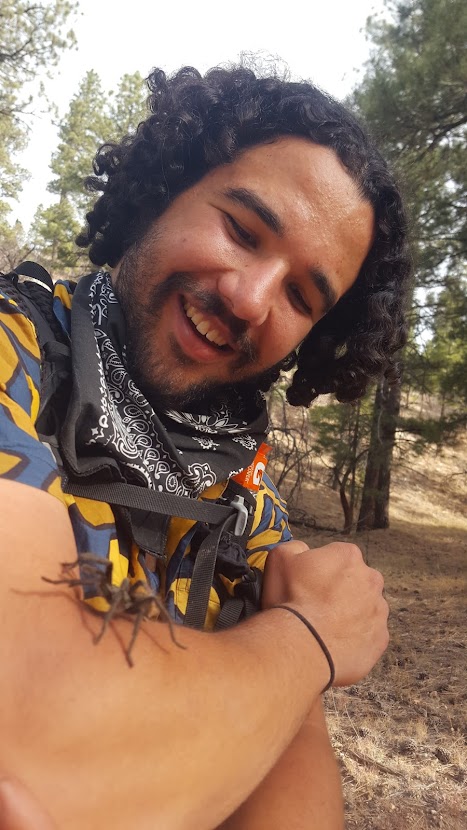
The next day we walked a short distance to nearby Tusayan, AZ, where we enjoyed a hotel stay to clean up. Cleansweep got his resupply, but mine never arrived. Instead I spent a pretty penny at a local store to re-up. With Flagstaff not too far off, we left Tusayan early in the morning the following day and sped through more Ponderosa Pine. Along the way we enjoyed tarantulas, which were in mating season, as well as a few herds of elk. Unfortunately, it was also hunting season, and many hunters we shared the land with felt it was appropriate to not only leave burn piles smoldering in the forest, but also dismembered parts of hunted game in the middle of the trail: legs, heads, you name it. Disgusting.
At this rate we were already hiking about 30 miles per day, and within a day and a half from Flag we saw the San Francisco peaks (Mt. Humphreys, highest elevation in AZ) in the distance. We knew we were close to Flagstaff when we entered Aspen forests, and the city itself wasn’t far off. Once there, we met up with Squeaks, who was staying with trail angels Melody and Tim Varner. The Varner’s provided us a vegan dinner, a shower, and custom AZT hiker robes to wear for the day!
It was a treat to be in such delightful company with the Varners, but sadly we had to say our goodbyes after a short respite. Continuing southbound, we would enjoy the final few days of Northern Arizona’s mild elevation profile. Continuing to hike 30s, we met Juice, a bike packer making his way from LA to Boston. He was headed to Winslow, AZ, and I gave him some water before following his bike tracks the rest of the day. Shortly after, the climate began to change: we were met by deciduous foliage, the first running water of the trail (outside of the Colorado), and new geological formations. We had began to descend the Mogollon Rim, and our time in central AZ was upon us.
Central Arizona (255 miles)
Until now we had amassed plenty of 30+ mile days. We hadn’t seen another thru hiker in what seemed like forever, and the fresh legs were started the trail with were no longer so fresh. Our next resupply area was Pine, Arizona, where Cleansweep and I took the opportunity to hit the local laundromat to recharge and wash our clothes. While there we met Lynda and Roger, two locals, who invited us to shower and relax at their home. I don’t think Lynda and Roger were overly familiar with the AZT community, and we greatly appreciated their hospitality before venturing further down the rim. That evening would entail us following a trail of blood through the thicket (see hunting season I mentioned earlier), which was unsettling to say the least.
We would pass UTVs and hunting tents the following mornings before a surprising twist: a new thru hiker! We were glad to meet Myogi (make your own gear), who’s name we had noticed in trail logs previously. Myogi was also known as Dan Timmerman, a former professional cyclist who owns his own gear company: Timmermade. The emergence of Myogi was a nice change of pace, and we enjoyed conversation that morning before he got off trail for a premeditated rest in town. Around now the trail texture had began to change into uneven, rocky terrain, crowded with manzanita and cat’s claw, which left our legs scratched and bloody. Little did we know, this was only the beginning of what I would describe as being the hard part.
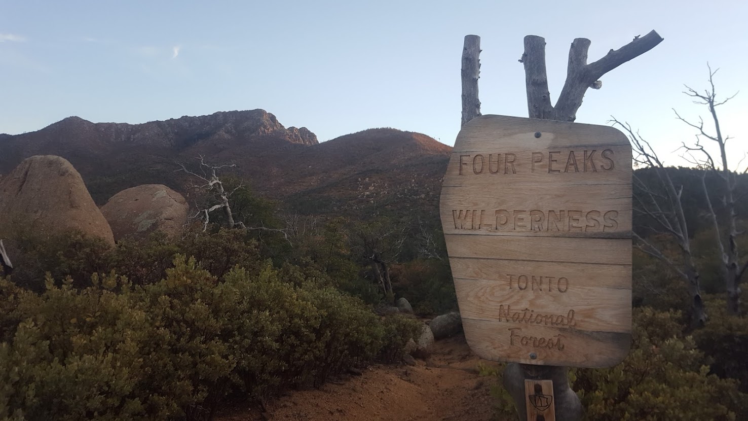
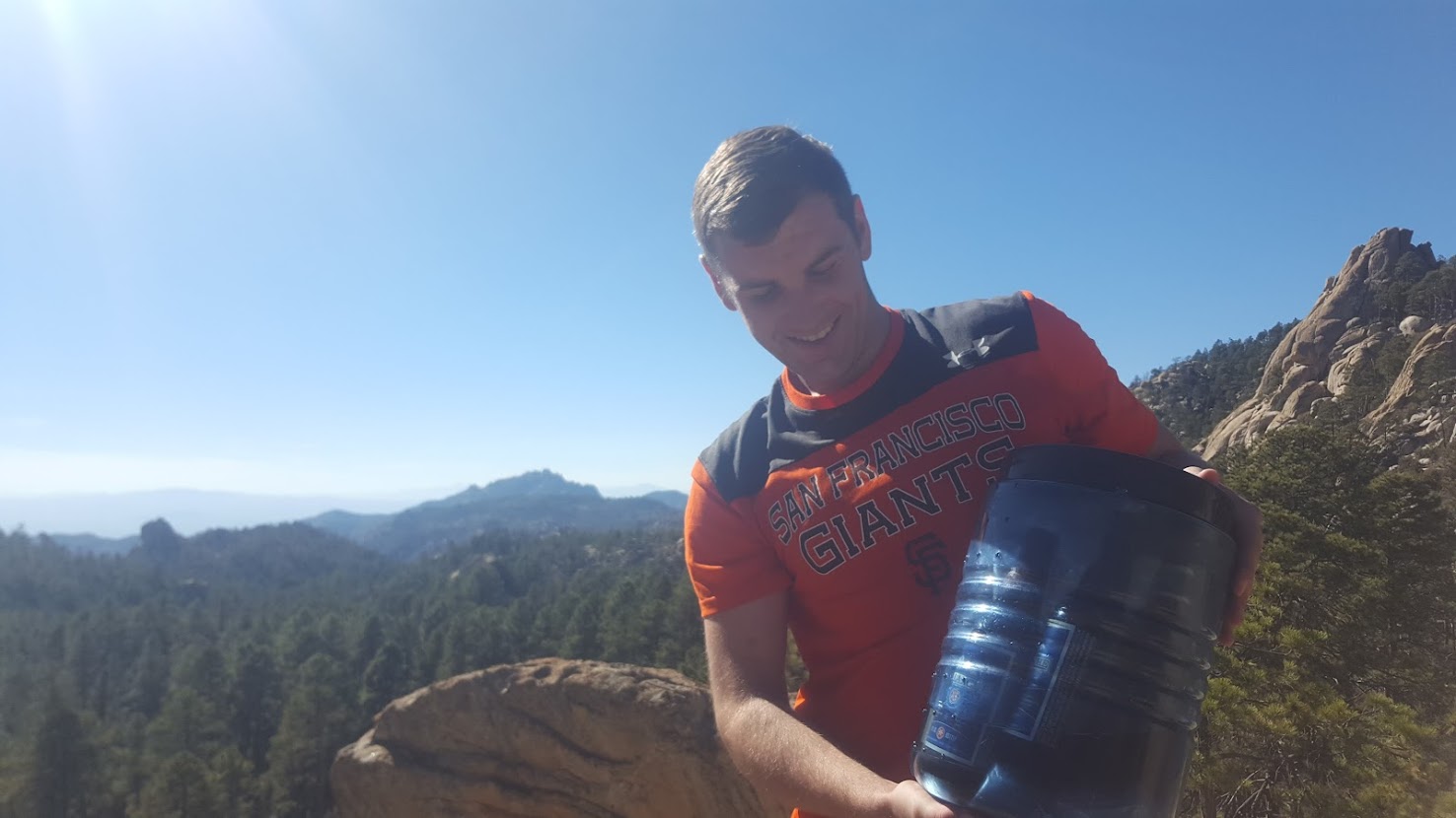
About halfway through our journey Cleansweep and I enjoyed a lunch and water refill at a river in the midmorning. There was good news and bad news upcoming. The bad news: the Mazatzal Mountains were ahead of us and supposed to be quite challenging, with tough elevation profiles and little water. The good news: we planned to meet up with some of my coworkers the next day. We optimistically cameled up with water and made were on our way. It was only about 25 miles or so until our next water, and I felt relatively healthy. However, I underestimated the speed we could hike with through the Mazatzals, and I ran out of water late at night, still 10 miles from the next water source. To add insult to injury, the vegetation of the region had torn my shorts apart. Essentially trudging along trail in my underwear, but encouraged by Cleansweep (who was nice enough to split a few ounces of water with me), we made camp. The next morning I found the strength to hike the 8 miles to our water source. These which were among the most difficult 8 miles I’ve ever hiked. Relieved to have fresh water again, we crushed several liters, replenished our bottles, and continued to hike in anticipation of meeting my friends for lunch.
Around noon we reached our destination at Theodore Roosevelt Lake. My coworkers, Mike, Siera, Casey, and Brie aren’t your run-of-the-mill office employees: they are guides. That meant guide level travel magic – beers, electrolyte tablets, salad, fruit, good vibes, and even new shorts! We exchanged stories, drank and ate our fill, and relished in good company on the banks of the reservoir. The only thing more full than my belly, was my heart. Mike, having done trail maintenance for the Forest Service in the Four Peaks/Mazatzal area in the past, joked about how challenging the section was. Really, I was chagrined to leave their company: we were tired and could use a good night’s sleep in Phoenix! Despite my feelings of complacency, we said our goodbyes and plodded toward the Superstition Mountains, where my guiding employer often hosted backpacking trips for eager guests.
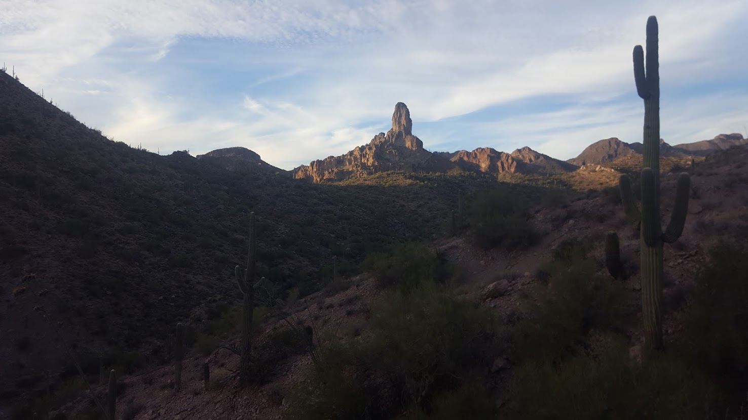
The Superstitions were tough, but not at all bad. We were given beers by a group of hunters, and even ran back into the PCTers we had met earlier on in our journey. Landscapes began to morph before our eyes into the Sonoran Desert I was familiar with, thrumming with greenery and the sounds of coyotes, insects, and birds. The trail weaved through Reavis Canyon, an old orchard from a homesteader years earlier, before spitting us out on the other side near Superior, AZ. On our last evening of the Superstitions we ran into another hiker we had noticed in the hiker log: Steel Cranium, a former communications professional who (years later) would end up guiding for the same company I worked for. The following day, Cleansweep, the PCTers, and myself would hitch a ride into Superior, AZ, which is anything but superior: this rundown town offered us a restless, sketchy hotel stay in one of the seediest accommodations I’ve ever had the misjudgment to stay at. Cleansweep and I spent the night, but the PCTers and Steel Cranium moved forward in favor of resupplying in Oracle, AZ down the trail.
Leaving Superior, we ran into Mama D, who was an avid section hiker from rural northern AZ. Next up on the docket was the Gila River, where my companion and I were lucky to see multiple foxes, javelina, and deer. The Gila stretches through a section of the CDT in New Mexico as well, so I was eager to check it out this far down stream. Shortly after crossing the Gila, we were met by yet another thru hiker: Crash, aka The Hiking Story, who had grown quite a following online. Crash would be the last new thru hiker we would meet on trail, and we enjoyed his conversation as we left the oasis of the river and delved deeper into the desert. The next morning the three of us were surprised to meet Sequoia, a trail angel, at a parking lot. Not only did Sequoia offer root beer and fruit – but here was Myogi, who we hadn’t seen in several days. The four of us set off after a fun morning and enjoyed a day as a quartet, eventually spending the night at a water tank around mile 584.
Crash explained his many hikes abroad (he was from Australia), whereas Myogi educated us on the flora and fauna of the southwest. I saw the first cardinal of my life, and the conversation with Myogi gave me a renewed appreciation for the region. A little past mile 600, near American Flag Ranch, Crash and Myogi said their goodbyes in favor of a resupply in Oracle, AZ. Once again a duo, Cleansweep and I set our sites ahead for the final third of our trip: the Sky Islands in the Sonoran Desert.
Southern Arizona (193 miles)
Now closing-in on the end of our hike, our mileage had dropped from low 30s to mid 20s (the increased elevation changes and temperature had resulted in lower daily mileage). Only 200 miles away from the Mexican border, the prospect of finishing the trail was upon us. Cleansweep began to make arrangements with his sister to pick us up near Mexico, as she was vacationing in Tucson: in order to make the arrangements, we needed to increase our daily mileage. First we needed to ascend Mt. Lemmon, just outside of Tucson. We gradually climbed the mountain and were pleased to see coues deer (an Arizonan subspecies of white tailed deer), which we’d never seen before. Eventually we made it to Summerhaven, a mountain community near the top of Mt. Lemmon. If I had missed out on my resupply box earlier in Tusayan, now it was Cleansweep’s turn, as his box hadn’t arrived yet. With disappointment he resupplied at the overpriced store in town.
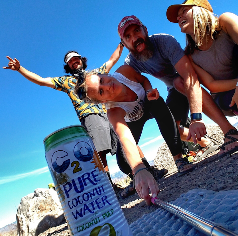
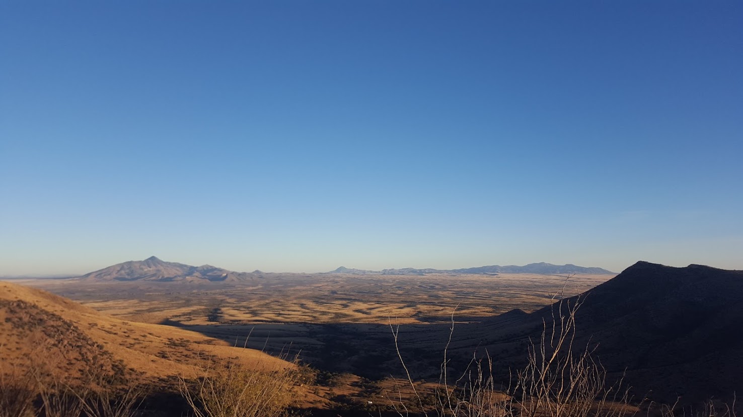
There was a bright spot to Summerhaven: my friend Ross, and avid hiker who was stationed in Tucson with the Airforce, agreed to meet us for some trail magic. With him he brought a bear can full of beer cans (say that 5 times fast), which he carried as we hiked together for a few miles in the early afternoon. Ross and I were childhood friends, and never in my life did I think we would be meeting under such circumstances. He explained to us the notion of Sky Islands – seemingly singular mountains that dotted the Sonoran Desert in the bottom half of Arizona, looming over the cacti and sand. On clear days you could see for miles to the next sky island. Mt. Lemmon was just the first peak in the region for us on our journey south. Several beers and many good vibes later, we bid adieu to Ross and dropped in elevation to Sabino Canyon, a popular spot for many Tucson recreationists.
While collecting water early the next morning we were met by familiar faces: Steel Cranium, PerBear, Righteous, Kirby, and ourselves had once again all converged. We hiked with them that morning and made good timing. It was a weekend, and as we navigated local trailheads, we ran into plenty of day hikers, one of which took notice of our gear and struck up conversation with my companions. As we approached the Rincon Mountains later that day we were met by a happy surprise: my good friend Ross had returned, this time with ice cream and fruit, and was joined by the day hiker we had met earlier! The six of us hikers relished in the delightful trail magic during the hottest part of the day, wondering what made us deserve such spoils and camaraderie. With our blood sugar levels through the roof we slowly trickled southward toward Mica Mountain, which is along the border of Saguaro National Park East. We quickly paced across an open patch of land, gunshots looming around (damn hunting season), before making a strenuous climb up Mica Mountain during sunset. After collecting water, the band of thru hikers made camp: unfortunately this would be the last time Cleansweep and I would see the other four, as we left before them the next morning and never crossed paths again.

Dropping off Mica Mountain and back into the swaths of the Sonoran Desert meant leaving Saguaro National Park East, which I found to be a fun section. The following days would be long hours of sandy washes, towering saguaro cacti, and hot blue skies. We crossed Highway 10 with haste and checked our mileage: right on track, we were hitting 30+ miles a day, and were on pace to obtain over 200 miles in only 7 days. Things got tricky in this section, as we had resupply boxes waiting for us in Patagonia, AZ, but realized we’d have to push in order to arrive there prior to Sunday, when the post office would be closed. A low-light was coming across more deer carcasses and decapitated heads, lazily left on the footpath by selfish hunters. We also began to see border patrol navigating washes, who gave us a long look (disheveled hikers) before passing us by. After much toil we arrived in Patagonia, where we enjoyed resupply (Signs from the PCT sent us a package- it was awesome!) and a final hotel stay.
Now, less than 50 miles from the Mexican border, we were all but finished. The heavy mileage had caught up to me, and I slogged on my way up the final climbs on the trip. Along the way we noticed littler in the form of food packages, clearly marked in Spanish – it seemed it was left my migrants who had crossed the American border, hence the border patrol we had seen previously. Cleansweep and I enjoyed our final lunch at a spring that fed into a bathtub, not too far away from the Mexican border. He stayed behind a few minutes while I pressed on. Only moments ahead of him, I was fortunate to see my first and only coatimundi of the trail.
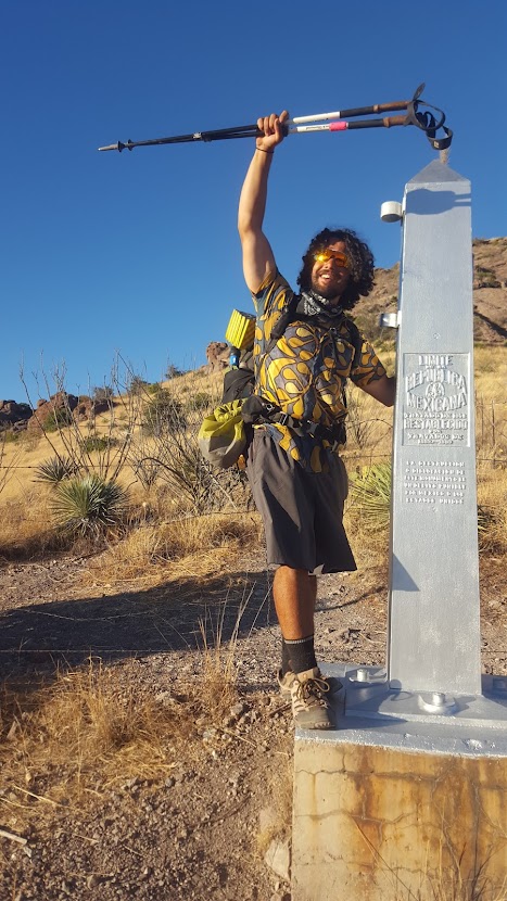
On 11/24/17 the two of us reached Coronado National Monument, which overlooked the Mexican border. In only 31 days, Cleansweep and I had hiked the entirety of the Arizona Trail, averaging over 25 miles per day, with zero 0 days. It was a grueling experience, and I felt better for having walked the path. The two of us enjoyed lukewarm beers in Mexico, underwhelmed by the fact that plans to link up with our ride north (Cleansweep’s sister) had fallen through. We spent the remainder of the afternoon unsuccessfully trying to hitch a ride from the monument: we would spend the night in a shelter near the border and hike to the visitor center the following morning. From there, we paid for a taxi to take us into Sierra Vista, AZ. It took us 3 nights (1 in Tucson, 1 sleeping behind Chileen’s on 17 [as seen on Bar Rescue], and 1 in Flagstaff), 8 hitchhikes, and many uncomfortable hours, before we finally arrived back in Kanab, UT. The two of us grabbed my automobile and drove through the night through the Virgin River Gorge and Las Vegas before sleeping on public land not far from Tehachapi, CA, on the PCT. Just like that, I dropped Cleansweep off at Black Bear Diner in Tracy, CA and made my way home.
The Arizona Trail ended up being much more challenging than expect. I gained a new appreciation for the Sonoran Desert’s flora and fauna, as well as the remainder of the great state of Arizona. The experience suggested that despite what AT and PCT hikers believe, doing one of those famous trails does not make one a hiking expert: really, they’re prerequisites to more challenging endeavors or more rugged trails. It was a great way to cap off an excellent guiding season, and I felt on top of the world as North America turned into the darker seasons.
