Vermillion Cliffs National Monument sits on the border of Arizona and Utah and is home to Paria Canyon and Buckskin Gulch. Paria Canyon is the longest slot canyon in the world (taller than it is wide) and spans across the state border.
There are a few different trailheads that access Paria Canyon within the national monument, and some of them lead to other fantastic destinations like the Arizona Trail, the Wave, and more. The most popular trailheads on the Utah side are Buckskin Pass, Wire Pass, and White House. If you’re hiking through, the main trailhead on the Arizona side is Lee’s Ferry.
It’s an incredible hike, but some of the logistics can be tricky.
Distance: 43 miles
Duration: 2 nights/3 days
Logistics
Quick breakdown
Fly to Las Vegas > drive to Page > overnight near trailhead > leave car and shuttle to other trailhead > hike > drive back to Las Vegas > fly home
Permits
The overnight use limit for the canyon is 20 people per day, so permits must be acquired in advance to overnight in Paria Canyon. Check out the BLM website here to learn more and get one. We arranged for Backcountry Found (see shuttle section below) to pick our permit up in advance.
Transportation
The closest major airports to the trail are in Las Vegas and Phoenix. Las Vegas has more flight options (at least from the PNW). From there, you basically have to take a private vehicle or hitchhike. We opted for the former and rented a car in Vegas. Keep in mind it’s about a five hour drive each way, so budget your time accordingly.
Accommodations
Las Vegas has a gazillion hotels to choose from. We chose a generic airport hotel for both ends of our trip to get in and out quickly. Once we arrived in Arizona, we decided to dispersed camp on BLM land not far from the trailhead. Page, Arizona has plenty of hotels if you prefer something more comfortable. Check out Campendium or freecamping.com to find free dispersed sites on public land. The Southwest has a ton of options.

Shuttle
Wire Pass to Lee’s Ferry is a point to point thru hike, so you’ll need to leave a vehicle at one trailhead and make plans to get back to it once you’re finished with your hike. Fortunately, there are a few shuttle services you can book to transport you from one trail to the other. We chose Backcountry Found: they have an excellent track record and were convenient, quick and easy to book. I highly recommend them. For an additional fee, they’ll pick up your permit, a gas canister, and provide you a paper map prior to your trip. You can also try your luck hitchhiking.
Bathroom
Paria Canyon and Buckskin Gulch are ecologically sensitive area. All hikers overnighting in the canyon must carry (and use) a wagbag to pack out all human waste.
Hiking Buckskin Gulch
Our shuttle driver picked us up from Lee’s Ferry around 7 a.m. on the first morning of our hike. We arrived at Wire Pass trailhead around 9 a.m. local time (Utah is an hour ahead of Arizona) after an hour drive and began our hike. Expect a scenic drive and plenty of other hikers at these trailheads.
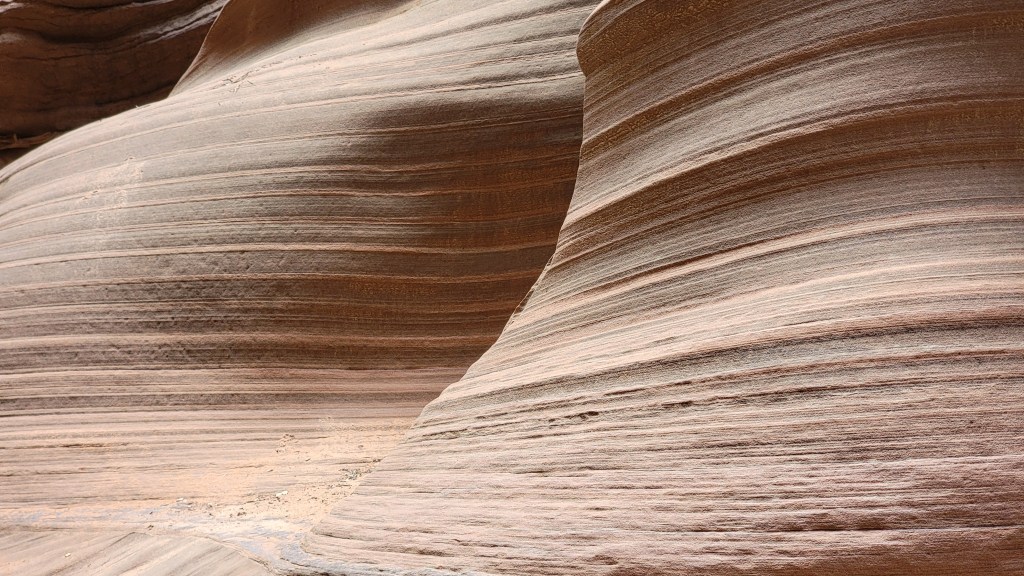
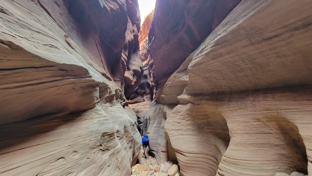
The trail from Wire Pass follows a sandy wash for about 1.5 miles before converging to a narrow slot within the sandstone: the beginning of Buckskin Gulch. This portion of trail is about 13 miles long and has no options for reliable camping or treatable water. It’s also the most scenic portion of the entire canyon and where the slot is the tightest. Occasionally the canyon will open up, but expect to be in the shadows for most of your day on trail.
Buckskin Gulch and Paria Canyon are also notorious, as many Southwest slot canyons, for flash flood potential. You can mitigate your risk of flash floods with some careful planning and research (we had no issue), but you should still expect to get wet. Even when the canyon is relatively dry, there are a few stagnant pools along Buckskin Gulch that can be a little deep. Apparently some folks have to wade chest-deep through them. We had no issue.

About halfway between Wire Pass and the Confluence (where the Paria and Buckskin meet) is an opening in the canyon where the Middle Trail converges with Buckskin Gulch. It’s a lovely spot for lunch; keep your eyes open for Petroglyphs on the canyon walls.
There’s also one semi-technical scramble around a bolder jam. One path goes underneath (that’s what we did since there was no water) and the other goes above. For the latter, there is a tied rope to grab and moki steps in the rock to climb down with.

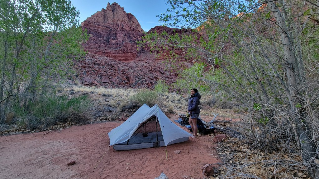
The Confluence is only a mile or two past the boulder jam. Here we saw a few other parties, some of whom had come from up the Paria instead, parking at the White House trailhead. For the next few miles the walls of the canyon are breathtakingly tall and dramatic. A few campsites are located not far south from the Confluence, but I advise walking a bit further for better camping. We stayed at Big Spring.
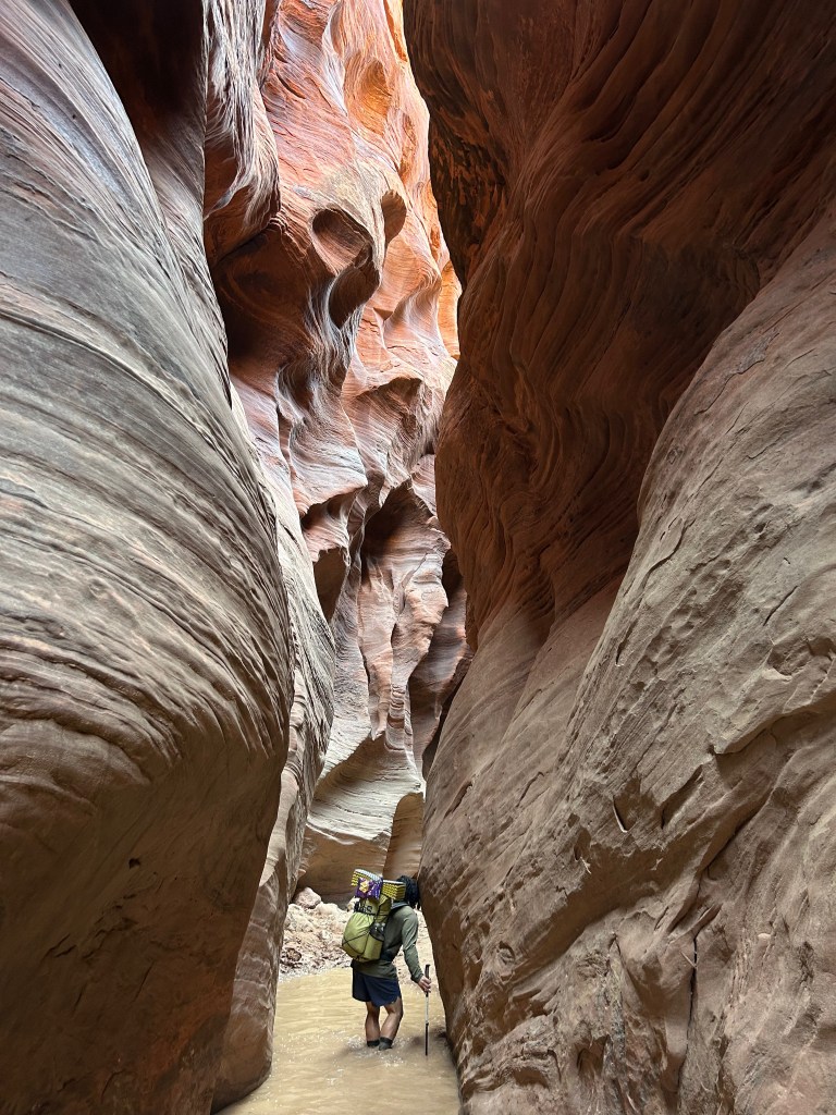
We walked 70% in water and 30% on land from the Confluence onward back to our car. Neoprene socks helped a bunch!

Speaking of springs — the water of the Paria is silty and gross. Don’t even bother trying to treat and drink it unless it’s an emergency. There are a few natural springs throughout the journey (some reliable, others ephemeral) that flow into the Paria. Look for the clear water along the cliffsides and lush greenery growing from the rocks to know where to collect.
hiking paria canyon
There’s hardly any elevation gain for this entire journey; I think we lost about 1,500 feet cumulatively. But that doesn’t make it clean, quick hiking. The constant water crossings, mud, quicksand, and route-finding makes for slow walking. We walked about .5-1 entire mile less per hour than usual, which made getting 20+ mile days a slog. Be sure to budget your time accordingly.
After Big Spring, the river wound onward in tight coils for many more miles. We passed massive arches in the rock walls, bubbling springs, swaying reeds and gurgling, muddy brooks. Slowly, the canyon begins to widen, welcoming more sunlight, and with it, more vegetation.
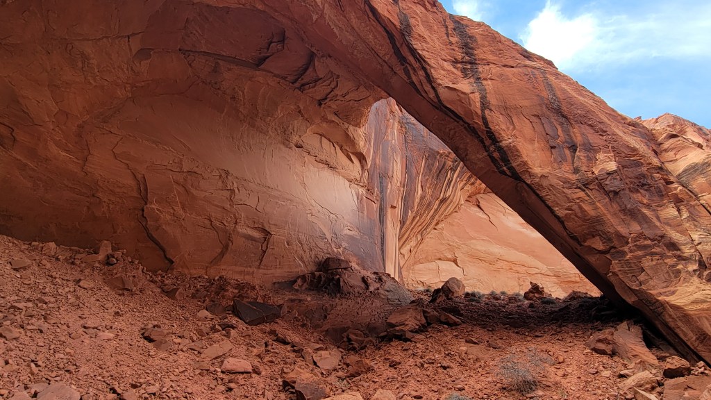
Deep in the Paria is the intersection of another slot canyon: Wrather Canyon. Wrather Canyon is a 3 mile roundtrip hike from the Paria on an unmaintained trail, but it sure is worth it! At the end of the hike is the impressive Wrather Arch. You can scramble up underneath it, but we were content to eat lunch and weather the wind. The side trail for Wrather is difficult to see from the Paria,so be sure to check your map resources if you’re interested in checking it out.

Keep an eye out along the cliffsides as you make your way. There’s a healthy population of bighorn sheep and condors at Vermillion Cliffs, both of which we saw up close on our journey. Also keep an eye out for bats over the river at twilight!
About a dozen miles north of Lee’s Ferry is Last Reliable Spring. Yeah, that’s literally what it’s called. It’s also where we filled up on our final carry of water before trekking on another mile or two and making camp. Camping felt more abundant this far south in the open canyon.
Finishing at Lee’s Ferry
The remaining hike was more of the same on the last day, only with less water crossings as the canyon continued to open up. We began to see day hikers about two miles from the parking lot.

On the drive out, be sure to stop at the boat launch along the Colorado River. It’s the only pace you can drive up to its shores along its entire length. There was a search and rescue training being conducted when we visited.
Other optional (must?) see attractions when driving to and from Las Vegas:
- Check out the Jacob Lake Inn and enjoy famous cookies
- Stop on Navajo Bridge and look for condors
- Visit Horseshoe Bend in Page!
